|
|
Post by anfhiker on Oct 15, 2019 20:24:58 GMT -5
I set out on Saturday October 5th to hike Jeff's proposed Pennsylvania Wilds Trail. This would take me from Parker Dam State Park to near Arnot, PA. I will use this thread to try to provide a report on my trip. I spent 10 days in total on the trail, so I'll do one day at a time after this post. I'm not sure how often I'll have time to do a report on a day so it may take the next few weeks in total.
As a spoiler alert, I did not make it all the way to the Sand Run trailhead. My car was parked there the night of the 4th and I ended up getting there but my ankle seemed to just wear out by the morning of my 10th day. I ended up making it to about 4 miles from Antrim on the MST before I had to bail out to Morris and call for a ride. It's unfortunate, because I felt great and was making good time on day 9 and felt like I could have finished the trail that day had the very painful injury (something like shin splints but it was low on my ankle on the front) not popped up.
Now for a couple of notes and a basic gear list. First, the trail is likely longer by a good bit than the estimated 171 miles. My GPS had me at 174.2 miles when I bailed out; my phone, which is steps based and tends to be more conservative, had me at an even higher 179 miles. My fitness tracker tends to go higher than either and wouldn't be a very good estimator as I wore it around when I was around camp and hanging my food bag and such. I was pretty careful about shutting my GPS off whenever I had to stop for more than a brief stop, and for every time I left it on for a 5 minute food and rest break, there was at least one time where I forgot to turn it on for a short time after hitting the trail. I estimate that I had about 16 miles left when I finished, so conservatively I would place the trail at least at 185 miles and maybe as high as 190. Jeff, where I think you missed some miles are as follows: 1) the QT section in the East Cross Connector area was at least 15 miles between the north and south sides of the trail with all those side trails. I was at 53 miles getting down into Sinnemahoning on the 8th and I think you had it at 48. 2) I think you missed the T Squared Trail in your estimate from Pfoutz Rd to the BFT. I had that section at approximately 26 miles. The rest was pretty well spot on, so that would make the difference in your 171 vs my estimated 185-190. For you elevation buffs, my GPS tracked me at 28,549 feet of elevation gain. So...NC PA is pretty rugged.
Second, I had mostly good weather. I got rained on during two days; Monday the 7th and Saturday the 12th. On the 7th it rained all day, and on the 12th it was more of a morning shower. Other than that, the weather was mostly sunny. Days were between 55-65 for highs and lows had a wider variance, with it being upper 40s in the early part of the trip and lows in the mid 30s the last few days. Fall colors were quite nice as the understory was very bright and the views on the eastern side of the trail were really showing a lot of color.
For my gear, this is the basic stuff I took:
-REI Passage 2 Tent
-Osprey Atmos 70 Backpack with a Waterfly waist pack to store items I needed to access quickly
-Kelty Cosmic Down 40 sleeping bag
-Big Agnes Q Core Insulated Sleep Pad (this saved me as the Kelty bag wasn't enough on the last few nights when temps plummeted to near freezing
-Survivor Hiker Pro water filter
-Salomon 4D 3 GTX boots
-MSR Pocket Rocket Stove with many Mountain House meals to eat. An 8 oz fuel canister was well more than enough
-Samsung Galaxy S10 for photos with an Anker battery for backup charging (which had some issues and will be covered in the Day 4 report)
-For clothing I wore whatever moisture wicking stuff I had...a variety of Columbia, REI and other materials. I carried a few light long sleeved shirts and a fleece vest. I mostly wore shorts to hike, convertible Columbia pants and some plain Adidas basketball shorts. Socks were also an eclectic mix with Darn Tough, REI, Woolrich and Lorpen being represented. I probably wore Darn Tough the most.
-Garmin GPSMap 62stc for navigation
-For extra food I had a mix of stuff...MREs, nuts, pretzels, Snickers, Nature Valley Granola, Fig Bars, some chocolates, beef jerky, electrolyte tablets, etc
-Maps for all of the trails with the exception of the Algerine and Long Branch Trail which I downloaded on my phone and stored as a GPS
Anyway, I will try to update as I can starting with Day 1 from Parker Dam. That post should appear in the next couple of days. I took a ton of photos and videos, but I'm not sure if this board makes it easy to post them. I'll try to add some to my posts.
|
|
|
|
Post by jmitch on Oct 16, 2019 8:37:33 GMT -5
Wow, great job. Sorry to hear about your ankle.
|
|
ki0eh
Forum Elder
Posts: 196 
|
Post by ki0eh on Oct 16, 2019 22:23:25 GMT -5
I saw a report on Facebook from someone who must have run into you on the BFT. Awesome effort!
|
|
|
|
Post by anfhiker on Oct 17, 2019 8:54:42 GMT -5
Yeah, that must have been Mike. He was coming up the hill from Little Slate Run with a big DSLR camera and tripod in hand. I felt kinda bad for him lugging all that weight up the hill in the rain, except that he was coming to a nice set of vistas to make that hike worth it.
|
|
|
|
Post by anfhiker on Oct 18, 2019 21:11:39 GMT -5
Day 1-Saturday, October 5th This trip started off with a bit of a snag as a friend and I drove to the Sand Run Falls parking lot on the evening of Friday, October 4th. We had left my work in Warren around 430 and headed immediately over. On the way, I called him to check and see if he wanted to stop for some food. A typically voluminous eater, he declined. It turns out that he had his vehicle tires rotated and the heavy lugs were cupping and causing extreme road noise, making him sick to the point of dizziness and nausea. So I drove us into Mansfield for our hotel for the night. On the morning of the 5th, he was doing little better so I drove across Rt 6, down Rt 144 to drop my ammo box cache off near where the Donut Hole Trail crossed the highway, and on to the main trailhead at Parker Dam State Park. I was a bit thankful for some of the delay, because the day started out around 32 degrees and warmed up as the morning went on. It was still maybe 50 when I said goodbye to my friend and hit the Quehanna Trail around 11:15 AM. It would warm up into the upper 50s but that was about it. The cool temps worked in my favor as it was still sunny, and I was able to make pretty good time. The understory of beech was golden as the sun shone through it, and I was in good spirits despite the fact that I had left my pocket knife in my buddy's truck. The Quehanna Trail is a personal favorite with its many loops and side trails and is a trail I've done many backpacking trips on, so I was looking forward to getting moving on a trail that was familiar. I made my way up the Laurel Run drainage and to the top of the plateau. I flushed a grouse, PA's state bird, across the stream and saw several white tailed deer as I soaked up the sunshine.  Along the way, I passed a couple of hikers from nearby who were doing the West Cross Connector loop as an overnight hike. They were carrying a pistol in case of emergency, which might have been my own preference had I not been loath to carry even an ounce more than was necessary. I crossed the Laurel Run Road and Tyler Road within a relatively short time and made my way past the West Cross Connector and down along the Alex Branch, a very pretty stream. I worked across the scenic Trout Run, where I was tempted to stop and fish, but as I'd gotten moving an hour or so later than I hoped, I was still hoping to make decent time and not get too far off schedule.   The QT has many beautiful meadows and I was able to see several on the first day.    After these, I slowly made my way up a long, shallow and then increasingly steep hill that became Chestnut Ridge, which I believe may be the highest point on the PA Wilds Trail at 2350+ feet. The temps had begun to drop by this point and the sun was dipping behind some clouds, which along with a steady breeze made hiking in shorts and a t shirt a bit dicier. The reward for the climb (which wasn't remotely bad compared to what was to come) was a nice view. 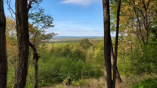 The rest of the day involved making my way across both Knobs Road and then the Caledonia Pike before working my way down the hill into the Gifford Run drainage.  By this point it was getting to be around 6 PM and days being shorter, I wasn't sure if I would be able to find a campsite easily. I had hiked some of this section in May of 2016 but hadn't had a GPS with (I was actually fishing then-Gifford Run has some beautiful brook trout) so I was unaware of what locations could be there. As I made my way across the nice bridge and down along the rocky stream, I was pleased enough with my mileage for the day, even though I had hoped to make it a few more miles. In the end, I found an open area and set up camp (no fire). I was able to boil my water on a small foot bridge, hang my food in a tree down trail, and be quite ready to get some sleep by 9 PM.  Mileage for the day: 16.41 miles Mileage for the trip: 16.41 miles |
|
|
|
Post by jmitch on Oct 20, 2019 16:35:55 GMT -5
This is great.
|
|
|
|
Post by anfhiker on Oct 21, 2019 20:06:24 GMT -5
Day 2-Sunday, October 6th I woke up early at 6 am and although I was slow getting my stuff packed up, was still on the trail by 730. Today was a day that I hoped to make up some time, and with the weather forecast looking iffy for today (and especially tomorrow), I was going to need a blessing to avoid getting wet while making some good mileage. I passed down along Gifford Run, which ended up having a campsite maybe 1/4 mile downstream from where I had camped. The temps hadn't dropped much overnight, as it was in the low 50s when I took off for the day. The clouds had moved in overnight and threatened some precipitation, which I was really hoping to miss. As I hiked up toward Lost Run Rd, I saw two deer and heard something else crashing around in the laurel on the hill to my left. I yelled, hoping to scare whatever it was into moving (perhaps into my view), but I never did see it. The trail became a bit rockier as I got to the ledge heading toward Lost Run, and passed a power line swath before the Quehanna made it to the road.  I made it to the QT intersection with the East Cross Connector quickly and was heading up across the Wild Area toward north side of the trail. The trail winds off the top of the plateau and crosses Mosquito Creek at a road bridge.  The remains of an old dam sit just upstream from the bridge. Colors were beginning to pop pretty well on the hills here.  I made my way up Meeker Run, stopping for a snack and to filter some water. I had been on this trail many times, doing the Southeast Loop of the QT in 2013 and 2018, and the entire Eastern Loop in 2015. Meeker Run is very scenic, with boulders and cascades. I've seen trout in it before, so it would have been a fine spot to break out the fishing pole. But today was a day I was more interested in making miles. 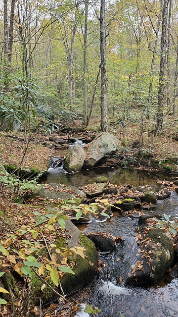 Shortly after the pools, I made a left/switchback up the hill on the Crawford Vista Trail. For all my time in the Quehanna, I had never been on this trail. Boy, was I wrong to not have made the journey before. The trail is pleasant and the view is so worth the walk (about 0.7 miles to the vista from the QTCC). I passed several small meadows on my way out to the main view over the Mosquito Creek valley. I took some photos and videos, made a quick call to my parents since there was some cell service, and moved on.   The trail then curves back into the woods and within about 0.75 miles reaches the intersection with the Mosquito Creek Trail. I took the left onto this trail, which descended into Mosquito Creek's valley once again. Within a short time, I was at the Bridge Trail intersection. I made my way right (north) onto this spectacular trail, which generally follows Mosquito Creek or its tributaries into the upper bounds of its drainage. There were fields of cottongrass just dying off for the winter, but it really had a very barren feel to the whole area. Stunted trees, lots of rocks and tannic water made for a very unique feel from anywhere else on this hike.    Making my way to the top and through the broad valleys of the upper reaches of this drainage felt a bit like walking through a Tolkien fantasy...perhaps like the Barrow Downs or the Dead Marshes. But it was still a very neat area that makes the Quehanna so different from other trails in Northcentral PA. It wasn't too long and I made my way back to the East Cross Connector, which wound around the Beaver Run impoundment (which had some sort of construction going on as I was there) and back around to where the Lincoln Trail connected in. I made the right here and headed through some cool conifer forests and into a gravel lot for the Beaver Run blind. I had intended on stopping to cook some lunch here, but as I got to the lot, it began to rain, and I didn't want to sit out in the open, so I moved on. I crossed the Quehanna Highway and saw a sign stating that a rattlesnake had been spotted near the view ahead. As it was nearing mid-October and the snakes are usually denned up by then, I wasn't too worried. I stopped on the rock at the Lincoln Trail's vista and cooked my lunch (or boiled the water) under the shade and took in the view.  I made my way down into Paige Run's lovely glade, which was filled with hemlocks and tall rhododendrons, as well as many cascades. I worked my way across the stream and climbed up to the top, where the Teaberry Trail connected in with the Lincoln Trail. I followed the Teaberry Trail around to the east, passing another view.  I quickly made my way back to the East Cross Connector, which contained a shallow uphill grade for quite a long time, carrying me to a dirt road. As I hiked, the rain picked up a little, but was still not very heavy. A check of the radar earlier showed that the heavier rain was moving around me, thank God. That was a prayer answered.  It was getting to be later in the afternoon as I made it to the Quehanna Trail again. Almost as soon as I saw the orange blazes again, the trail began to descend into Porcupine Draft's valley. At first it was relatively gentle, and it got steeper as it went. This valley was filled with nettles toward the bottom, but thankfully the shorter days and recent cold nights had knocked them back a good bit. This drainage also contained a fair number of downed trees, which became difficult to navigate with the full pack I had on. I had to take the pack off and push it over a couple of logs. I was at Red Run Rd by 5 PM, and I stopped to filter some water and take a little break. I had hoped to make it to near Arch Springs or Hoover Rd today, but the trail had gone on longer than I had expected and the trundle down Porcupine Draft was a little more strenuous than I expected. I decided to find the first site I could up Sanders Draft. As luck would have it, I found one relatively easily, in a flat area between some springs coming off the hillside and the stream itself. My tent was easy to set up as it wasn't wet, and I was able to get some food and get to bed without too much of a rush. I knew that it was due to rain overnight, so my plan was to sleep in a little and get going as soon as the rain let up on Monday morning. I did some reading and drifted off to sleep before it had even started to rain. Mileage for the day: 21.82 miles Mileage for the trip: 38.23 miles |
|
jbs86
New Member
Posts: 8
|
Post by jbs86 on Oct 22, 2019 19:44:43 GMT -5
Really enjoying this thread, thanks for sharing. Looking at trail maps, I always thought there was great potential to string together a long through hike of the area, but never quite found the time for it.
|
|
|
|
Post by anfhiker on Oct 23, 2019 19:38:43 GMT -5
Day 3-Monday, October 7th. I woke up in the morning without an alarm, knowing that the rain was going to come down and make getting moving a bit tricky. It had rained quite hard overnight, and though my tent was nice and dry, I could hear Sanders Draft roaring outside of my cover. I spent a while waiting on the rain to calm down, reading and resting up after a long day on Sunday. It got to be about 10:30 and the rain was light enough that I was able to get out of the tent and get my food bag down, filter some water and pack my tent and such into my backpack. I was on the trail around 11 am. The beauty of Sanders Draft was not lost on me, as the lack of roads in this drainage meant that the water stayed pretty clear, even despite the heavy rain.   Shortly after leaving camp, as I moved up the valley of Sanders Draft, I met a young couple who were hiking the QT in the opposite direction. I didn't get exactly where they were from, but they said they typically hiked in the Catskills or White Mountains, so I believe they must have been from somewhere east of me. They were excited to have seen elk the evening before as they crossed a pipeline swath at the top of Laurel Draft, as that was a big reason for their trip to the Quehanna. It was nice to talk to some people for a few minutes, as I hadn't seen another person since the parking lot on Sunday, and hadn't talked to anyone since shortly after I started my trip on Saturday. Not long after I passed them, the rain began to pick up, and it was steady and moderate pretty much the entire day. It was warm enough, luckily, that my rain jacket was enough to keep me warm. At the top of Sanders Draft, the trail turned left on an old road and across some meadows. The trail was inundated with water at this point, and my shoes, for how good they typically are, weren't enough to keep the water from getting in through or down my leg and into them. I made my way slightly downhill and turned right, passing Arch Springs and a pretty neat campsite at an old stone foundation. Relatively flat hiking through some laurel and oak overstory was pleasant.   I made it to Hoover Road without too much issue. There was a small kiosk here advertising the trail, and I took cover under the small roof and used it to eat some snacks before heading further along. Shortly after this, I began to head downhill into Laurel Draft's valley (there were no elk at the pipeline crossing). The stream was flowing well, although I didn't get down to the water to take any photos (I took few pictures the entire day due to the rain). By mid-afternoon, I was at Wykoff Run Rd and paused again under the kiosk to eat, filtered some water from the stream and took a break. I knew that Upper Pine Hollow was going to be a fairly strenuous climb, so I wanted to be rested up. Upper Pine Hollow is a beautiful glade in its own right, and though the walk was relatively steep (about 900 feet in 1.5 miles), it was manageable. However, it was after 5 PM when I made it to the intersection of the Old Sinnemahoning Trail, which I turned left on. Goodbye, Quehanna Trail. You were beautiful. The Old Sinnemahoning Trail is an old Jeep road that is about 4.5 miles long and connects Jerry Run Road to the Quehanna Trail. I had some concerns as the day grew short that there might be a lot of blowdowns or other issues to contend with. Thankfully, this trail was in great shape. It was even mowed for more than a mile and was very easy walking. I was able to make good time, and even passed a camp site that I considered staying at.   I was able to make it a couple of miles across the plateau and into a section of trail that was heavy with rhododendron. I ended up deciding a flat spot in the trail that wasn't a camp site at all, but was convenient as I figured that no one was likely to come up this trail before I left in the morning. I had been fairly well soaked by the persistent rain, but it thankfully stopped by the time I made camp. To my surprise, I even had a little bit of cell phone service. I made a couple of calls and changed out of my wet clothes, then got into my tent to warm up. In a not so pleasant surprise, my Anker battery died out of the blue, which was potentially complicating for the rest of the trip. A friend from Emporium offered to meet me the next day to bring a spare, so I was thankful for that as I wanted to keep taking photos and have a lifeline in case of emergency. As I went to sleep, I found some solace that the restaurant in Sinnemahoning was scheduled to be open Tuesday, so at least some hot food was on the docket for the next day. I didn't get the miles I hope for in, but I was warm, dry and ready for a big day tomorrow. Mileage for the day: 12.64 miles Mileage for the trip: 50.87 miles |
|
|
|
Post by anfhiker on Oct 27, 2019 18:29:08 GMT -5
Day 4-Tuesday, October 8th I woke up in the morning to much different weather than I had on Monday. The rain had stopped and I could tell that somewhere behind the fog, the sun was shining and it was going to be a much better day. It's still never fun to put on wet boots to start the day off. It had stayed relatively warm overnight, maybe 50ish. I made my way down off the mountain on the Old Sinnemahoning Trail, and it was pretty evident that not all that long ago, the trail was being used as a Jeep road. I even saw a truck cap off to the side of the trail. I believe there was only one blowdown the entire way down into Sinnemahoning. The fog did hang pretty low in the woods, which gave it an eerie feel.  I was off the hill in less than an hour. Sinnemahoning is a classic Appalachian town, with old steel bridges, a small population and not a lot going for it otherwise. One person was airing their house out and said hello to me as I walked by on Jerry Run Road. I made my way onto Wykoff Run Road, which crosses the Sinnemahoning Creek. As I walked along, many cars passed by as the road was fairly busy for mid-morning on a Tuesday. I caught some glimpses of the creek, where I saw a bald eagle flying low to the water in search of fish. It was a lovely walk as I made it to Route 120.  To my surprise (and at the time, something of dismay), the Willows Restaurant was closed. No hours were posted on the doors and I had no way of knowing if this was planned or not. Someone pulled into the parking lot and asked me as I was sitting on the front bench if it was closed, and we agreed that it was our loss to miss out on a nice breakfast. I grudgingly ate my normally scheduled breakfast and moved on east on Rt 120, crossing the First Fork and turning left onto the Donut Hole Trail and into Jericho.  Jericho, which is pretty much a "suburb" of Sinnemahoning, is a collection of several camps and a few permanent homes. I passed by an old timer who was fiddling with his lawn mower in his garage; he told me that he had seen a bull elk in his yard that morning, and that I would probably encounter some deer and maybe a few squirrels (even the two legged variety) in my next section. I laughed and moved on. The trail turned past some camps and headed up over Ellicott Run. The Donut Hole Trail is by far the least hiked section of the PA Wilds Trail, at least in terms of the main stem trails. I had hiked on this section from Jericho to Cooks Run in May as a scouting hike and I knew that there would be some difficult terrain and blowdowns. I stopped before heading up the bulk of Ellicott Run to filter some water and get a snack, as I knew I had a long and steady climb of nearly 1200 feet ahead of me. The stream is beautiful, with many drop pools and lovely runs, but unfortunately the trail follows the old grade up well away from the stream, so you're left with little peaks through the trees. I made it to the top of the hill by late morning, and found out that my friend was now uncertain if he could meet me due to a semi-emergency. I decided to shut my phone off except for making emergency calls at this point, in case I was going to be left without a battery to recharge. I made my way across a pipeline right of way, then left onto Montour Road, then right onto Homewood Camp Road and another right onto Rock Run Road for a short distance before the trail veered left over the hill. The trail in this section was steep and grassy, which made it hard to see the rocks that were becoming more prevalent. I had fallen on this section when I hiked it in May, so I was more careful today. I was down and across a dry drainage before moving back up the hill toward the top of a nice ridge, which afforded no views except a peek through the trees across what could have been a beautiful vista of Cooks Run's drainage. It was mid-afternoon as I descended down a pretty valley and made it to Cooks Run. The trail makes a hard left here and follows what seems to be an old grade along Cooks Run, before it crosses over. This was the point that I made it to on my May hike and was about 11 miles from Jericho. I passed behind a camp where the trail turned right up the hill toward Kettle Creek, and I saw vehicles and heard voices. I talked with a couple of guys who were part of the club who owned the camp, who were interested in my trek and other topics that were covered. I rested for about 20-30 minutes talking to Don and Wayne, who offered me water from their well, which I happily accepted as pumping water was quite time consuming. I drank up and said goodbye to them (and their dog) and headed up the steep hill toward Kettle Creek. I felt as though I was getting a bit stronger, because even though it was a 600+ foot climb, it wasn't that much of a struggle and I made good time up the hill. I stopped at the top and found out that my friend was able to make it after all, so I felt comfortable leaving my phone on and taking some photos when I made it to the beautiful Kettle Creek Vista. This was definitely a highlight of this trail, and though it's a vista you can drive to, there's definitely something more rewarding about making the climb.  Having hiked up to the view in April of 2016, I knew that a pretty gnarly descent awaited me down to the bottom. The road walk was a little dicey, even though it was short, because I now had two blisters on the back of my heels thanks to the wet boots. It wasn't too bad, though. I then proceeded to make my way down Honey Run, which is a bruiser with steep slopes, uneven footing and a lot of rocks. My friend was supposed to meet me at 6, and I felt pretty comfortable about making it to Kettle Creek State Park by then or even earlier. The descent made it quite difficult, as it was slow going. I wasn't quite sure about the stream crossing of Kettle Creek below the dam, as I had never done it and with heavy rains yesterday, I was leaning toward taking the high water route and walking the road down into the Lower Campground. I made it to where the Alice Trail kicked off, and felt like it would be easier to not face the potentially high water. So I worked my way around the hill, and this trail brought me out to the parking lot about a mile or so above where it would cross on the DHT. As I approached the road, the trail bobbed up and down the hillside like a serpent, presumably to avoid the very rocky and steep slopes that were emerging all over the hill. I got a text from my friend that he was at the park (a cell tower sits just below the dam and near the Lower Campground). I gave him a call and he met me at the parking lot for the Alice Trail and we traveled down to the campground for the night. At the campground, the park ranger let me know that there were no tent sites available at the Lower Campground and if I wanted one, I'd have to go to the Upper Campground. This is kind of strange, considering a long distance hiking trail runs right through the campground. It should probably be addressed long term for the DHT as well as the PAWT. Not interested in walking another couple of miles in the morning, I paid the $32.50 for an easy access site and we set up my tent quickly. I was very thankful to have not only a battery and extra pocket knife from my friend, but also access to a hot shower and for not having to hang my food in a tall tree for the night. The campground hosts were very friendly and offered to accommodate me however they could, which was nice. I did hang my one pair of wet shorts in the shower house for the night and took advantage of the air driers to dry out my shoes for a good long while. That would pay dividends in the day ahead. It wasn't a super early night, but I drifted off to sleep warm, clean and dry, which was definitely more than I could say the night before. The toughest part of the trail awaited. Mileage for the day: 19.87 Mileage for the trip: 70.74 |
|
|
|
Post by anfhiker on Oct 27, 2019 19:18:48 GMT -5
Day 5-Wednesday, October 9th I woke up fairly early on the 9th and the temps were cool but moderate, maybe 45 or so. I had intended on getting going as soon as possible, but I took a little more time and ended up hitting the trail a bit around 8:30. In the meantime, the hosts had woken up and opened up the small visitor center, and we made small talk about the park and I thanked them for their hospitality. My first task of the day was climbing up Summerson Run to the top of the plateau. My goal for the day was to make it as far past Rt 144 as possible, wherever that took me. Having done a good bit of the DHT now, I knew that campsites would be at a premium and making it as far as the Susquehannock Trail intersection was probably not going to happen. The walk up to the top of the hill was steep at times but reasonable, and I knew that it was going to be relatively flat for a while after that. The trail was in a bit better shape in this section as well, which I was pleased with. I made good time across the flatter terrain and even though there were spots where the vegetation encroached on the trail a bit, most of it was dying back so it wasn't holding the dew as well. In the late morning, I walked past a gas well site where the trail was routed around. Past this, the woods changed a bit and included more open meadows, which were quite beautiful with the leaves changing.  The one issue was that the trail was a bit difficult to follow, as the blazes were not all that visible from point to point. I managed to keep the trail, though. I quite enjoyed the sun and the warmer temps into the low-mid 60s. Around the corner of one of the turns came an unexpected vista called the Hevner Run Vista. I could see the radio tower that sat at the Tamarack Fire Tower site in the distance, so I knew that I had two more downhills and an two hills to climb to go before a nice break.  I was able to make it down the hill, which was steep at times and shallow at others, to the Right Fork of Hevner Run. I had done some snowshoeing here last winter and knew there was a pretty little falls that I'd get to enjoy before the climb up out of the first valley. I'm certain that this hole contained some pretty brook trout, but I didn't have time to stop.  The rest of the early afternoon included a smaller climb up to the hill between the two branches of Hevner Run, followed by a descent to the Left Branch. I made solid time, as my pack was getting lighter by the day as I ate more food. I stopped for a snack and some energy chews for the climb ahead to the fire tower, which I remembered being fairly challenging. It ended up having several large blowdowns, which made for tougher sledding on the 700ish foot climb. Still, I was at the tower by 2 PM.  This is one of the few of the old State Forest fire towers that are still climbable. Unfortunately, on this day they had the fence locked off so I wasn't able to go up. Still, the sun was vibrant and it was very pleasant to empty my wet gear from my pack and spread it out on the grass to dry for a bit. My tent, rain fly, ground cloth, rain jacket and pants all dried completely within minutes from the direct sun, and even the wet shirt and shorts dried a bit. I had my lunch sitting under the gazebo where a pump well sat. I watched as some construction crew were working at the communication tower site, and after about a half hour I decided to move on down the trail. I passed the guys working and slipped around a truck that was blocking the trail. The trail down to Rt 144 is full of laurel and is nice and dry. You do cross a pipeline and follow a small drainage down. The leaves were pretty along the opening.  I had cached an ammo box with half of my non-MRE food and slipped a can of Coke in as a treat for completing nearly half my hike, which I was pleased to make it to quickly. I filled my pack back up with the extra food, drank my pop, and moved on. There is also a roadside spring being piped out where many locals pick up water, which I used to refill my bottles. The trail then turns left for a very short distance on Rt 44 before moving down across Drury Run on one of the strangest foot bridges I've seen. The rail is in the middle? 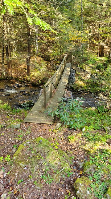 I made my way across carefully on the upstream (left) side of the tilted bridge and then up the small drainage of a tributary of the creek. This section of trail was very pleasant and even had a bit of maintenance, it appeared.  The rest of the late afternoon was spent making my way across the plateau and emerging on a pipeline. To my surprise, I found that I had excellent cell service on the line, which I used to listen to the radio feed of my beloved St Louis Cardinals play the Atlanta Braves in a playoff game (the Cards scored 10 runs in the first inning to win easily). The side of the pipeline was mowed back and although the blazes were few and far between (and hard to see off in the brush sometimes), it was nice to walk in the open.  I made it down the pipeline walk of about a mile, and the trail then veered left into the Hensel Fork valley. It was pretty steep at times, which made me thankful that I was headed this way and not the other for tonight. I made it across the Hensel Fork and back up the hill. The descent down to Sandy Run Road wasn't that difficult and I made good time, although it was beginning to get darker. I got to where the trail crossed Paddys Run road which had a small, rugged but usable campsite. I was tempted to stop there, but there was a truck there and I figured a hunter might come out and spook me at any time. So even though I knew it would get dark unless I found a campsite up McNerny Run, I pressed on. It was a relatively warm night, I felt strong and the trail didn't look steep, so why not? I pressed on up the trail and darkness closed in as I didn't find any camp sites near the trail. I put on my head lamp, grabbed a drink and figured I could make Pfoutz Road at worst. I did end up making it there and turned right onto the gravel road as it was completely dark. It was slightly spooky as I saw eyes flashing in my headlamp, but figured they were all deer. I finally settled down for the night at the top of Pfoutz Road where the trail turns left off to go down into Merriman Hollow. Luckily it was a nice flat spot and there was a good enough tree available to hang my food bag in, and I even had enough time and cell service to watch the last inning of the ball game on my phone before I went to bed. I did my usual standard Bible and Lord of the Rings reading and drifted off to bed feeling pleased with my daily progress. Mileage for the day: 20.98 miles Mileage for the trip: 91.72 miles |
|
|
|
Post by jmitch on Oct 27, 2019 19:56:25 GMT -5
Incredible. Best trip report in a long time.
|
|
|
|
Post by anfhiker on Oct 29, 2019 18:38:32 GMT -5
Day 6-Thursday, October 10th I woke up at 6:45 am and the temperatures had begun to get colder at night. I knew that this was supposed to happen, and wasn't really looking forward to testing the limits of my 40 degree bag. However, I was thankful that the days were due to be sunny and the temps would be moderate, in the 60s for the most part. I packed up my gear and had my breakfast, and was on the trail at 8 am. I began the day by descending down Merriman Hollow, which is fairly steep but not overly rocky. I was looking forward to getting to the junction of the Donut Hole Trail with the Susquehannock Trail, which promised better trail conditions. The top of the hill was dry, but the vegetation was still wet from either dew or remnant from the rain as I turned left up the Osborne Branch. This section of trail has a good stretch of old logging road, which crisscrossed the stream several times. Luckily the water was just low enough that I was able to rock hop. There was one very large set of blowdowns on the trail, which were just past where I took this photo.  It was about 9:30 when I made it to where the DHT and STS intersect, which was ironically the hardest of the crossings of the Osborne Branch, just above where the Porter Branch comes in. The Susquehannock Trail, which is an 85 mile loop trail, heads west toward Cross Fork alone, while it runs along with the Donut Hole Trail for about 9 miles heading east. This section was initially a bit disappointing as it was on some pretty significant side hill with a lot of vegetation, which as mentioned was all wet and eventually soaked my boots that I had finally gotten completely dry for a day. It wasn't too bad as there was a section near a gas well where someone had mowed. I made a left up Scoval Branch as I was very pleased to enjoy the sun on my back, with temperatures rising.  It wasn't too long and I passed the Scoval Branch shelter, which was built by the Susquehannock Trail Club and is the only shelter on the Pennsylvania Wilds Trail route, currently. I stopped to eat a "second breakfast" and enjoy sitting down in a dry spot for a while. This is a very pleasant spot with a nice fire ring and a pretty location. 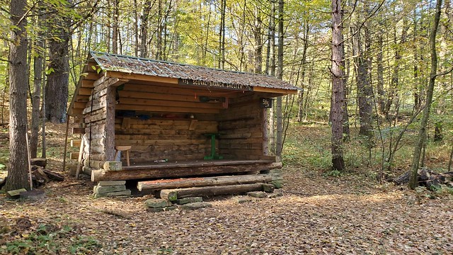 I left here and the gentle slopes for the day as well, I would find out. From here, the STS/DHT become very rolling, with pretty much constant ups and downs as you head into different stream valleys. Once I left the Scoval Branch Shelter I came out onto a pipeline, headed across the headwaters of the stream and then up to the top of a small hill. 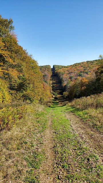 Once over this, I dropped back down into the headwaters of the Osborne Branch again, and back up the hill before turning right onto a snowmobile/forest road. This road went on for about a mile and gradually got better, as it went from recently logged semi-mud to a limestone road. I passed another few gas well locations as the sun was getting higher in the sky, lifting my spirits and warming my back even more. The trail eventually drops down to Little Greenlick Road, where you pass across the stream on another gas well road (many of these are storage wells, or locations where the formation has been emptied out and is now being used to store gas during the spring and summer to be used in the next winter). I stopped near on the pad and took my pack off while grabbing a snack. I was fairly annoyed by the large number of flies which were swarming and biting me whenever I sat still, so I didn't loiter long even though I would have liked to. At this point, I was on the Italian Hollow Trail. The trail was fairly steep but grassy and I was filled up with food so I was feeling good. I was quickly over the hill and met up with Greenlick Run, which I followed for nearly a mile. This is a pretty stream which is fairly typical of the Allegheny Plateau...nice runs with scattered pools and structure littered with some logs, and likely loaded with trout. Again, I was trying to catch up from my poor day on Day 3 so I wasn't able to break out the fishing pole (I should have, in hindsight). There were a couple of camp sites on the map along the stream/ Eventually, the trail turns left and up Bobsled Hollow, which begins on a decent grade and then gradually gets steeper to become a significant climb.  I was a little worn when I hit the top of the hill, and looked forward to a little bit of flat walking...which lasted maybe a few hundred feet. The trail begins to sharply descend into Long Hollow, eventually finding the dry stream and following it down through some serious nettles (thankfully they were dying back, again) and crossing Twelvemile Road near a large culvert. It was easy to tell that this drainage could carry some serious water in times of heavy rains. I crossed the road and shortly thereafter, the foot bridge across Left Branch Young Woman's Creek. On the other side is a nice campsite near the water. At this point, I met Gary and his dog, who were taking a break after coming down Morgan Hollow. Gary was from near me so we talked about where we are from. His dog was on her first backpacking trip ever at 11 years young, and was taking on the entire STS in one shot. Impressive! Gary was on his third day on the trail and was making good time, it seemed. I was pleased to have some time to chat with another person for the first time in a few days. Eventually we headed our separate ways and I began to make my way up Morgan Hollow. Morgan Hollow is the most difficult climb on the STS and maybe even the entire PAWT. The trail begins on a moderate grade and then quickly becomes extremely steep with no switchbacks until the very top. The rise is approximately 800 feet in about a half mile, which feels like it may never end. The footing is ok but occasionally slippery and I was thankful that I took a long break before attempting it. 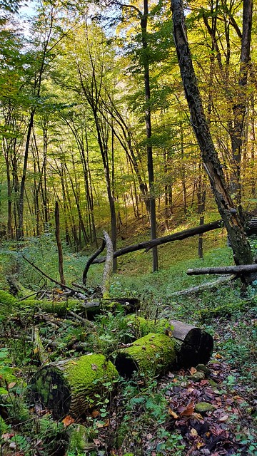 (Looking back down the hill) Eventually I crested the hill and made my way back over the gentle hump of the "peak" and to Fork Hill Road. Here, the STS makes a left (north), splitting from the Donut Hole Trail, which heads right (south). As the PAWT follows the Donut Hole Trail, I said goodbye to another trail and made my way along the dirt road for about 3/4 of a mile before the trail went left and continued east into Bull Run's valley. Shortly after leaving the road, the trail became very wet and I was surprised to find a well maintained spring house with a pipe flowing cold, fresh water out of it. This was one of the better springs I came across on the trail and I was pleased to fill my bottles up and rehydrate. The trail follows along the Bull Run drainage for several miles and was in very poor shape with high vegetation, rocks (many hidden), burs and briers and blazes that were difficult to see. I lost the trail twice here, once for a short time (maybe 100 yards) and another time for many times that. I was getting a bit frustrated as I felt like I lost some time there and would struggle to make it as far as I hoped. Eventually I made it to Right Branch Young Woman's Creek, but it was after 6 PM. There was a monument here for the first purchase of State Forest land by Pennsylvania. Kind of a neat spot.  I considered camping here, as it was flat and grassy. There was a camp right near it that had a car parked out front, so I figured I had better check to make sure it wasn't someone's private lot. So I went and knocked on the door, and a young couple came out. They said that the spot wasn't their property and that they were fine with me camping there. The man seemed to be knowledgeable about the trail and the area, and he suggested that there were campsites up along the trail after it crossed Seven Mile Run a ways up. So I decided to press on as I had at least a half hour of daylight left. I made my way up along the road as daylight waned, then crossed the stream on Long Memorial Bridge. The trail then turns left and follows the stream up the valley. Unfortunately, I can't tell much about how it looks because it was getting very dark and the campsites I had been told about eluded me. I eventually gave up after my headlamp's batteries became very dim and decided to set up my tent in the middle of the trail. I found a spot under some hemlocks that was not flat, but at least wasn't sloped side to side. I didn't end up doing any cooking tonight as I ate some snacks instead. I was glad to have gotten the big hills of today out of the way and tomorrow was going to be a day with less overall elevation. I did some reading and slipped off to sleep fairly early, hoping to get an early start tomorrow. Mileage for the day: 19.28 miles Mileage for the trip: 111.0 miles |
|
|
|
Post by anfhiker on Oct 30, 2019 18:50:32 GMT -5
Day 7-Friday, October 11th I woke up early enough again, and as I was in a dark valley, it felt like the coldest morning of the trip. My cheap thermometer said it was 40, but it felt like it might be even a bit cooler than that. I got my pack loaded up and was on the trail just after 8 am. I was excited to see some new ground and finish the Donut Hole Trail today, which had been difficult and not that well maintained in places. I made my way up Seven Mile Run and turned right into a small side stream's valley, which then ascended steeply to the top of the plateau. Part way up, I saw two deer run back across the hillside in front of me, including one nice buck, probably an 8 point. I didn't have time to get any photos before they darted into the laurel, though. The trail went right up the valley before turning back right and up to the top of the hill. Once I made the top, the trail caught some old log roads, and I had a little cell service to send a text and make a call to my parents to let them know how I was doing. I was enjoying the sun as it got warmer and the trail was more open and pleasant to hike. 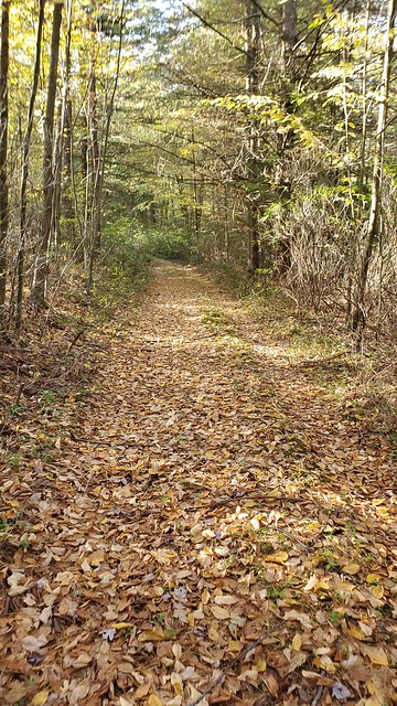 It was less than a mile from the crest of the hill to a left turn onto an active forest road, which then led me across Dry Run Road and onto a lease camp drive. I followed the trail/driveway past a nice camp and crossed the headwaters of Cougar Run, where I stopped to filter some water under a canopy of hemlocks. The trail then turns right and winds down the hill through a very lovely forest of these same hemlocks. The trail was in very nice shape here and the stream was just gorgeous as it shimmered in the mid-morning sun, picking up water as it flows toward Hyner Run. 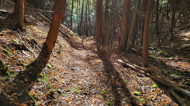 I was very happy to be able to enjoy this time on the trail and knew that I would need to be on the lookout for the T-Squared Trail that would mark my turn from the DHT. I passed a camp site where a side stream came in, and it wasn't too long before I was at the intersection. The orange blazed DHT turns right and crosses the stream, while the yellow blazed T-Squared Trail heads left up the hill.  Immediately upon hitting this trail, the difference is notable. The trail heads up the hill but does so on a series of switch-backs, giving some peeks through the leaves over the Cougar Run valley. About mid-way up the climb, the trail gets a bit rocky but has been nicely cleared by a maintenance crew, which made some nice hiking. It wasn't long before I made it to the top and entered a very nice stretch of woods, flat and colorful with the changing leaves.  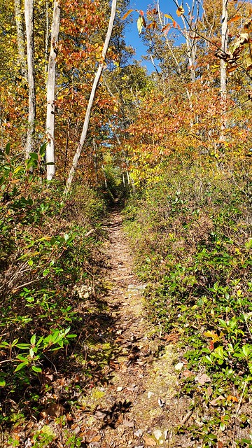 The T-Squared Trail is about 6 miles long and connects the Donut Hole and Black Forest Trails. It is cleared back about 3-4 feet in many areas and has a very nice treadway. All of the significant climbs and descents are switch-backed, which makes it a real joy to walk and a nice respite between difficult stretches. I walked down into the Mill Hollow drainage and back up after crossing on a bridge, then continued with rolling hills as I crossed Dry Run Road again and angled northeast to head toward Benson Road. It was around 1 PM when I made it to Benson Road, passing a camp where three of the owners were coming out as I headed past. It was a father and son with someone I didn't find out, and they offered me a bottle of water and the use of their porch if I wanted a flat spot to eat my lunch. I talked with them for a while about the area and they said they were going to head down the trail to cut some brush for hunting lanes during deer season. I took advantage of the chance to sit in one of their porch chairs after I got my tent spread out in the sun and had my lunch, then moved on down the trail. Not much changed about the T Squared Trail as I moved along the plateau. It really was a pleasant walk with only a few rocky spots and plenty of space to walk.  It was about 2 PM when I descended the steep hill into the Baldwin Branch valley and took my first steps on the Black Forest Trail, which would be my companion for the next 25+ miles. I stepped across the stream and began to ascend, stopping for a moment to tie my shoes partway up as I had to do a ton of times on this trip (the laces on those boots are sturdy but nearly impossible to keep tied, even in a triple or quadruple knot). When I stood up to walk again, I heard someone call out behind me "coming up behind," and I was passed by Mike, who was hiking with his dog Bearly. We both commented on the steepness of this (short) section of hill, and I mentioned that I thought things would get tougher on the BFT rather than easier. As we were walking at the same pace, we walked along for a few hundred yards until he stopped for a break and I continued on. It wasn't long until I made it to the top of the hill and proceeded up a camp road and across Route 44. The trail then follows Trout Run Road for a short distance, complete with a view overlooking the top of Naval Hollow's drainage, hinting at what's to come.  Shortly after this, the trail turns right and up across the top of the hill before emerging again on Trout Run Road and crossing by a camp. As I walked across the driveway/yard, the owner of the camp, Andy, waved and came toward me to talk. I asked if he had a spigot I could use, which he did not, but he handed me two bottles of water as we talked for a bit. He told me that I was coming up on the hardest part of the trail in Callahan Run and Naval Hollow, and suggested a camp site at the top of Callahan as a good place to stop for the night. I thanked him for the advice and downed the water, and he handed me another bottle for the road, which was very nice of him. I wished him luck as he was headed out for the evening to do some archery hunting and I moved into the woods as I saw Mike coming down the road behind me. Behind his camp was a trail register and the trail moved up a small hill before dropping back down to Big Trail Road at another vista.  From this point, the trail was descending into Callahan Run's drainage, and the trail became very steep for quite a while. It was about 4:30 PM when I made it to the stream crossing, which is below and above several cascades and a small waterfall. There is a beautiful camp site at this spot and I stopped to consider my options. My intended stopping point for the night, Naval Hollow, was about 4 miles away. I knew I had a climb, a bit of level walking and a steep downhill to make it there. I also knew that I had a "bail" campsite about a mile away at the top of Callahan Run, and I wasn't sure that there was anything in between mile 28.3 and mile 31 on my map. I ended up deciding to take a nice long break and do a little fishing. I got out my fishing pole (a Pen Rod) and strung the line and got my hook tied. Then I searched my bag for the bait I had brought...only to find nothing. Somehow, somewhere the bottle had fallen out or was taken out and not put back in my pack! So that was a waste. I looked under some logs and rocks but found nothing suitable to use, so I took a few photos and rested a little bit more.   It was a bit after 5 when I hit the trail again, and I expected a difficult climb to the top of the hill. In the end, maybe due to the rest and maybe due to better conditioning kicking in, I did not have much trouble at all making it to the Cutoff Trail intersection with a lot of daylight to spare. I found a pleasant, flat camp site and set up my tent. I got my gear out to work on drying it and made the only fire I'd make on this trip. I sat on a log and ate my spaghetti and snacked on peanut butter M&Ms, really enjoying the easiest day I'd had on the entire trip. I was looking forward to a great day ahead that I knew would include a lot more beauty...and a lot more work. 
Mileage for the day: 15.5 miles Mileage for the trip: 126.5 miles |
|
|
|
Post by anfhiker on Nov 1, 2019 18:05:16 GMT -5
Day 8-Saturday, October 12th I woke up early again and was able to enjoy the early morning, getting my gear packed up and packing only my M&Ms in my waist pack as a snack because I knew that I'd be passing Slate Run and the Hotel Manor today. I was so looking forward to some civilization...and most of all...a burger from the restaurant! The temperature hadn't been too bad overnight as I was on top of the hill...so it was around 45 as I got going. I was on the trail about 7:30 and by the maps, I knew that I had about 14-15 miles to go to make Slate Run. I set a goal to be there by 4 PM, hoping to beat the rush of people that might be coming in for dinner after a day in the woods. I looked forward to the views that I knew were coming today, although they would come at the price of a lot of elevation gain and loss. I walked up and over a hump along the spine of the ridge known as Hemlock Mountain, enjoying the trail as it rolled along. It wasn't long at all before I came to my first set of views, one facing each into the Callahan and Naval Run drainages as the trail rose from a dip.   I continued to steadily rise along the sharp ridge of Hemlock Mountain for about a half mile before I came to a gorgeous view facing south over Callahan Run and south along the Pine Creek valley. There was a nice camp site here that is not shown on the map...I was kicking myself a bit that I didn't push on to make for here as I could have had a great view of last night's sunset. As is, it was still an incredible sight.  I stopped for a bit and enjoyed the view, then started to make my way down off the mountain into Naval Run's valley, with another view to cheer me part way down.  The trail became very steep and rocky for a while, heading off the hill on a spine that reminded me of Cirith Ungol with its twists and sharp drops. Still, I was making solid time as I made it to where the trail began to switch-back further down into the valley. I was walking across one when all of a sudden, I saw a nice buck dart across the trail in front of me and labor on his way up the hill. Quite the creature!! It wasn't long until I met the hiker who had spooked him...a younger guy from the Philly area who appeared to be motoring along very quickly. He mentioned that he had camped along the Gas Line Trail the night before and broke camp about the same time I had, but he was much further along than I was, pace-wise. We talked for a bit and I finished my descent to the stream. About the time I got to the flat of an old road along Naval Run, I noticed some rain drops falling on my pack. It was due to rain today but as I didn't have any cell phone service late in the day, I couldn't recall if it was supposed to be in the morning or the afternoon. As I walked along the stream, I noticed several camp sites, one of which was occupied. The rain began to pick up so I eventually decided I'd need to put on my jacket and gaiters to keep myself as warm and dry as possible. I made my way down to Naval Run and crossed, where I stopped to filter some water as the rain was coming down fairly hard. While I was pumping the water, I saw a woman with two teenagers and a St Bernard who came up the trail and then continued past it, up into the brush. The woman kept calling out "Bear," which was either the dog's name or some kind of command. They were all wearing vests that indicated that they were part of some kind of search team. I wasn't sure whether it was practice or active, and I didn't want to get in the way, so I moved on. The climb back out of Naval Run was difficult, but the BFT has many switch-backs which make the climbs tolerable. I worked my way up the hill and the rain began to slow down, so I was able to take off my jacket after having it on for maybe a half hour. I didn't mind cooling off a little as "waterproof and breathable" is an oxymoron and despite it being cool, I was warming up fast. It was still mid-morning on my way up the hill as I passed a view with a sign for Pine Creek Half Dome, which is supposed to be the highest creek to rim rise in the Pine Creek gorge-1360'. This was between the two branches of Callahan Run and made for a pretty view.  The trail then continues up the hill and makes a left onto an old road, which is the Gas Line Trail. There was a trail register at this intersection and the blazes weren't all that clear, so I took a wrong turn for a short distance before backtracking and continuing on. Along the ridge rising up and the road, the trail passes so many views that one could get overloaded with the beauty. I ended up skipping the last one because I had stopped to take many photos and needed to make some time. Still, I really enjoyed the flatter walking for a mile or so. 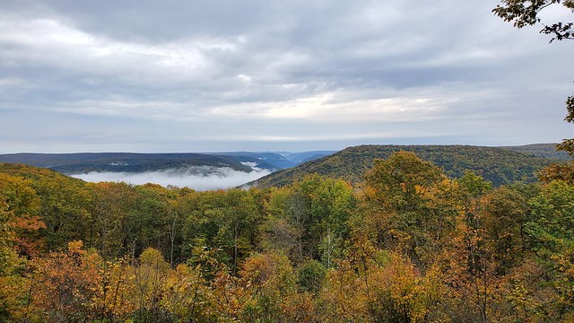   The trail eventually makes a right off the Gas Line Trail and descends into the Little Slate Run valley. Not far down, I passed a man walking up who was carrying a DSLR camera in his arms. He had it covered up with a plastic bag to keep it from getting wet. I admired his spirit in carrying all that weight around, but it's not something I would have done. We spoke for a bit and he mentioned that he felt way out of shape on the climbs and that he had started at 6:30 this morning, with a goal to do the entire trail. I forgot his name but he did mention the Facebook Hiking & Backpacking Pennsylvania group, which I joined when I got home (I mistook him for Mike earlier in this thread, who I mentioned in the Day 7 report). The descent into Little Slate Run was tough, most especially because it involved a drop down along the stream, then a rise back to the top of the ridge, followed by another steep drop into the other branch of Little Slate Run. You know the trail you're on is tough when even the descents involve difficult ascents! I made it down to the other branch of Little Slate by just after noon. This spot has a camp site and good water source, and I paused before beginning the climb back to the top. It was steep, but I made it without a lot of trouble. Once at the top, the trail makes a right onto Manor Fork Road for a short distance. There were some people out along the road and at camps as I walked along, eventually re-entering the woods where the Manor Fork Rd intersects with Pine Hollow Rd. By this point, the rain had completely cleared and the sun was beginning to poke through the clouds, which lifted my mood as I walked across the plateau. I was in need of water, though, and after about a mile there appeared to be a spring at a point where the trail dropped down to the very headwaters of Little Slate Run. It was not running, however, when I got there, so I kept moving toward Foster Hollow, which at MM 39 was about a mile away. The beautiful foliage was my companion along the trail as the walk to where the descent began was very pleasant. 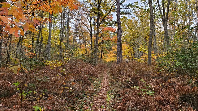 I made my way down the rocky, steep branch of the dry stream bed, picking my footing carefully so as not to slip on the slightly slickened stones. Right where the trail reached the bottom and turned, I met a man and his son who were hiking part of the North Loop this weekend. I was getting my filter out to get water and they told me that there was a great spring at the top of the hill. We talked for a bit about the climb going each way and wished each other luck as they headed up the hill. I decided to get some water anyway as I was out and wanted to rehydrate at least a little before climbing. Finishing up, I was putting my stuff back in my pack when two ladies came down the trail behind me. They were about to finish their hike on the northern section of the BFT at Slate Run and were feeling it from the descent. I made my way in front of them up the hill and as this climb was "only" about 500 feet, made good time to the top. At the top was a camp site next to a pond, which was the "spring" the father and son had told me about. A group of 40-something men were stopped on the other side from me and one of them was urinating right next to the pond when I emerged from the woods, so I was fairly glad I didn't have need to get more water at that point. I talked to them as I walked past and they warned me of the steep hill down to Slate Run and I told them that they had a good set of hills going the other way, but we didn't talk more than that. From here, the trail leveled off for a while, winding through the laurel under the oak and sassafras overstory that I'd grown so accustomed to before making a right at a lovely vista over part of the Slate Run valley.  From here, the trail begins to drop steeply down the hill into Slate Run, following the spine of the ridge for a good portion. The reward for your aching knees and tired thighs is a wonderful 270 degree view of the valley.   I kept moving and made it down a small run's glen and across Slate Run Road. From here, I knew I had a relatively flat walk into town, so I was happy. The trail was about as expected, paralleling the road with occasional views of the stream, which is an excellent and well-used trout stream. As I got close to Slate Run, I came up on a group of young men who had been day hiking and were looking for a spot to camp for the night. There were many areas that it seemed people were using to camp, despite the "No Camping" sign written on the map. It was a little after my 4 PM goal when I made it to the Hotel Manor. I dropped my pack behind the kiosk and talked to a few people who were standing on the bridge looking at the water. They knew about Parker Dam and had a few questions about my hike, which I was happy to talk about at the time. A man came walking down the stream while we chatted who had been fishing (without any luck) and we talked about the trout streams that were in the area. Eventually I made my way into the restaurant and sat down. I was very happy to grab a burger and fries (go salt!!) and eventually struck up a conversation with the man at the table next to me, who was clearly a hiker. He said that he had been hiking the BFT and was stopping at the restaurant before going home. We bonded over our intense hunger and desire to get to dinner as soon as possible; he had even taken a shortcut to get here sooner. Ha! He mentioned a couple of possible camp sites for me to check out on my way up the trail and we kept chatting once my food got there. Eventually he paid his bill and left and I was able to fully concentrate on my food, which I finished along with two Sprites and three glasses of water. It was about 5:15 when I shouldered my pack again and made my way up the trail.  The trail from Slate Run heading up was much gentler than the other grades I'd been on, and with a full belly and well-hydrated, I was in a wonderful mood. The sun was hitting the hill and with temperatures in the upper 60s, it was absolutely perfect hiking as I made my way up gradient. The trail was a nice mix of some neat rocky areas with formations similar to those near Little Pine State Park on the Mid State Trail, open forest and even an old quarry in the midst of it, complete with a view. 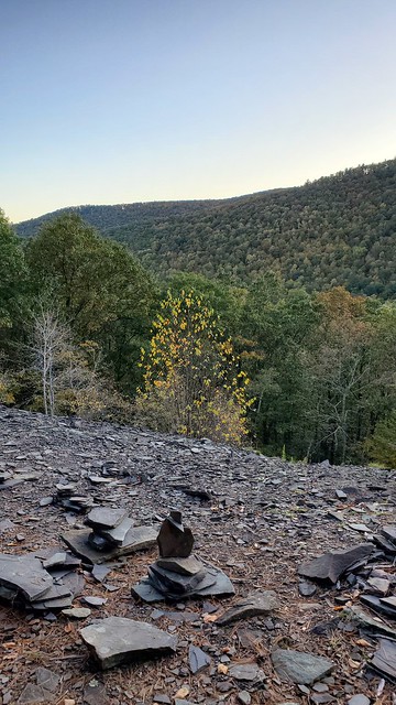 The trail past here became an old road and it was neat walking along here. Eventually I emerged into another area where stone was quarried. There was a fire ring here, it was filled with a beautiful amber-colored grass and was flanked on either side by a small stand of birch trees. It was not a stretch to say that this was the high point of the entire trail for me...this spot was absolutely perfect and the air was still warm as I thanked God for the ability to just enjoy this moment of beauty and tranquility.   I considered camping here but I had a good bit of daylight left and wanted to get a bit further. The trail got a bit steeper, following the old road and eventually cresting the mountain about 2.5 miles and 1200+ feet from where the climb began. It was starting to get darker now and I was ready to find a spot to rest for the night. About 3 miles in from Slate Run, I passed a spring on the right of the trail which had a camp site. My friend at the restaurant had told me about it and that there was a "secret spot" that was very nice and comfortable, so I set up my tent there and settled in for the night. I was feeling extremely good and felt as though I would have a shot with the easier terrain tomorrow to make up even more mileage and have an outside shot at finishing on Monday. The temperatures began to drop and although I now had a slight toothache (I've had some work on this tooth throughout the last year and it often would get sensitive and ache a bit when it got cold), I was looking forward to a good night's sleep and a nice day tomorrow. Mileage for the day: 20.1 miles Mileage for the trip: 146.6 miles |
|
|
|
Post by anfhiker on Nov 3, 2019 21:03:32 GMT -5
Day 9-Sunday, October 13th The night's sleep was anything but good. It turned out that my tooth was not simply a bit sensitive...an infection had crept in behind the filling and was starting to set in (I wouldn't find this out until after I got home). After I tried to get some rest, it would throb and ache off and on for almost four hours, finally calming down enough that I was able to get about 3-4 decent hours of rest. I woke up to what was the coldest morning yet. It was not fun getting out of my 40 degree sleeping bag, knowing that it was barely above freezing (I had a small amount of cell service and the local Weather Underground stations all read 28-32 degrees). I took some time to grab water from the spring and packed my stuff up. I knew that despite the cold start, it was still due to get to near 60 degrees today so it would be a temporary inconvenience. I also knew that it was going to be a much easier day terrain-wise as I'd be on some connector trails for a long stretch. I broke camp about 8 am and was quickly across the plateau to the intersection of the Black Forest Trail with the Algerine Trail, which exits right as the BFT turns left.  The Algerine Trail is named for a group of people known as "Algerines," so named for a group of people who were known in the olden days to steal logs that washed out from the splash dam runs and either sold them back to the timber companies or sold them at market themselves. The yellow blazed trail heads northeast from the BFT for about 2 miles on mostly flat ground before making a hard right turn, emerging onto Gamble Run Road at a parking lot before the road moves onto private property. A sign here indicates that it's about 6.3 miles to the West Rim Trail. 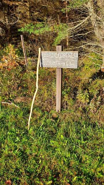 From here, the trail continues east and, oddly, changes to red blazes. I was able to make excellent time along here as the lack of elevation made for quite pleasant trekking. The frost was still evident on the ferns and grass along the trail. 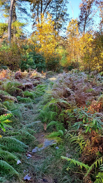 The trail then winds north along the edge of the plateau well above Cedar Run's drainage. It passes mostly hardwood forests, with an occasional mix of red pine plantation. At the end of the one of these, the trail turns right and begins to head down Hamilton Hollow. 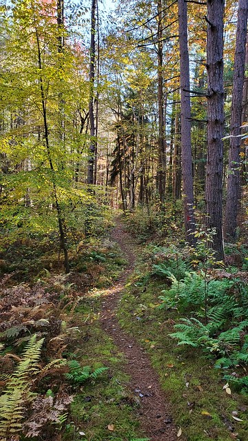 The walk down Hamilton Hollow was relatively steep but nothing compared to what I'd already finished, so I was doing fine. There wasn't much in the way of water on the way down, but had there been, there would have been a pretty little falls.  It wasn't long and I had made my way down to Cedar Run along a nice road. I stopped to enjoy the view and the brief bit of sunshine, although it was still chilly out. Cedar Run is another famous trout stream in Northcentral PA, and I could see why. It had a lot of character, with many large pools for trout to shelter in and grow big. 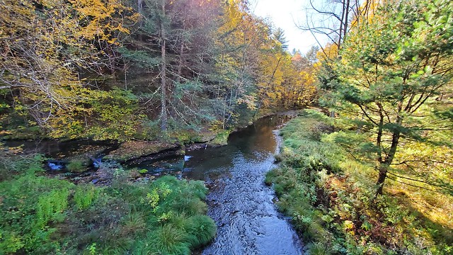 From here, the trail follows Mine Hole Road for a short distance before turning left up the very steep bank onto the Long Branch Trail. The trail at this point actually had a different name; a native name that was given by a group of Boy Scouts who had worked on building this section of trail about 20 years ago (I could not remember the name and didn't take a photo of it). There was a very large blowdown right at the beginning of this trail that was difficult to get around, and there were a number of trees to cross as the stream follows Long Branch up its glen. The beauty of this glade made it worth it. A number of cascades and a 15 foot waterfall were the highlights, but the entire trail is very worth the hike.   As I made my way to the top of the 700 foot climb, I walked through familiar terrain; I had done this section of trail on a scouting hike in July. The leaves created a canvas of color and cushioned my feet as I walked along and made the top of the hill while it was still before noon.   The trail heads nearly straight east as it moves toward the West Rim of the Pine Creek Gorge. I was thankful that the very swampy area that I had to route around in July was all dried out now, and I continued to make excellent time as I passed a cross trail and then turned right at another one to stay on the LBT. The trail had red, then blue and yellow blazes here, but wasn't bad to follow as it was mowed recently. It was 12:30 PM when I made the sharp left onto the orange blazed West Rim Trail, which fits its name and is a 32 mile trail that ends at its northern terminus in Ansonia. I've hiked the entire trail once and have done shorter hikes on it many times, so it was like meeting a familiar friend. I would only be following this trail for a short time though, maybe 2 miles. Still, I noticed some familiar landmarks, including an old dynamite shed.  I was ambling down the trail and met a couple who had done a short hike along the rim and were headed back to their car; it was nice to talk to people along the trail and tell them about the PA Wilds Trail and where I started. Many of them were aware of where Parker Dam was, and quite a few were not. But I figure that any education I could give about the beauty of our area was worth the investment. I left them and moved on, passing a nice vista that gave me a view of what awaited me as I would be in Blackwell before long. 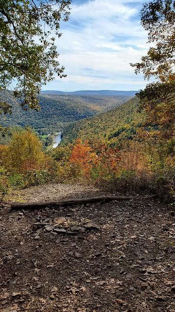 Given the very daunting hills of the DHT and the BFT, the more rolling terrain of the West Rim Trail was pretty easy and it wasn't long until I entered Bohen Run's stream valley. Here, the West Rim Trail continues north, while the Mid State Connector Trail follows Bohen Run toward Blackwell. I made the right onto this trail and moved down the yellow blazed trail swiftly. This trail has a lot of beauty, passing two waterfalls, one along Bohen Run and one along Jerry Run. As the first falls was well off trail and I was on a mission (food!), and the second falls was barely flowing, I didn't get a chance to take photos of either. The trail gets a little steep as it approaches Blackwell and has some tight quarters for walking; someone had recently even built some bridges/walkways in the worst section, where I presume the landslide had closed the trail before. It was in this spot that I met two men about my age who were exploring the trail and looking for something new to see; they mentioned that they had a camp along Stony Fork and that they liked to do some hiking when they came to visit. It was about 2:30 when I made it to Rt 414 at Blackwell; I was pleased with my pacing as I'd made it about 15.5-16 miles in 6.5 hours, including stops. I made my way past the turn for the trail and dropped my pack in front of Miller's General Store before going in. I picked up three slices of pizza, a birch beer, an orange juice and some salty cheese crackers. I was sitting outside on the deck, enjoying some sunshine and watching families play, groups of bikers pass by on the Pine Creek Rail Trail, and generally just enjoying life. A couple walked up and asked where I had hiked in from; they were impressed as I told them about the incredible beauty of the walk I'd been on and I was happy to offer them a couple of suggestions for pretty hikes near Slate Run, where they were headed to look at the leaves. One visitor that I was a bit disappointed not to see was Nibs the cat, who had greeted me when I stopped here on a Saturday morning in September on my hike on the WRT/MST. I figured he must not be a fan of the crowds. Eventually I knew that I'd need to shoulder my pack and move up the trail. I went inside one last time and the owner offered me use of the sink to fill my bottles, which I accepted. I made my way back to the Mid State Trail, which enters Blackwell from the southeast off Gillespie Point and then heads north along the Pine Creek Rail Trail for over a mile. The sun was absolutely brilliant as I was walking along the gravel trail; many groups of bikers were out today and as the afternoon shadows grew, the number of bikers slowed to a trickle. I was in such a good mood that I hardly paid any attention to the slight pain that was emerging in my left ankle. I was used to having aches, pains and sores on this trip and they pretty much all went away after loosening up, some ibuprofen or both. The scenery was sublime.  I made my way right and began to ascend Stone Quarry Run when I was startled by some noise in the dry creek bed below me; it was the guys I'd met on the other side of the creek. They had left the trail on the other side, waded the creek and were going to explore this valley. We chatted for a minute about backpacking and the kind of meals I'd take on the trail, and then I moved up the very steep hill. Within a short distance, the trail became less steep but still presents a challenge, rising nearly 1000 feet in about a mile. I immediately noticed that this section of the MST was not nearly so well conditioned as the trail was south of Blackwell, which I had done in that September trip and was maybe the best kept trail I've ever been on. Nearer to the top of the hill, the trail turns left at a campsite and the intersection with the Fork Hill Trail and onto an old grade. The trail turns left shortly thereafter and makes a bit of a horseshoe as it follows the shape of the hill, passing a sign for a trail that leads to a vista (I didn't take it...and don't really understand why the trail wouldn't go past the vista anyway?). It then curves back to the same grade you were on before, after which the trail begins to drop in elevation before descending a bit more sharply to Water Tank Run's main branch. Here, there was just a touch of water but I was around a mile from a camp site and was feeling fine so I pushed on further. The trail crosses the stream and then turns left up the hill for a bit before winding around the hillside between the two branches of this stream. My intended goal was the campsite at Mile 10 of the Pine Creek Press map I had measuring from Antrim back toward Blackwell; this would mean that I had 10 miles to go to Antrim the following day. As I got closer to my goal, I had to drop down over into the other branch of Water Tank Run, which had a little bit of water as well. I followed an old road that was a little difficult to see at times along the stream, looking for the camp site that showed on the map. It began to get darker, and I was getting concerned that said camp site didn't exist or was hidden away somewhere that I didn't see. I had passed on about half way between the two branches, but it was dry and the map wouldn't be that off...would it? In the end, it became a mystery as I passed further up the valley and through some neat rock formations; at this point it was getting dark enough that I'd need my head lamp soon and I knew that my only real shot to find a flat camp spot would be at the top of the hill. I climbed up and to Clay Mine Road, which wasn't too promising but had some dirt turnouts that might suffice if needed. At this point I turned off my GPS as I was going to camp here one way or another. I turned left as I checked my phone and found that I had a bit of signal and came upon a gravel parking lot about 75-100 yards from the trail up the hill. I decided that this would have to be my home for the night. Tent stakes wouldn't work here so I found some decent sized rocks to hold my rain fly on and got settled in for the night. I was getting pretty cold, pretty sore and hoped that I had one more good day in me to make it to my car. The weather for tomorrow night looked downright frigid and I didn't think I would enjoy having another evening in the cold, especially with a potentially painful tooth to deal with. So I did some reading and settled down for the night, pleased with the day but praying for a much better night's sleep. Mileage for the day: 21.1 miles Mileage for the trip: 167.7 miles |
|
|
|
Post by anfhiker on Nov 3, 2019 21:47:38 GMT -5
Monday, October 14th I was very thankful that I slept well overnight. The full moon made it almost too light in the tent, but it was nice that I didn't need my headlamp to get outside the tent for nighttime relief. I was amused to see a rabbit had taken up residence in the same area I had and was munching on grass in the middle of the road; woods rabbits are pretty rare and it was a little startling hearing something walking around until I realized what it was. I had decided this morning that I wanted to push as hard as I was able to in order to finish today; I had the day off tomorrow and figured that even if I needed to really make a marathon of it, I would have a day to rest up and recover. I was really not looking forward to two things...the ford of Stony Fork, as it was mid 30s overnight again, and the long road walk from Rt 287 through Antrim to the upper stretch of the MST. Anyway, I broke camp at a decent time again: 7:30 as I wanted to make some time. I was greeted by some neat rock formations that reminded me a bit of home.  I was also greeted by the return of my sore ankle. This was much less pleasant as I knew that I was going to be struggling all day. I began to descend a steep tributary of Stony Fork, where I stopped to get water at a small trickle over some mossy rocks. As the stream valley descended, there were more areas where pretty falls would have stood if not for the low flow of this time of year.  Unfortunately, this was also the start of the really significant pain I would experience today; the rocky stream valley meant uneven footing and lots of angles to walk on, which made for increasingly sharp pain across the front of my ankle. Once you reach the bottom of the valley, the trail flattens out and follows Stony Fork at a slight distance, with the exception of two places where it goes up on the hill for some reason; I'm not sure but this may be a property issue. Anyway, I was slowly making my way down along the stream, which is beautiful but never really offers close up views unless you are willing to leave the trail. I did a couple of times where it was close by and enjoyed the rocky gorge with beautiful water.  About 1.75 miles from where you reach the view of the stream, the MST turns left and crosses Stony Fork on a gravelly ford. The temperature had seemed to only get colder as I dropped into the valley this morning, so I was coming to dread dipping my feet into the icy waters. What a blessing it was, then, to notice a log that had fallen into the stream just upstream from this crossing. It made for a perfect crossing and I didn't even have to take my boots off! I was super thankful for that. 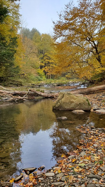 The Mid State Trail then follows Roland Run uphill, across Stony Fork Road, and to the top of the hill. At first, the trail is steep and it gradually becomes more moderate as it follows an old road (or railroad) uphill. I felt encouraged to know that my ankle was feeling fine on this uphill, and I made better than expected time as I chased the first sunshine of the day up the valley. This stream was dry at the bottom but after a half mile or so, turns left across the stream where water was flowing. I stopped and got my bottles full again and took a little break as I contemplated my course of action for the rest of the day. I knew that making it the 20-25 miles was going to be difficult with a heavy pack so I planned on a couple of "easier" options...I could walk out to Antrim, try to find someone who might give me a ride to cut out the few miles of road walk, then stash my heavy pack and take my waist pack with a few pieces of essential gear to my car, then return to get my pack. Another option would involve the same as above but without the ride. Either way, I knew a long day awaited me. I left my spot and began to follow the trail up and over the hill of one side of this drainage and into a side stream's valley. The trail here follows some old road for a while, up and over the hill and continuing up for some time. I was surprised by how much water there was even at this elevation, and was surprised again when I realized how little mud I had encountered on this trip. As someone who hikes in what we affectionately call the Allegheny National Rainforest, I was used to dealing with a lot of mud and had forgotten that I hadn't really dealt with much of it in my 10 days. The trail continued uphill and began to flatten out, continuing to follow the old road and coming with some more mud, although nothing terrible. I followed the trail slowly along the flat, as my ankle was getting worse. I took some ibuprofen and trudged on, eventually crossing a road that was called Plantation Road on the map. At this point it was a dead end with a yellow gate and there were trucks parked there; I assumed they were archery hunters. I kept moving, trying to keep a decent pace up. I began to descend into Slide Run's valley and had to stop to take some Tylenol in hopes that a mix of painkillers would soothe my ankle. The trail began to get steeper and steeper and I misstepped a few times, which caused intense pain. The trail was following this same old grade and eventually turned right onto the southern hillside of the stream; I missed the turn. The grade was in OK shape for a while and gradually got worse as I felt lost and in pain. I emerged where the grade and the trail met; there I saw a mailbox with a trail register. I also saw a sign that said "MORRIS 1.5 KM." I knew that Morris had cell service where I could call for a ride and that it also had a bar/restaurant to wait at. I thought for a moment about turning left on the MST and continuing on, but I knew that my body was telling me that it was time to give in. I didn't want to quit, but my time on the Pennsylvania Wilds Trail was through.  I turned off my GPS as the yellow blazed Slide Run Trail looked to be pretty easy to follow. Had there been more water, there were several pretty cascades that would have made for nice photos, but they were just trickles now. The trail crossed the stream three times on the way down and was steep enough that I had to be careful on my ankle, but I didn't struggle a ton. When I emerged onto Rt 287, I had some service so I called Pine Creek Outfitters. They told me that they would be able to pick me up around 1 PM and as it was 11:30 I had some time to head over to the Crossroads Tavern to get some lunch while I waited. I walked along the nice, wide median and made a call to my parents to let them know my plans, then stopped in for some food. I had just finished my lunch when the PCO van pulled up. The woman was the same one who'd shuttled me on my West Rim Trail hike in October 2013 so we chatted about the trail and their services and schedule (she was also the one who warned me that there was a bear stalking hikers on the WRT just before I hiked it in September; thankfully that bear had been relocated). We made it to my car around 2 PM and I was thankful that it started right up with no issues. I said goodbye to them and made another phone call to let someone know I was out of the woods (literally!) and headed home. The rest of the day was just a backtrack along my route; I stopped at PCO and paid for my shuttle, then made my way down Rt 144 to collect my ammo can. I reminisced about the trail that I had completed and how neat it was to have taken in so much of God's marvelous creation, and to have had wonderful weather to do it in. I though about checking on the Tamarack Fire Tower to see if it was open, but I was tired and needed to get home. I made my way west toward Emporium and dropped my friend's gear he had loaned me off. As I drove the route I continued to think about the difficult but rewarding trail and how it might be improved, promoted or made into the hiking destination it really could be; I will outline a few things in a coming post. I then shot up Rt 46, back across Rt 6 and 59, and home. Thus ended my hike. I was pleased with how far I made it, but couldn't help but be disappointed in not finishing. I still hope to go back, maybe in the spring, to hike the rest and get GPS on that last 15-20 miles. All in all...not a bad 10 days. Mileage for the day: 6.5 miles (plus another mile or so exiting the woods) Mileage for the trip: 174.2 |
|
|
|
Post by anfhiker on Nov 3, 2019 21:52:10 GMT -5
So that ends my trip report. Thanks for reading it; I hope you enjoyed it and many thanks to Jeff for putting to paper what I had dreamed on for several years. It really helped to have your expert sense of where the trail would go. I truly enjoyed it immensely.
I have a couple more posts to share, which I plan to get to in the next few days. The first one will be a list of my personal "Top" lists of things on the trail. I like rankings so I suppose it makes sense that I thought a lot as I hiked how certain parts of the trail compared to others. If you've hiked parts of these I'd be curious to know your thoughts! The second post will include some things I think that could ultimately help make this a destination hike for folks looking for a challenging, rewarding through hike of a "new" route.
Anyway, thanks again for reading and Happy Trails!
Stlcard
-Psalm 118:24 ~He lives!~
|
|
|
|
Post by jmitch on Nov 4, 2019 12:30:23 GMT -5
Again, great job and thanks for doing this. Your photos clearly show this is a high quality hiking route.
As for route changes, I was thinking of having the PAWT follow the DHT to STS to North Link Trail to BFT. Another idea was DHT to STS to Cross Fork to Dry Hollow Ridge Trail to STS to North Link; the benefits of this route is that it would include Cross Fork and Ole Bull State Park (and Spook Hollow), but I'm not sure as to the condition of the Dry Hollow Ridge Trail.
It has been a challenge deciding if/how to include the WRT, which is a notable trail and Barbour Rock vista is quite the endpoint. In the end I felt the MST to Sand Run Falls was more diverse and included two more towns (Blackwell and Antrim). While the WRT has about 9-10 vistas, MST has about 4 vistas, ruins, rock/boulder features, impressive swimming holes and rapids on Stony Fork, and 4-6 falls, two of which are impressive. Sand Run Falls and its gorges are truly beautiful and also make for a great scenic endpoint (or close to it). I also thought about MST south to Little Pine or Woolrich, but again, MST to Sand Run Falls was more diverse and it also stretched further across the PA Wilds. Maybe the WRT and MST south to Little Pine or Woolrich can be east end alternatives for thru hikers.
Thanks for your efforts. Hopefully the PAWT can catch on and attract hikers and backpackers across the beauty of the PA Wilds.
|
|
|
|
Post by jmitch on Nov 4, 2019 12:33:56 GMT -5
Is the Tamarack Tower going to be open? The old one was, but it has been completely rebuilt. I hope people can climb it because it does have great views.
|
|

