

Tussey Mountain (Pennsylvania, Jan/5/2019)
Jan 6, 2019 15:09:02 GMT -5
Post by GaliWalker on Jan 6, 2019 15:09:02 GMT -5
Tussey Mountain (Pennsylvania, Jan 5, 2019)
Iron Stone / Mid-State Trail loop
My first hike of the new year: soggy trails, rocks galore, rain, mist, and finally some sunshine and views. Let the fun begin anew!
A 3hr drive eastwards to central Pennsylvania deposited me at the eastern shores of Lake Perez around sunrise. 15min later (8:00am) I was on my way, hiking the Lake Trail under a gentle rain and a lowering sky.
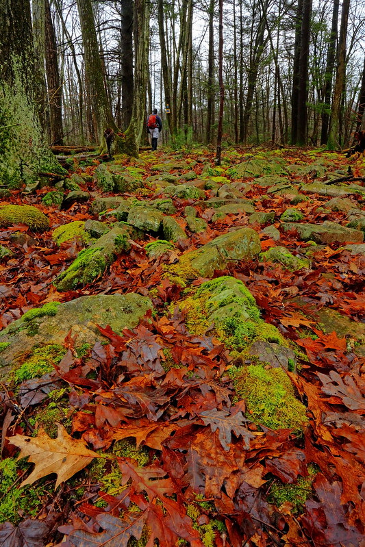
I skirted the inlet of Lake Perez, navigating the boggy terrain atop a network of boardwalk. After walking up and down the maze of trails in the vicinity of the Stone Valley Nature Center's Visitor Center, I eventually found myself on the Iron Stone Trail. This was a soggy mess due to the heavy rain that had been falling since the past day. Having said that the colors were extremely vibrant and everything looked minty fresh. Raindrops bejeweled every branch and berry. Moss and lichen covered rocks glowed neon green.
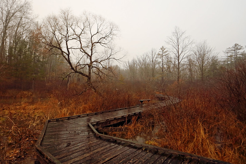
Boardwalk
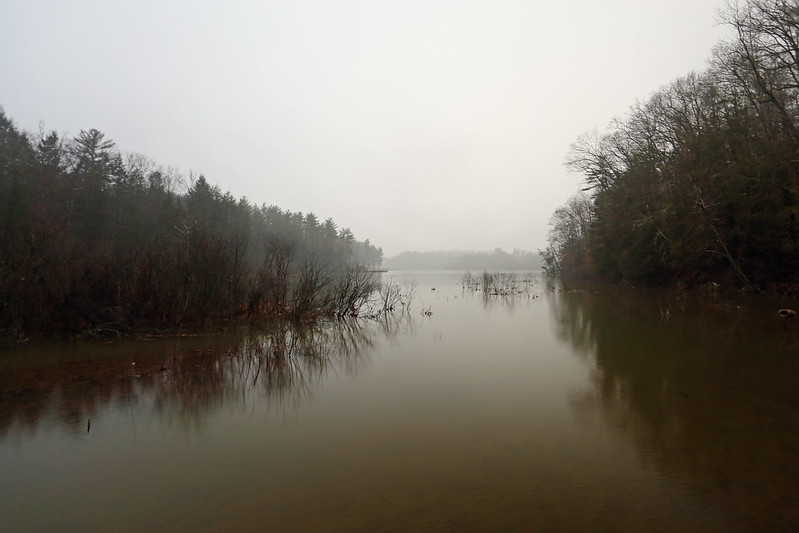
Lake Perez inlet
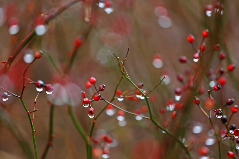
Jewels
Ankle twisting rocks...but so pretty! (selfie)
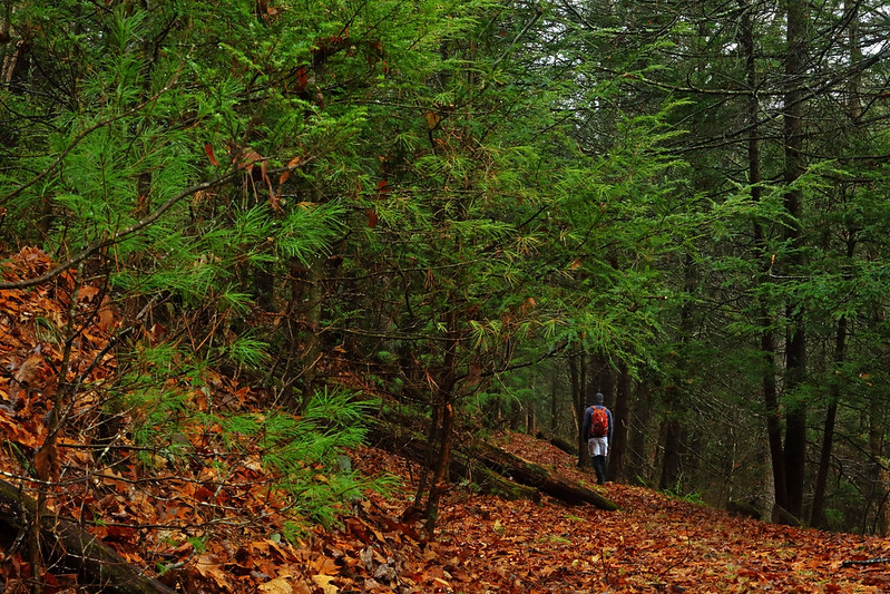
I walked for a stretch alongside pretty Shaver Creek, passing the Monroe Iron Furnace, which had been in service in the late 1800s, and then through a lovely pine and hemlock forest.
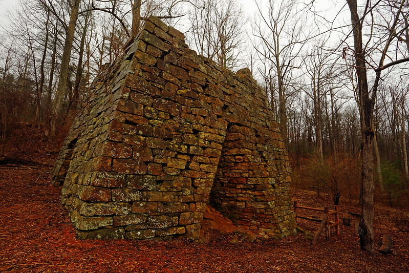
Monroe Iron Furnace
Vibrant forest (selfie)
After a climb up to an logging road where the grade flattened, I hit the worst stretch of walking on the day: the ground was saturated, ankle deep, with rainwater and from all the side creeks that were cheerfully running down the trail. This stretch was only around a half mile, but it felt interminable. Thankfully, it was over when I hit the junction of with the Mid-State Trail and could begin my climb up Tussey Mountain.
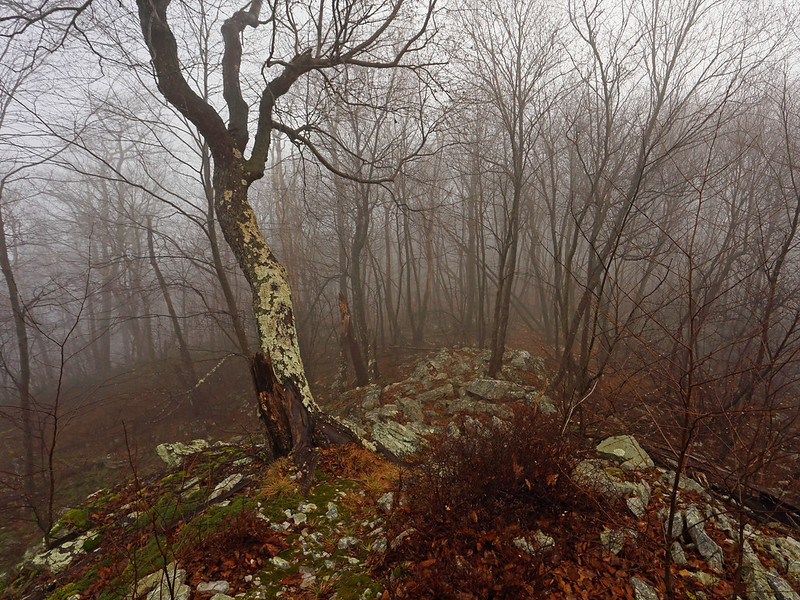
It was 11:00am and the forecast was for the rain to stop around then. No such luck! My steep 1mi climb up the flanks of Tussey Mountain was in a downpour, easily the heaviest rainfall of the day. I gained the ridge at Jo Hay's Vista. Thick mist blanketed everything and if I hadn't been so happy at having left the muddy valley trails behind I would have told Jo Hay where to stick her vista!
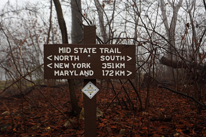
Mailbox on the Mid-State Trail!
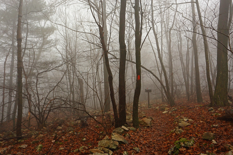
I continued southeast along the Mid-State Trail, hiking atop the extremely rocky spine of Tussey Mountain. It was sublime! The mist conditions lent the rocky outcrops an ethereal backdrop.
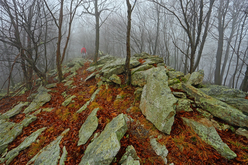
Sublime
Just before my descent off the ridge the sun finally broke through and I was able to get a nice view of Leading Ridge from a talus slope. Not a moment too soon though, since a few minutes later the Indian Steps Trail dropped me down the mountainside as quickly as any trail I've been on in Pennsylvania. 500ft of elevation were lost in 0.3mi. In places boulders had been maneuvered into place to act as steps, which were almost more trouble than they were worth, because the wet conditions had made them extremely slippery.
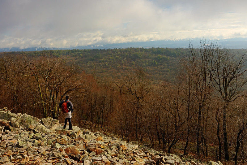
Finally, some views (dorky selfie)
As soon as I reached the valley between Tussey Mountain and Leading Ridge, the Crownover Trail took me up to the spine of Leading Ridge, on an ascent that was nearly the mirror image of the steep Indian Steps descent. Atop the ridge I hung a left. A rocky surface kept the going slow, but this soon gave way to a wider and much smoother old jeep road. I motored along the road, first along Leading Ridge's ridge-top, and then gently down its flanks.
At the bottom I vended my way through a beautiful pine and hemlock forest. The dark woods, with late afternoon light filtering through, were magical. Even though by now I was looking to just get back to the car, I was becalmed. This spot was one of the highlights of the day.
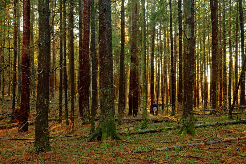
Magical dark forest (selfie)
I finished off the hike by skirting the southern shores of Lake Perez, basking in golden sunshine.
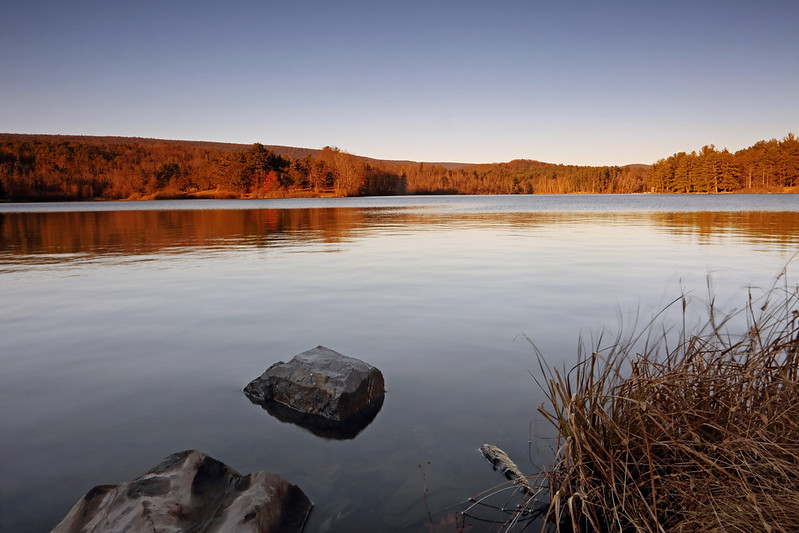
Lake Perez
Stats: 16mi, 8hrs, 2400ft elevation gain.
Iron Stone / Mid-State Trail loop
My first hike of the new year: soggy trails, rocks galore, rain, mist, and finally some sunshine and views. Let the fun begin anew!
A 3hr drive eastwards to central Pennsylvania deposited me at the eastern shores of Lake Perez around sunrise. 15min later (8:00am) I was on my way, hiking the Lake Trail under a gentle rain and a lowering sky.
I skirted the inlet of Lake Perez, navigating the boggy terrain atop a network of boardwalk. After walking up and down the maze of trails in the vicinity of the Stone Valley Nature Center's Visitor Center, I eventually found myself on the Iron Stone Trail. This was a soggy mess due to the heavy rain that had been falling since the past day. Having said that the colors were extremely vibrant and everything looked minty fresh. Raindrops bejeweled every branch and berry. Moss and lichen covered rocks glowed neon green.
Boardwalk
Lake Perez inlet
Jewels
Ankle twisting rocks...but so pretty! (selfie)
I walked for a stretch alongside pretty Shaver Creek, passing the Monroe Iron Furnace, which had been in service in the late 1800s, and then through a lovely pine and hemlock forest.
Monroe Iron Furnace
Vibrant forest (selfie)
After a climb up to an logging road where the grade flattened, I hit the worst stretch of walking on the day: the ground was saturated, ankle deep, with rainwater and from all the side creeks that were cheerfully running down the trail. This stretch was only around a half mile, but it felt interminable. Thankfully, it was over when I hit the junction of with the Mid-State Trail and could begin my climb up Tussey Mountain.
It was 11:00am and the forecast was for the rain to stop around then. No such luck! My steep 1mi climb up the flanks of Tussey Mountain was in a downpour, easily the heaviest rainfall of the day. I gained the ridge at Jo Hay's Vista. Thick mist blanketed everything and if I hadn't been so happy at having left the muddy valley trails behind I would have told Jo Hay where to stick her vista!
Mailbox on the Mid-State Trail!
I continued southeast along the Mid-State Trail, hiking atop the extremely rocky spine of Tussey Mountain. It was sublime! The mist conditions lent the rocky outcrops an ethereal backdrop.
Sublime
Just before my descent off the ridge the sun finally broke through and I was able to get a nice view of Leading Ridge from a talus slope. Not a moment too soon though, since a few minutes later the Indian Steps Trail dropped me down the mountainside as quickly as any trail I've been on in Pennsylvania. 500ft of elevation were lost in 0.3mi. In places boulders had been maneuvered into place to act as steps, which were almost more trouble than they were worth, because the wet conditions had made them extremely slippery.
Finally, some views (dorky selfie)
As soon as I reached the valley between Tussey Mountain and Leading Ridge, the Crownover Trail took me up to the spine of Leading Ridge, on an ascent that was nearly the mirror image of the steep Indian Steps descent. Atop the ridge I hung a left. A rocky surface kept the going slow, but this soon gave way to a wider and much smoother old jeep road. I motored along the road, first along Leading Ridge's ridge-top, and then gently down its flanks.
At the bottom I vended my way through a beautiful pine and hemlock forest. The dark woods, with late afternoon light filtering through, were magical. Even though by now I was looking to just get back to the car, I was becalmed. This spot was one of the highlights of the day.
Magical dark forest (selfie)
I finished off the hike by skirting the southern shores of Lake Perez, basking in golden sunshine.
Lake Perez
Stats: 16mi, 8hrs, 2400ft elevation gain.