vdeal
Forum Elder
Posts: 616
|
Post by vdeal on Oct 23, 2014 7:55:39 GMT -5
MR, Indeed I do have a file with the public route to Haystack. Went there a few years back. It's pretty long though. From the pipeline and back we made it an entire day trip. I'm at work and don't think I have it here. I'll check at home.
|
|
vdeal
Forum Elder
Posts: 616
|
Post by vdeal on Oct 23, 2014 8:01:12 GMT -5
Dunkard,
Looked at the Upper Shaver's file in both Google Earth and Topo. Looks like it will take some work to figure out trips that aren't in and outs or involve a lot of FS road hiking. Topo was actually more helpful in visualizing the routes. I think I'll have to manually separate the paths into categories such as FS road, railroad, old grades, etc. Guess there's a lot of work to do or I'll just wing it next year and go down there. Again, thanks for the file. It's probably the only large area in WV I haven't got much experience with. A buddy and I did mountain bike down there many a moon ago We road up FS235 from Fish Hatchery Run (the bridge was out then) up the mountain for 14 miles before turning around. I believe we turned around at the junction of FS235 and FS267 at the headwaters of Odey Run. I have to say that it was remote land but I wouldn't want to walk that kind of road for very long. Hard on the feet.
|
|
MRHyker
Forum Elder
Out to Lunch
Posts: 130 
|
Post by MRHyker on Oct 23, 2014 8:02:12 GMT -5
I can't see what I'm doing wrong to be missing those "off track" waypoints. The files I posted here initially had waypoints turned off in TOPO! but when I tell it to include them only one additional waypoint shows up - the comm tower off of the pipeline.
When I unzipped the KMZ file there was only one file - thew .kml. Is that correct?
You do know that Nat Geo discontinued TOPO! a couple of years ago?
|
|
vdeal
Forum Elder
Posts: 616
|
Post by vdeal on Oct 23, 2014 8:19:08 GMT -5
MR, a KMZ is simply a zipped kml so that an OS knows to open it in GE. Yep, knew about Topo! - a shame but I have all of the states in this area and others usually show up on eBay if needed. Getting the license to work is the tricky part. What I don't like about most programs is the inability to freehand draw a route. That is a big plus with Topo! I have found a very nice online program called Caltopo - here's the link. It will let you freehand draw and has many overlays including USFS maps. I didn't download the updated file so I don't know about it but the first one had all kinds of waypoints. |
|
|
|
Post by Admin on Oct 23, 2014 8:30:44 GMT -5
Unless I'm missing something I can only get TOPO! to convert "routes" to GPX. I usually just use enough waypoints to roughly describe its shape and include waypoints at critical intersections and landmarks. I've had a few requests to convert every inch of a "track" to GPX but TOPO! can't do it. As you know a track is different than a route.
I haven't looked yet - can GPS-Babel convert .tpo files to GPX?
|
|
|
|
Post by Admin on Oct 23, 2014 8:47:16 GMT -5
Unless I'm missing something I can only get TOPO! to convert "routes" to GPX. I usually just use enough waypoints to roughly describe its shape and include waypoints at critical intersections and landmarks. I've had a few requests to convert every inch of a "track" to GPX but TOPO! can't do it. As you know a track is different than a route. I haven't looked yet - can GPS-Babel convert .tpo files to GPX? I just answered my own question. You can convert a freehand track (.tpo) to .gpx. It shows the waypoints and track when I import it into TOPO! as gpx. |
|
vdeal
Forum Elder
Posts: 616
|
Post by vdeal on Oct 23, 2014 10:28:30 GMT -5
Never had any problem with Topo. You can set the number of waypoints to use to create a route. I always set it at 9999 (the maximum) and then let Topo decide how many it needs. Overwise you end up with straight lines instead of following the path. In topo you select your path and click export gps geocache to make a gpx file. I'm running the Mac version so it may be a bit different.
|
|
|
|
Post by Admin on Oct 23, 2014 10:59:40 GMT -5
When you upload the gpx file onto a GPS unit as you describe using the route all you can see the route for all of the waypoints.
|
|
|
|
Post by dunkard on Oct 23, 2014 11:43:11 GMT -5
|
|
|
|
Post by dunkard on Oct 23, 2014 11:49:29 GMT -5
vdeal those kmz are on the google group page. I could upload stuff easier to that. Did you get the Forest Roads kmz file. If you open it in Googe Earth and click on the road line It brings up a table associated with each road so you can figure out if its open or gated. It gives the approximate dates that the roads are opened if they are ever opened. You'd still need to check the Vehicle use maps to get more accurate dates but it works in a pinch and is very handy.
|
|
|
|
Post by dunkard on Oct 23, 2014 11:51:35 GMT -5
What gps unit are you using MR? I have a garmin oregon and have alway had problems with it displaying tracks I use waypoints more than tracks because of that.
|
|
MRHyker
Forum Elder
Out to Lunch
Posts: 130
|
Post by MRHyker on Oct 23, 2014 11:59:04 GMT -5
Garmin Oregon 450. I have no problems with routes or tracks in gpx files. Can you imagine tryting to view 500 waypoints on that small screen.
|
|
|
|
Post by dunkard on Oct 23, 2014 12:11:51 GMT -5
My unit never shows my the tracks I import as a gpx. They are there if I go to edit the track I can select it in the track manager screen and it then will show up on the map screen. I must have a setting turned off or something but I've learned to use the waypoints as a check or when I need to find water or a campsite. Any ideas why I can't view the tracks from the gpx files. I have other map overlays that show tracks fine just not the one I create?
|
|
MRHyker
Forum Elder
Out to Lunch
Posts: 130
|
Post by MRHyker on Oct 23, 2014 12:20:09 GMT -5
Could the unite be uploading the track as a route? That's where my uploaded GPX files go. Go to "route planner" and see if the file is listed there then tap on it and then "view map".
|
|
MRHyker
Forum Elder
Out to Lunch
Posts: 130
|
Post by MRHyker on Oct 23, 2014 12:21:53 GMT -5
I just saw your new Avatar. Is that a Brittany? Looks just like my old girl, Kira - God bless her soul!
|
|
|
|
Post by Admin on Oct 23, 2014 12:48:01 GMT -5
Here are both routes. Blue should be USFS. Look correct? 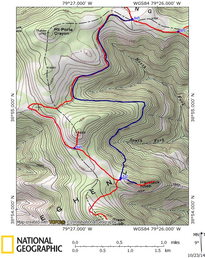 |
|
vdeal
Forum Elder
Posts: 616
|
Post by vdeal on Oct 23, 2014 12:51:47 GMT -5
MR,
The blue is the USFS route but I believe dunkard is bushwhacking up the ridge much earlier than necessary. I came up right to the little field below Haystack. Like I said earlier though, I don't have my file here. Will check this evening.
|
|
vdeal
Forum Elder
Posts: 616
|
Post by vdeal on Oct 23, 2014 12:54:29 GMT -5
dunkard,
I got the usfs road maps quite a while back. Yep, know about the MVUM's - see my earlier post.
|
|
vdeal
Forum Elder
Posts: 616
|
Post by vdeal on Oct 23, 2014 12:58:19 GMT -5
Okay, I just looked at the Haystack map on GE and I can almost say with certainty that it cuts up over the mountain considerably earlier than we did. Will confirm this evening.
|
|
MRHyker
Forum Elder
Out to Lunch
Posts: 130
|
Post by MRHyker on Oct 23, 2014 13:01:57 GMT -5
Here's what my unit's Route Planner looks like showing the canyon rim hike we always do: 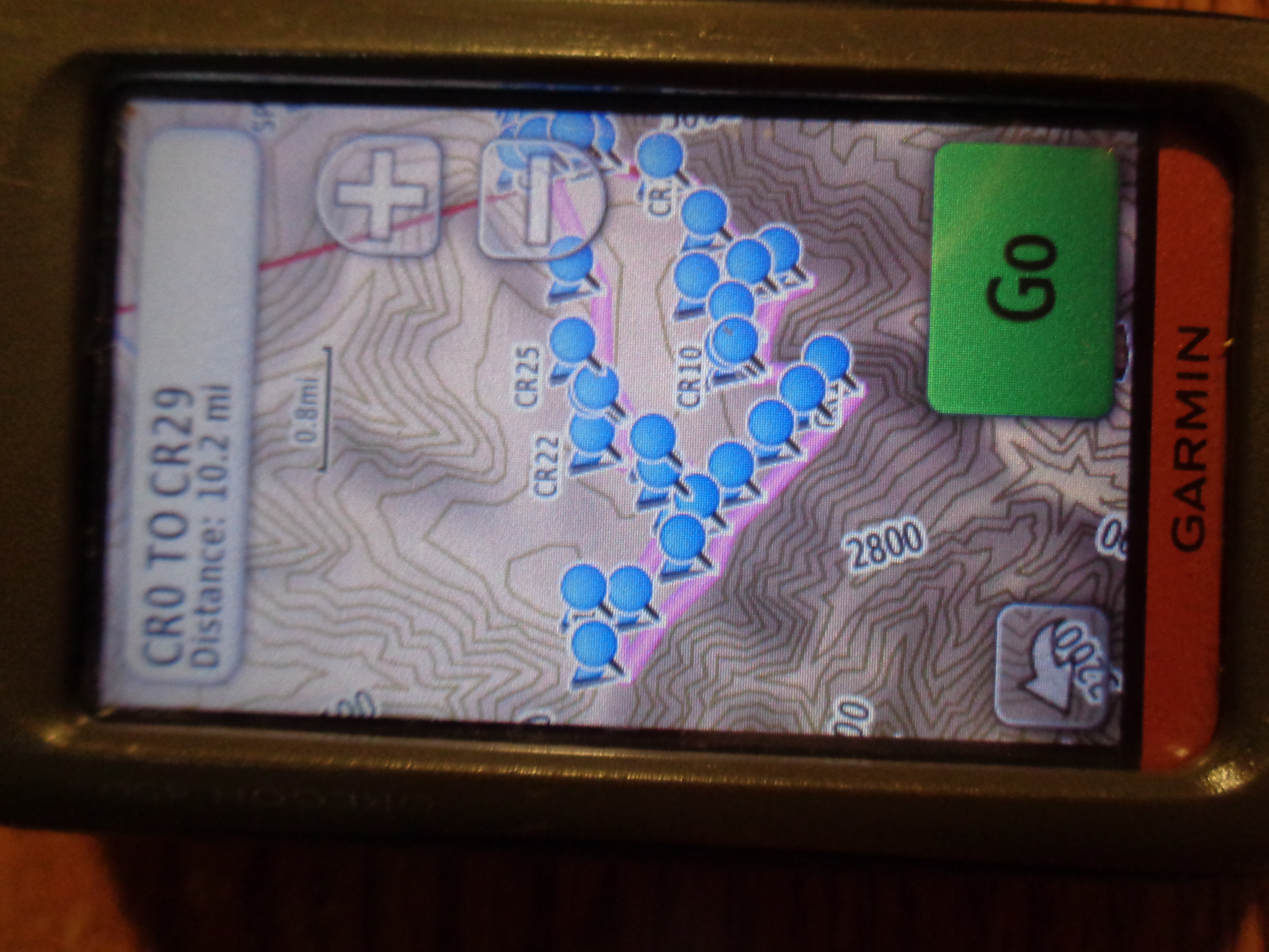 |
|