

Allegheny Trail: Blackwater Canyon to Rt. 33
Oct 18, 2015 13:21:04 GMT -5
Post by hikeer on Oct 18, 2015 13:21:04 GMT -5
Spent 3 days on the Allegheny Trail this week traveling from beginning of Canyon Rim Trail (between Thomas and Parsons) and coming out where Rt. 33 crosses Glady Fork between Harman and Elkins. A very nice hike overall, with excellent trail conditions for the most part. The Allegheny Trail has at some points in the past been poorly maintained/blazed in spots, but in the nearly 100 miles of it I've hiked in the past two years I have not found that to be the case. Blazing was excellent throughout this hike, I never had any trouble knowing where to go.
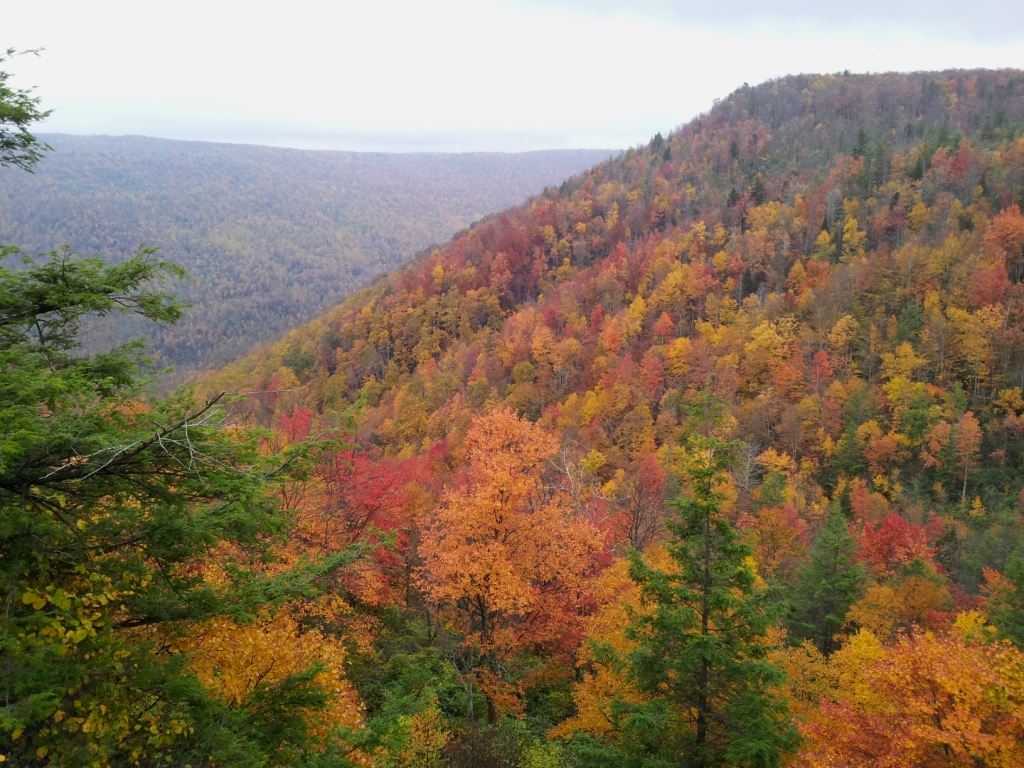
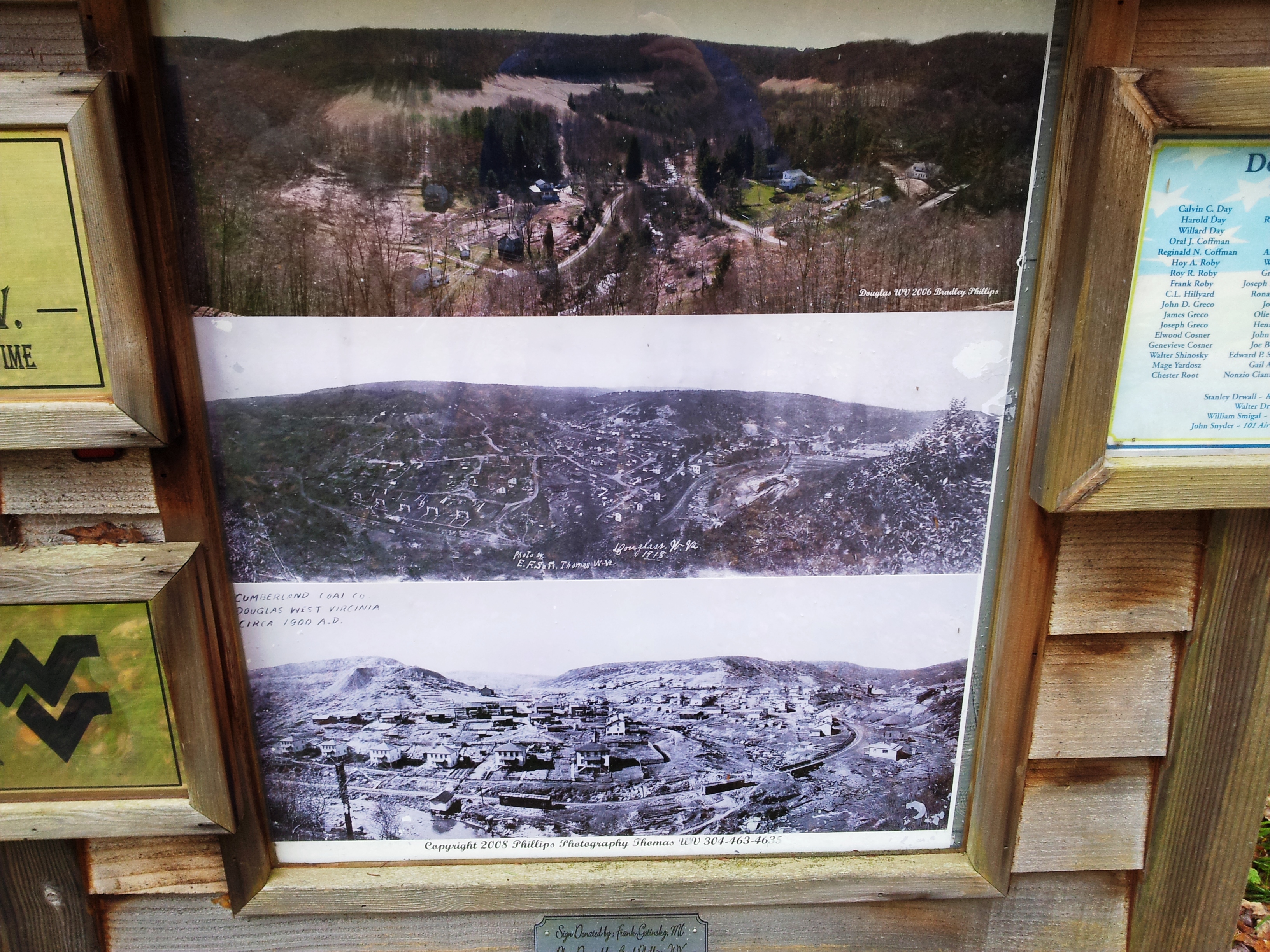
The Canyon Rim Trail is accessed via FS 16 off of US Rt. 219 just below the top of Backbone Mt. (near the windmills) and traces the rim of the Blackwater Canyon, with several opportunities for nice views over the canyon as you hike. The trail eventually comes back out on FS 16 for several miles, bringing you into the old mining town of Douglas. This is a very scenic section with a great deal of solitude until you reach Douglas. Douglas has a cool display as you come into town, with pictures showing what the town looked like at the height of mining around the turn of the century. The difference between then and now is quite stark.
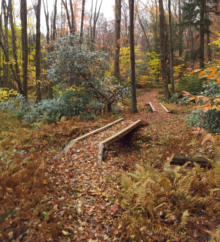
The trail follows a paved road for the next +/- 3 miles and brings you into Thomas. An interesting note is that there were apple trees all along this road, must have been 15-20 right alongside the road, all of them loaded with apples, several different varieties. At some point in the past someone must have tapped into their inner Johnny Appleseed! I arrived around 12:30 PM and headed into Thomas for lunch at the Purple Fiddle. After a filling lunch, I made the short trek to Davis. I'll note here that the trail no longer follows the path outlined in the Trail Guide, but continues through Davis, linking up with the Heart of Highlands trail system just across the bridge going out of Davis. The trail leads from there back to Blackwater Falls State Park. I did not make the trek down to the Falls as I've been there before and it was mid-afternoon and I was aiming to get to the shelter on top of Canaan Mt. to stop for the night. Made it to the shelter around 4:30 PM. According to the trail guide it should have been around 16.5 miles but my GPS clocked right at 20 miles for the day. The shelter is in good shape, with a very nice section of boardwalk added to the approach trail recently.
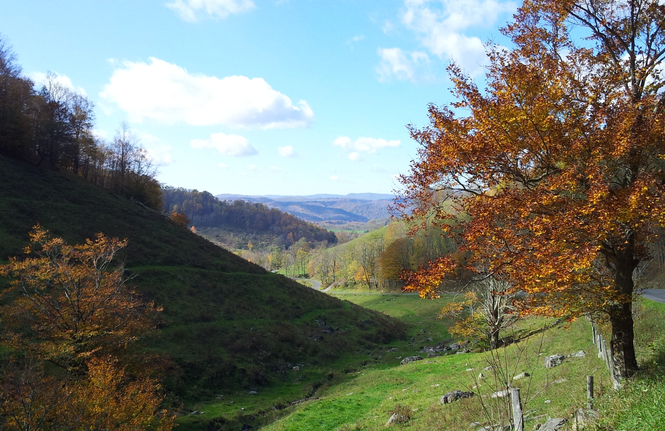
After a very peaceful night I headed out around 7:45. Temperature was a brisk 37* this morning, but sun was out, so it warmed to a pleasant hiking temperature in the 40's within an hour or so. The hike along Canaan Mt. down to Rt. 72 was an outstanding hike - as I mentioned before the trail runs concurrent with the Heart of Highlands trail system and all I can surmise is that HOH has some good funding sources as there were many bridges over creeks, any marshy areas had fresh gravel laid down, and sections through meadows were mowed, all of which is completely out of character for the Allegheny Trail! Not to demean the ALT, as I actually enjoy the more "natural" feel of the ALT. Much of the section I hiked last year felt like a walk through the woods, with no defined tread - just follow the blazes. I reached Back Hollow Rd and followed it for a mile and a half to the intersection with Rt. 72. I originally planned to walk the road section, but due to a need to be back home early on Friday night for homecoming (daughter was on homecoming court), I arranged for a ride to where the trail leaves the public road near Gladwin. It is a very scenic area - especially this time of year.
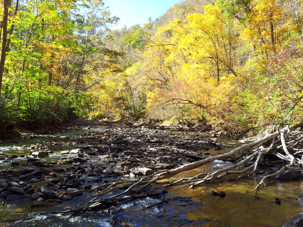
Resumed the hike in Gladwin, along the Glady Fork river, which the trail basically followed for the rest of the hike. Much of the remaining part of the hike was along an old railroad grade that followed the river. The grade has been washed away in parts, leading to a couple of sections that follow very steep hillsides above the river. One of these sections is also covered with loose rock, so caution is required, but nothing seriously sketchy. The trail intersects with another FS road at an area called Glady Fork campground, and follows this road for 2-3 miles. The trail then turns through a locked gate along a road that appears to be used for trout stockings in the spring and fall. I made camp along the river a couple miles from the gate. Nice quiet night along the river. Only had 7.5 miles left, which passed quickly the next morning and I hit the truck around 11:30 AM. Trail again followed the railroad grade for the biggest portion, although there is one stretch where the trail turns uphill and traverses the side of the mountain for a mile or so.
Overall a very nice trip, a lot of leaves are gone at higher elevations but fairly nice once you dropped under 3000'. I think that this year is a little below average in terms of color, but still a really nice time to get outside and enjoy the crisp fall air.
View from the Canyon Rim Trail
Old Mining town of Douglas - pics from 2006, 1918 and 1900
Back Hollow Rd
Some of the nice bridge work done on the section through Canaan State Park
Glady Fork
The Canyon Rim Trail is accessed via FS 16 off of US Rt. 219 just below the top of Backbone Mt. (near the windmills) and traces the rim of the Blackwater Canyon, with several opportunities for nice views over the canyon as you hike. The trail eventually comes back out on FS 16 for several miles, bringing you into the old mining town of Douglas. This is a very scenic section with a great deal of solitude until you reach Douglas. Douglas has a cool display as you come into town, with pictures showing what the town looked like at the height of mining around the turn of the century. The difference between then and now is quite stark.
The trail follows a paved road for the next +/- 3 miles and brings you into Thomas. An interesting note is that there were apple trees all along this road, must have been 15-20 right alongside the road, all of them loaded with apples, several different varieties. At some point in the past someone must have tapped into their inner Johnny Appleseed! I arrived around 12:30 PM and headed into Thomas for lunch at the Purple Fiddle. After a filling lunch, I made the short trek to Davis. I'll note here that the trail no longer follows the path outlined in the Trail Guide, but continues through Davis, linking up with the Heart of Highlands trail system just across the bridge going out of Davis. The trail leads from there back to Blackwater Falls State Park. I did not make the trek down to the Falls as I've been there before and it was mid-afternoon and I was aiming to get to the shelter on top of Canaan Mt. to stop for the night. Made it to the shelter around 4:30 PM. According to the trail guide it should have been around 16.5 miles but my GPS clocked right at 20 miles for the day. The shelter is in good shape, with a very nice section of boardwalk added to the approach trail recently.
After a very peaceful night I headed out around 7:45. Temperature was a brisk 37* this morning, but sun was out, so it warmed to a pleasant hiking temperature in the 40's within an hour or so. The hike along Canaan Mt. down to Rt. 72 was an outstanding hike - as I mentioned before the trail runs concurrent with the Heart of Highlands trail system and all I can surmise is that HOH has some good funding sources as there were many bridges over creeks, any marshy areas had fresh gravel laid down, and sections through meadows were mowed, all of which is completely out of character for the Allegheny Trail! Not to demean the ALT, as I actually enjoy the more "natural" feel of the ALT. Much of the section I hiked last year felt like a walk through the woods, with no defined tread - just follow the blazes. I reached Back Hollow Rd and followed it for a mile and a half to the intersection with Rt. 72. I originally planned to walk the road section, but due to a need to be back home early on Friday night for homecoming (daughter was on homecoming court), I arranged for a ride to where the trail leaves the public road near Gladwin. It is a very scenic area - especially this time of year.
Resumed the hike in Gladwin, along the Glady Fork river, which the trail basically followed for the rest of the hike. Much of the remaining part of the hike was along an old railroad grade that followed the river. The grade has been washed away in parts, leading to a couple of sections that follow very steep hillsides above the river. One of these sections is also covered with loose rock, so caution is required, but nothing seriously sketchy. The trail intersects with another FS road at an area called Glady Fork campground, and follows this road for 2-3 miles. The trail then turns through a locked gate along a road that appears to be used for trout stockings in the spring and fall. I made camp along the river a couple miles from the gate. Nice quiet night along the river. Only had 7.5 miles left, which passed quickly the next morning and I hit the truck around 11:30 AM. Trail again followed the railroad grade for the biggest portion, although there is one stretch where the trail turns uphill and traverses the side of the mountain for a mile or so.
Overall a very nice trip, a lot of leaves are gone at higher elevations but fairly nice once you dropped under 3000'. I think that this year is a little below average in terms of color, but still a really nice time to get outside and enjoy the crisp fall air.
View from the Canyon Rim Trail
Old Mining town of Douglas - pics from 2006, 1918 and 1900
Back Hollow Rd
Some of the nice bridge work done on the section through Canaan State Park
Glady Fork

