|
|
Post by AegisIII on Aug 31, 2015 21:40:28 GMT -5
At the beginning of the month when I searched around for new GPS traces I found one for the Mid State Trail in Rothrock that didn't quite match. 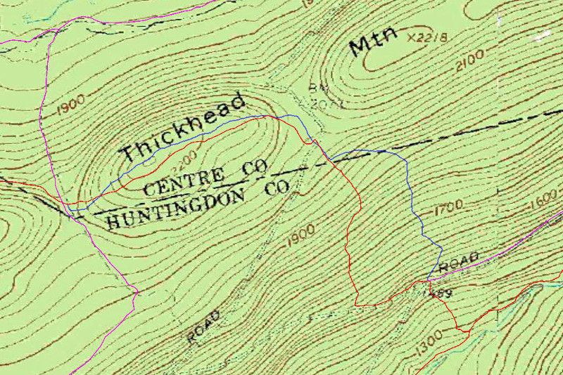 On the map I have the MST (and Greenwood Spur/SST) in red, other trails in pink, and the possible relocation in blue, which would avoid the short road walk on Bear Meadows Rd. Is this an actual relo? And if so, what's the status of the old routing? |
|
ki0eh
Forum Elder
Posts: 196 
|
Post by ki0eh on Sept 1, 2015 9:14:56 GMT -5
www.hike-mst.org/index.php/the-trail/section-updates/143-section-8The old routing actually channeled drainage from the upper limb of the road to the lower limb. Also the trail spent just enough time on the road to be confusing. It should be de-blazed and obscured but I have not been there myself to check. I'm not aware of any changes on that knob of Thickhead west of Bear Meadows Rd, the difference in the two tracks there looks like normal data noise to me.
|
|

