Roaring Plains circuit, West Virginia (Aug 30, 2015)
Aug 31, 2015 9:58:51 GMT -5
Post by GaliWalker on Aug 31, 2015 9:58:51 GMT -5
Roaring Plains circuit, West Virginia (Aug 30, 2015)
Route: South Prong Trail - Hidden Passage Trail - Canyon Rim Trail - Roaring Plains Trail - Boar's Nest Trail.
Round-trip stats: 15.5mi, 2800ft elevation gain, 9hrs. (Total trip time: 15.5hrs.)
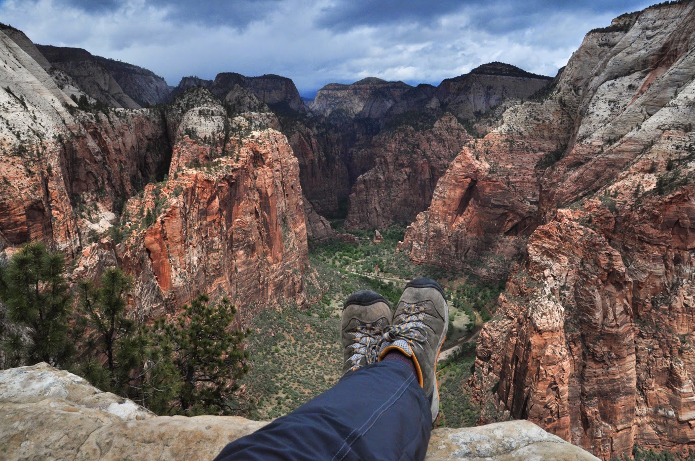
A couple of weeks ago, I'd taken the kids on a hiking trip to West Virginia's Dolly Sods region. This is an extremely popular destination because of its beauty. However, the similarly impressive, but much less crowded Roaring and Flatrock Plains plateau lies only a stone's throw away. As I pointed out the 4000ft high plateau of Roaring Plains to the kids, from atop Dolly Sods, I realized that I hadn't made a trip up there for more than a year. In fact, I couldn't remember ever having been up there in late summer.
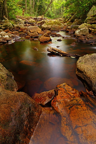
I reached the trailheads for the South Prong and Boar's Nest Trails after a 3.5hrs drive and was on the trail by 6:45am. I set off down the brushy South Prong Trail to the first creek crossing of the South Fork of Red Creek. Every one of my previous trips had involved a wade, but Red Creek was running so low that this time around the crossing was a simple rock hop. I began to climb gently up the side of the plateau to cross Red Creek one more time in another straightforward rock hop. This was an extremely scenic spot, so I paused here to take a photo or two and drink in the atmosphere.
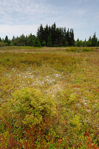
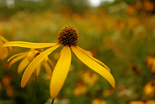
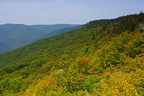
I continued along the South Prong Trail, crossing grassy FR70, until I was atop Roaring Plains. Here, I took a right on the Hidden Passage trail. Immediately, the scenic quotient went way up. Lovely, grassy flower filled meadows gentled my footsteps, as I flitted my way through them and the occasional grove of dark forest peculiar to the area.
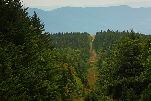
The Hidden Passage trail finished with a flourish, with expansive mountain views to the east and south, at an intersection with the grassy pipeline swath that cuts right through Roaring Plains. I took a left on this and followed it down through muddy, albeit flower filled terrain for a short distance.
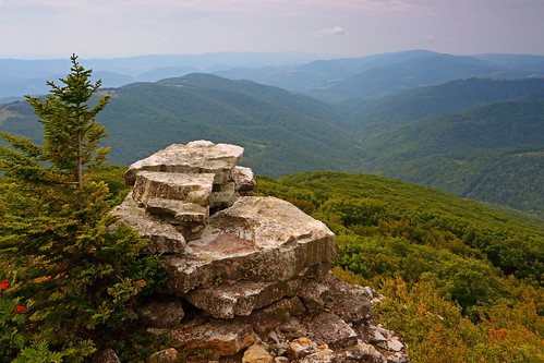
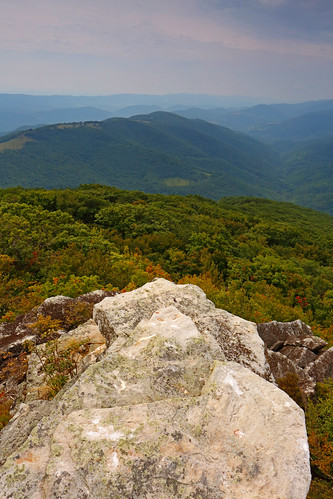
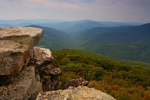
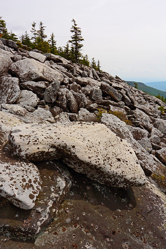
In a dip in the pipeline swath I took a right on the unofficial Canyon Rim Trail. The next 4.2mi would be the slowest and hardest part of the hike. There was minimal elevation change, but the spot the trail game required careful attention; especially so, since there was a lot of head-high brush. In numerous places the tread was hidden beneath encroaching brush, and progress was faith based. Around 1.5mi along the Canyon Rim Trail I reached the Point, the best vista on the hike. Here, the Roaring Plains rim protrudes into the valley to its south as a sharp prow. A series of rocky outcrops allow the perfect perches to gaze from.
I continued along the canyon rim for a further 1.4mi, to the intersection with the Teepee Trail. As I continued onwards the trail got significantly fainter and the going was quite slow. A little more than 0.3mi later things improved as I hit a large talus field and some helpful cairns appeared to make route finding straightforward. I rock-hopped the talus field for a while, dropping downward near the end, before exiting stage right. A little more than a mile later I reached the (official) Roaring Plains trail, where I could finally relax.
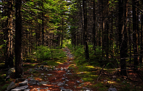
Trail, yay!
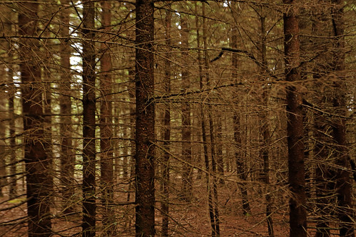
The rest of the hike wasn't bad, but decidedly less dramatic. The problem with the official trails that crisscross the top of the Flatrock and Roaring Plains plateau is that while they take you through mostly tree-less terrain, head high shrubs, plus a dearth of viewpoints, prevent you from getting to see much. I followed the Roaring Plains Trail until I hit the pipeline swath I'd hiked earlier, where I picked up FR70 for a short and quick 0.35mi. Here, I hung a left on the Boar's Nest Trail, which took me over the top of Flatrock Plains and then swiftly down to my car.
Route: South Prong Trail - Hidden Passage Trail - Canyon Rim Trail - Roaring Plains Trail - Boar's Nest Trail.
Round-trip stats: 15.5mi, 2800ft elevation gain, 9hrs. (Total trip time: 15.5hrs.)
A couple of weeks ago, I'd taken the kids on a hiking trip to West Virginia's Dolly Sods region. This is an extremely popular destination because of its beauty. However, the similarly impressive, but much less crowded Roaring and Flatrock Plains plateau lies only a stone's throw away. As I pointed out the 4000ft high plateau of Roaring Plains to the kids, from atop Dolly Sods, I realized that I hadn't made a trip up there for more than a year. In fact, I couldn't remember ever having been up there in late summer.
I reached the trailheads for the South Prong and Boar's Nest Trails after a 3.5hrs drive and was on the trail by 6:45am. I set off down the brushy South Prong Trail to the first creek crossing of the South Fork of Red Creek. Every one of my previous trips had involved a wade, but Red Creek was running so low that this time around the crossing was a simple rock hop. I began to climb gently up the side of the plateau to cross Red Creek one more time in another straightforward rock hop. This was an extremely scenic spot, so I paused here to take a photo or two and drink in the atmosphere.
I continued along the South Prong Trail, crossing grassy FR70, until I was atop Roaring Plains. Here, I took a right on the Hidden Passage trail. Immediately, the scenic quotient went way up. Lovely, grassy flower filled meadows gentled my footsteps, as I flitted my way through them and the occasional grove of dark forest peculiar to the area.
The Hidden Passage trail finished with a flourish, with expansive mountain views to the east and south, at an intersection with the grassy pipeline swath that cuts right through Roaring Plains. I took a left on this and followed it down through muddy, albeit flower filled terrain for a short distance.
In a dip in the pipeline swath I took a right on the unofficial Canyon Rim Trail. The next 4.2mi would be the slowest and hardest part of the hike. There was minimal elevation change, but the spot the trail game required careful attention; especially so, since there was a lot of head-high brush. In numerous places the tread was hidden beneath encroaching brush, and progress was faith based. Around 1.5mi along the Canyon Rim Trail I reached the Point, the best vista on the hike. Here, the Roaring Plains rim protrudes into the valley to its south as a sharp prow. A series of rocky outcrops allow the perfect perches to gaze from.
I continued along the canyon rim for a further 1.4mi, to the intersection with the Teepee Trail. As I continued onwards the trail got significantly fainter and the going was quite slow. A little more than 0.3mi later things improved as I hit a large talus field and some helpful cairns appeared to make route finding straightforward. I rock-hopped the talus field for a while, dropping downward near the end, before exiting stage right. A little more than a mile later I reached the (official) Roaring Plains trail, where I could finally relax.
Trail, yay!
The rest of the hike wasn't bad, but decidedly less dramatic. The problem with the official trails that crisscross the top of the Flatrock and Roaring Plains plateau is that while they take you through mostly tree-less terrain, head high shrubs, plus a dearth of viewpoints, prevent you from getting to see much. I followed the Roaring Plains Trail until I hit the pipeline swath I'd hiked earlier, where I picked up FR70 for a short and quick 0.35mi. Here, I hung a left on the Boar's Nest Trail, which took me over the top of Flatrock Plains and then swiftly down to my car.