Post by GaliWalker on Apr 11, 2015 9:39:14 GMT -5
Great Smoky Mountains National Park (April 5-8, 2015)
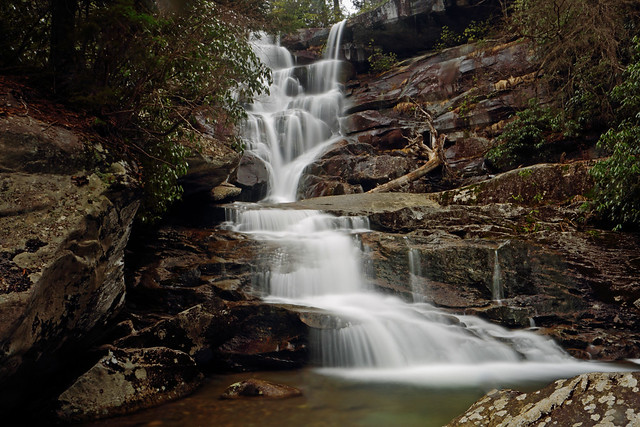
Billed asthe most popular National Park in America, Great Smoky Mountains National Park was not entirely what I was expecting. I was left with the impression that this is a hiking park, even though most people somehow manage to 'see' it primarily from a car - there are only a few roads that thread the park, so you have to hiketo see the good stuff. Maybe I picked the wrong set of hikes, but each one I did, from the shortest to the longest, sported a reasonable amount of elevation gain, some of it quite steep. I didn't get to experience many clear views, due to generally overcast and misty conditions, but I did enjoy the numerous cascading streams and waterfalls in more optimal conditions. In my opinion, springtime in the Smokies provides one of the best collectionsof waterworks you'll probably see.
April 5, 2015: Arrival, Alum Cave and Mount LeConte, Newfound Gap
The main reason that Great Smoky Mountains National Park is so popular is that around two thirds of the US population lives within a day's drive. I leftPittsburgh at 2:30am and reached Gatlinburg, Tennessee, right outside the entrance to the park, in a comfortable 8hrs. I tried to leave my luggage at my motel, but they refused, saying it wasstill too early. I wasn't ready to wait, so I left the luggage in the trunk – something I hadn't wanted to do, because of potential car prowl activity – and headed off to my first hiking destination of the trip: Mount LeConte via the Alum Cave Bluffs trail.
There are two parking lots for the Alum Cave Bluffs hike. Both were full, so I parked the car amongst all the others lining the road. It was 11:30am as I began my hike, in a knot of other hikers. Most of the early part of the hike was alongside the extremely scenic Styx Branch, flowing really well in the early spring conditions.
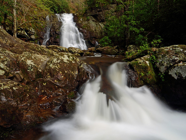
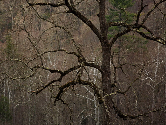
A little less than 1.5mi in, I crossed Styx Branch on a footbridge, and tunneled my way through Arch Rock. A final crossing of Styx Branch later the grade steepened and views of the surrounding mountains started to appear; Inspiration Pointsported a particularly nice one. A short and steep climb later I was at Alum Cave, 2.3mi in.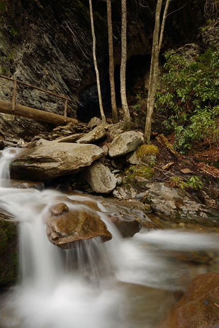
Crossing Styx Branch at Arch Rock
Alum Cave was a cavernous space beneath an overhang. Water dripped off the edge, leading to a curiously icy trail on this warm day. Once I got under the overhang's shelter however, it was quite dry. Even the floor was sandy. Lots of people dotted the cave, and I'd seen nicer versions in Ohio, so I continued up the trail towards Mount LeConte, after taking only a few snapshots.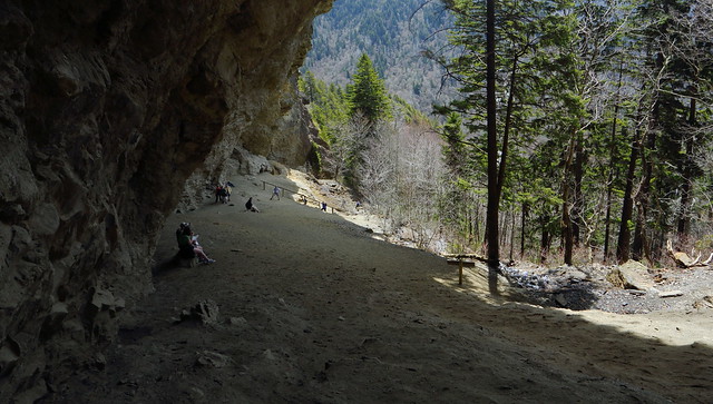
At 6,593ft Mt LeConte is the third highest peak in the park. Iwas expecting the crowds to shrink as I left Alum Cave Bluffs, but no such luck. The trail up was pretty interesting. There were numerous sections of a cliff face rising straight up on one side with a steep drop on the other. Icicles hung from the cliff face and water seeped through the rocks and across the trail. Thankfully the day was warm enough that the trail was never quite icy, but it was something to be mindful of. Hand-lines draped thecliff wall in these situations, for added security (I used thema few times on the way down).
About 5mi in the trail flattened, the mountainside broadened, the forest thickened, and I was atthe Mount LeConte Lodge. I had a bite to eat here, before heading 0.2mi up the Cliff Tops trial to the best views of the hike.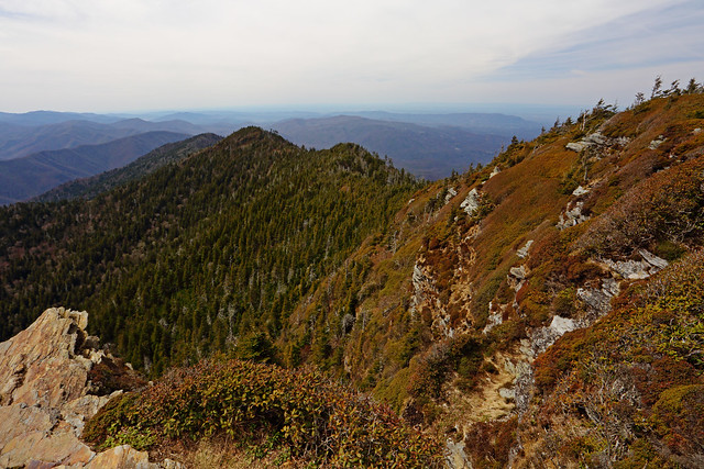
The way down was fast, until I hit Styx Branch. By now, thesunshine had disappeared, along with the crowds, so I was free to photograph the creek at my leisure.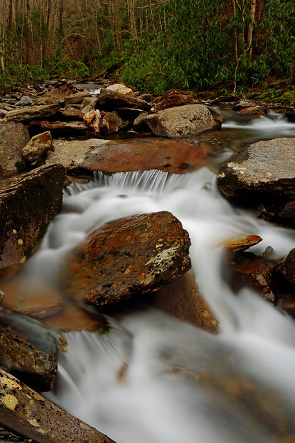
Alum Cave and Mount LeConte stats: 10.5mi, 3,300ft gain, 7hrs
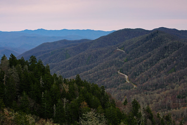
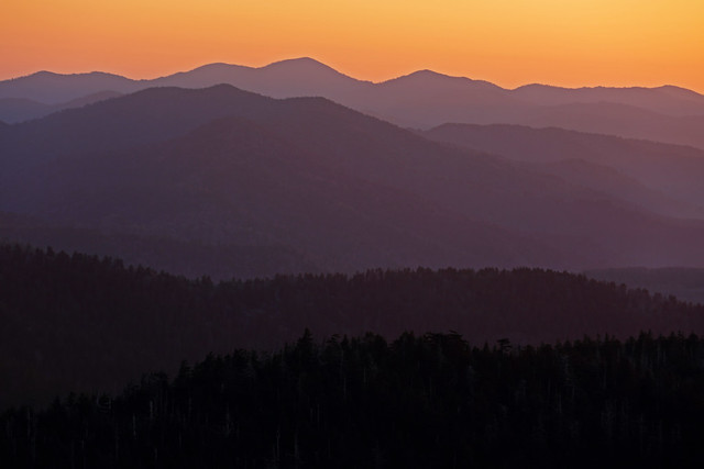
After my hike, I drove up to Newfound Gap to catch the sunset. Unfortunately, it had become pretty overcast, so I took a documentary shot or two and headed back down to Gatlinburg.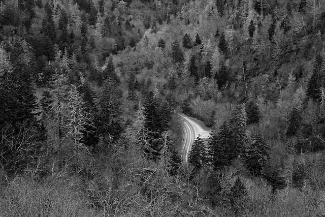
April 6, 2015: Ramsey Cascades, Chimney Tops, Road Prong
Ramsey Cascades forms the tallestwaterfall in the Smokies, so it was near the top of my must-hike list. I reached the trailhead at 6:30am. Unlike my previous day's hike, the parking lot was completely empty, which made for awelcome change. The first 1.5mi of the hike was along a gravel road, so I was able to make do with the mix of moon and twilight, and without my headlamp.
The Middle Prong of Little Pigeon River was a rushing presence beside me, though I could only hear it and not see it, because of the woods. As I switched from gravel road to proper trail, I swapped out the Middle Prong for the cascading Ramsey Prong. I paralleled this one for a while, beforecrossing it to entire a delightful cove. Unfortunately, I was aweek too early for wildflowers, but the place was magical anyway.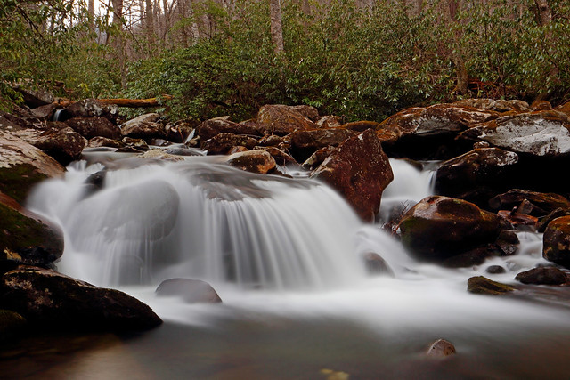
The grade was consistently steep. I crossed Ramsey Prongone last time and vended my way through a beautiful forest section. The last bit before the falls was the steepest part of the hike, but I could hear the waterfall by then, so zipped up the path.
Ramsey Cascades was quite pretty. I mostly believe that the setting makes a waterfall, and not necessarily the falling water, but here the cascading waterfall itself was the defining feature. I spent an hour soaking in the beauty, but it started to rain sideways, so I headed back down.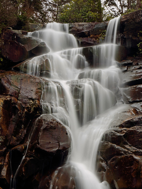
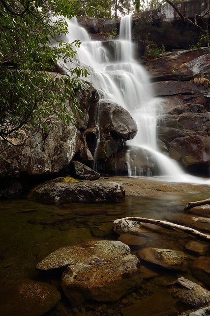
Ramsey Cascades stats: 8mi, 2,400ft gain, 5hrs
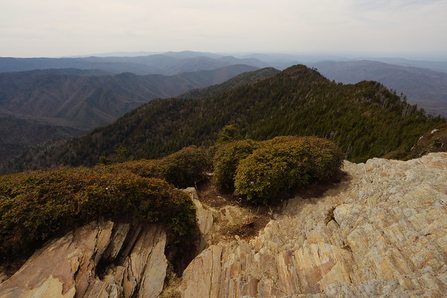
Chimney Tops is one of the few non-treed summits in the park, and 360° views. The hike is short, andhence almost as popular as my previous day's hike. I reached the trailhead and was on my way a little after 1:00pm.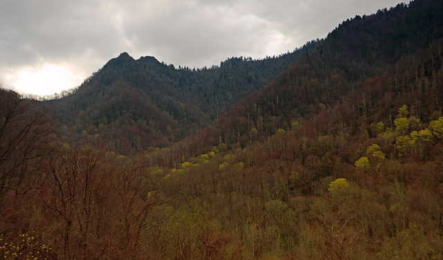
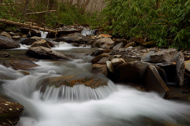
The defining feature of the Chimney Tops hike is a Class-3 scramble up top. With this in mind, I left my tripod and extra lens in the car. This was unfortunate, because the initial 0.5mi of the hike was the most scenic, as I hiked beside gorgeous Road Prong: beautiful cascades and white water had my mouth salivating. I decidedthat I would re-hike this section with my tripod immediately after Chimney Tops, if I had something left in the tank.
0.9mi inI left Road Prong and took the Chimney Tops trail steeply up the mountain. A mile later I was at the summit scramble. This consisted of a rocky spine with drops on either side. More than 3/4ths of the hikers turned around here. The remaining few, of whicha large number were kids, made their way up. There was some exposure, but hand and footholds were good, except for one slab about halfway up. It was pretty windy and rain had been spitting sideways at me the entire climb, so I took a few snapshots and headed back down.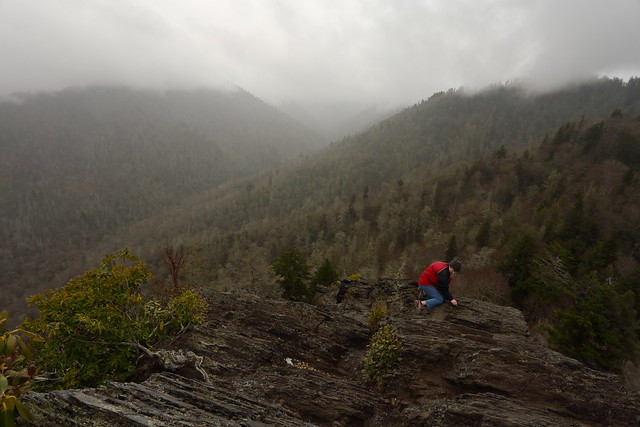

Chimney Tops stats: 4mi, 1,700ft gain, 2.25hrs
I was feeling pretty good, so decided to finish off the day with some stream photography on Road Prong. 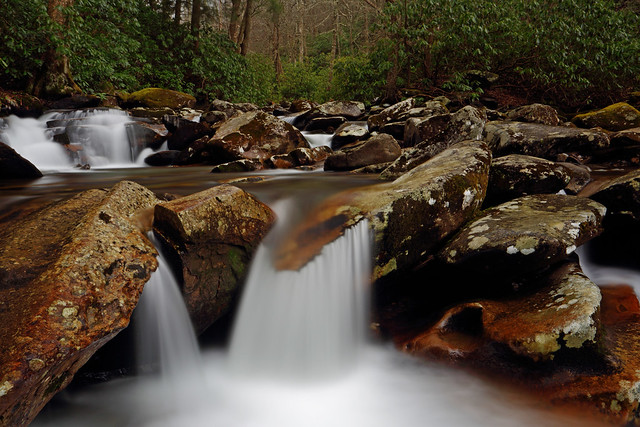
Road Prong stats: 1mi, 250ft gain, 1hr
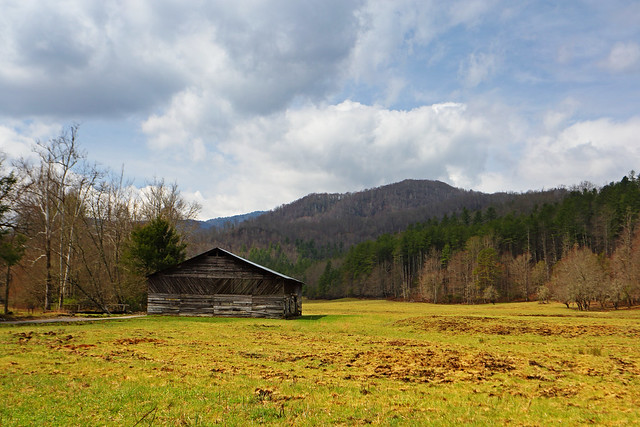
April 7, 2015: Cades Cove (Gregory Bald,Spruce Flat Falls)
The most popular part of America's most popular National Park is Cades Cove. There is a one way loop road that takes one around Cades Cove, which has bumper to bumper traffic during peak season. In order to make it to the trailhead for Gregory Bald I was on the loop road by sunrise, which is when the gated road opened. There were a few cars behind me but they all disappeared and I had the road, the Cove and the numerous deer foraging in the cove, to myself.
By 8:00am I was on the trailfor Gregory Bald. As on all my previous hikes, the initial route paralleled a creek, Forge Creek in this case. Also, as normal,the creek was extremely scenic.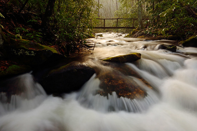
After three crossings of Forge Creek, hiking upward on a moderate grade, I started to climb in earnest. The dense rhododendron thickets I'd been ensconced in disappeared quite dramatically, to be replaced by more open woods. It also started to rain and the overcast skies grew greyer.The next three miles took me relentlessly upward, into thick mist.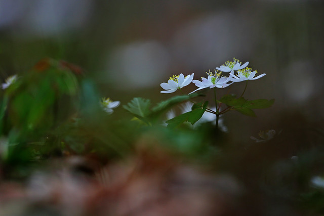
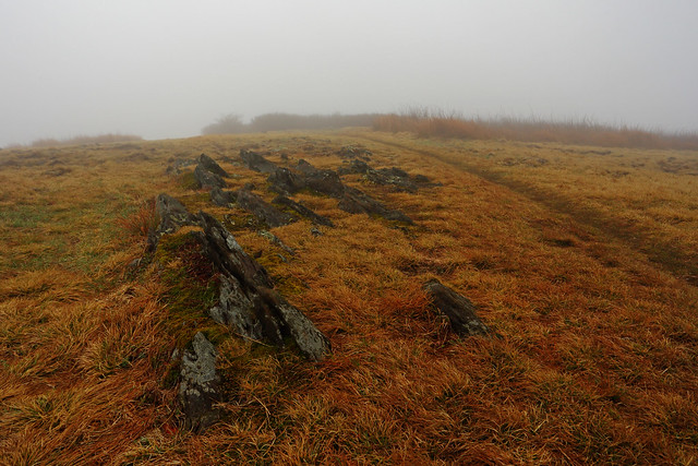
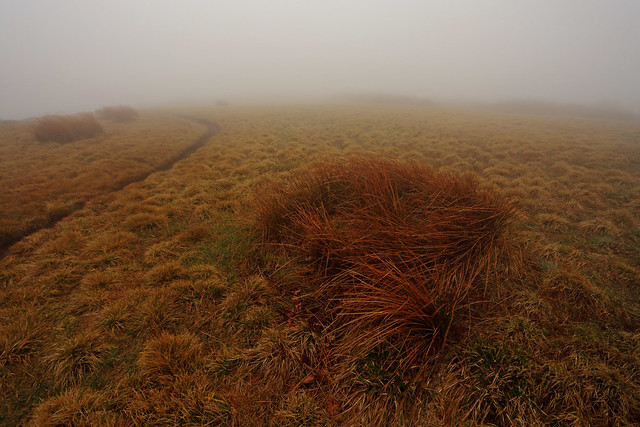
Gregory Bald is famed for its views and blooming azaleas. I knew I wasn't going to get the blooming azaleas, since thathappens in June, but now my views had also departed. As I reached the bald it was as I had feared. Thick mist blanketed everything. It wasn't all bad though: the bald was an extremely interesting place. Rolling grassland, dotted here and there with bushes, a few thickets and the occasional rock garden. I had the entire place to myself and had a lot of fun roaming around.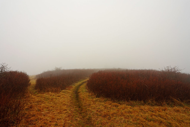
The way down was through more rain and the occasional backpacker.
Gregory Bald stats: 11.5mi, 3050ft gain, 6.5hrs
I finished offmy day with a short and surprisingly lonely trip to Spruce Flat Falls. The waterfall was extremely pretty, but evidently most people visit the more well known falls in the Park.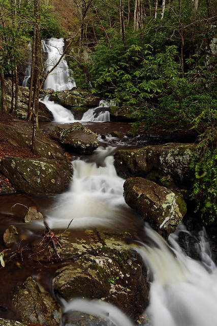
Spruce Flat Falls stats:2mi, 560ft gain, 1.75hrs
April 8, 2015: Clingmans Dome and Cataloochee
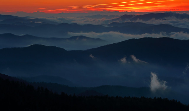
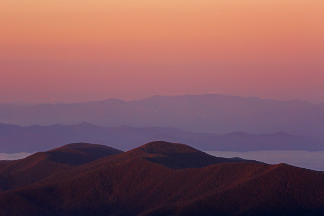
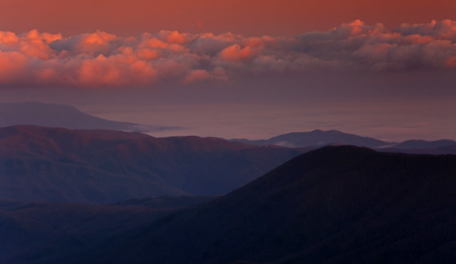
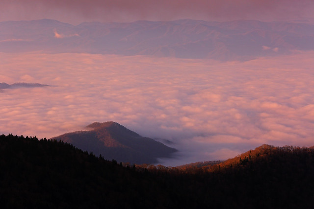
My entire trip, so far, had been bereftof a colorful sunrise and sunset. I had kept Clingmans Dome, at6.643ft the highest point in the Park, as well as Tennessee, for just such an event. My final day in the Smokies, and the forecast called for fog! However, when I got up in the morning and headed for Clingmans Dome things began to look better. There was thick fog to begin with, but by the time I got to the Clingmans Dome trailhead it had been left far below.
It was 6:30am as I hurried up the surprisingly steep paved road to the lookout tower,which capped Clingmans Dome. As I walked up the ramp that led to the top of the formidable structure, a gale force wind began to batter me. I knew that it was going to be a challenge to take photos. An absolutely spectacular sunrise proceeded to enfold, completely making up for the lack of good views on my Gregory Bald hike.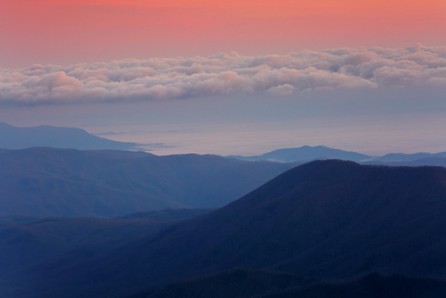
Clingmans Dome stats: 1mi, 360ft gain, 1.5hrs
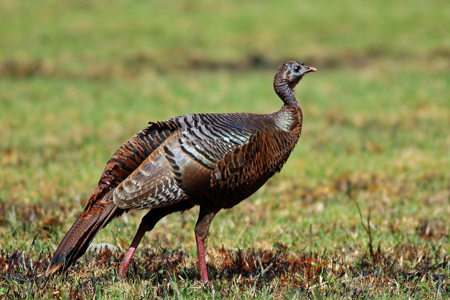
I had really wanted to visit Cataloochee Valley on my trip, basically to see the elk that were being reintroduced into the Park. It was a longish drive but quite a pretty one. Cataloochee Valley was nice but I was unable to photograph the elk. The solitary elk I saw was a couple of hundred yards off, in the woods and moving further away. A couple of courting turkeys were my consolation prize...nope, not enough consolation!
Summary
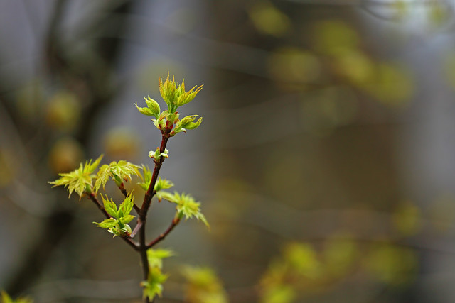
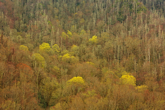
Great Smoky Mountains National Park was more impressive than I had expected. It's difficult to compare this Park to the western ones because it's the quintessential eastern showcase. The terrain is big and impressive, but the real beauty comes from the intimate: a beautiful mix of hardwoods and evergreen trees, popping wildflowers, a bounty of new leaves, but most of all the cascading streams and tumbling waterfalls which distilled all that beauty into the most soothing balm for the soul.
Wildlife seen: a large black bear, a coyote, a fox, white tailed deer, wild turkeys, numerous birds, and a solitary elk.