Michaux SF, PA TR
Apr 5, 2015 9:02:10 GMT -5
Post by Admin on Apr 5, 2015 9:02:10 GMT -5
04/04/15 – Michaux SF, AT/Blueberry Trail/Dead Woman’s Hollow Road Circuit: This was the first “new” hike that I’ve done since last July. Up front I want to thank Aegiss III for the gpx file he sent me and his tips. I was joined by Hardcore, The Mad Hatter, Wooly Bully and Christopher Robbins.
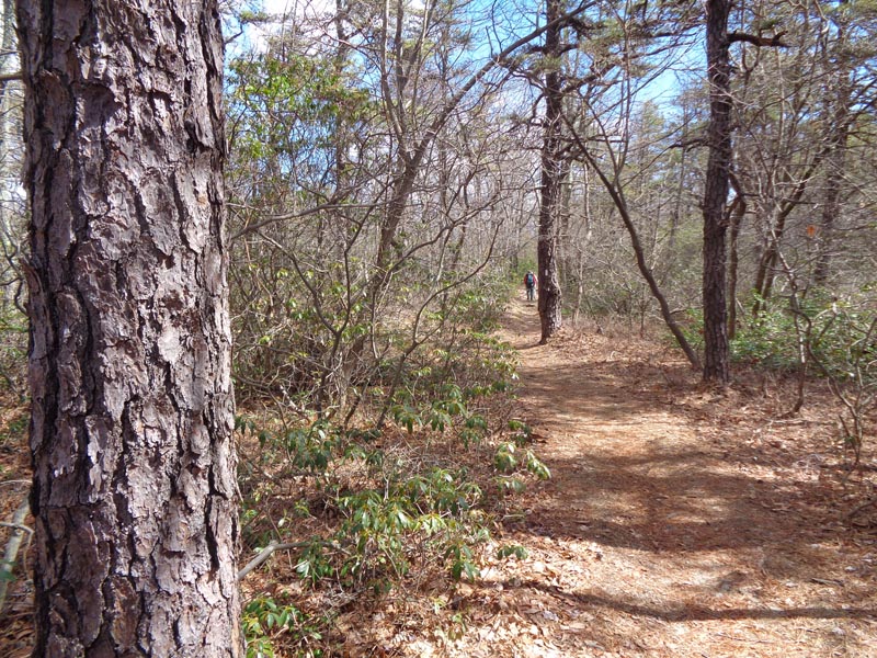
The AT parking lot on Shipensburg road is a large gravel affair enclosed by a corral and small pine trees. We began our hike NOBO on the AT, first through a pine forest on a wide grassy, woods road and then the more typical rocky footpath through mixed hardwood forest over rolling terrain.
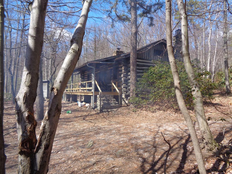
In 1,1 miles we reached the junction of the Dead Woman Hollow Road (our return route). Lore has it that a local woman whose name has long been forgotten was bitten by a snake in the hollow and died there. There is a nice parking area here should a hiker prefer to shorten this 7 mile circuit by 2 miles. Shortly after passing this intersection the AT joins the access road for the Michner cabin (a PATC rental). Once again we were walking on mostly flat, smooth trail covered with pine straw. In ¾ miles the AT makes a 90 degree left turn while the access road becomes the Blueberry Trail. We reach the occupied Michner cabin in ¼ mile.
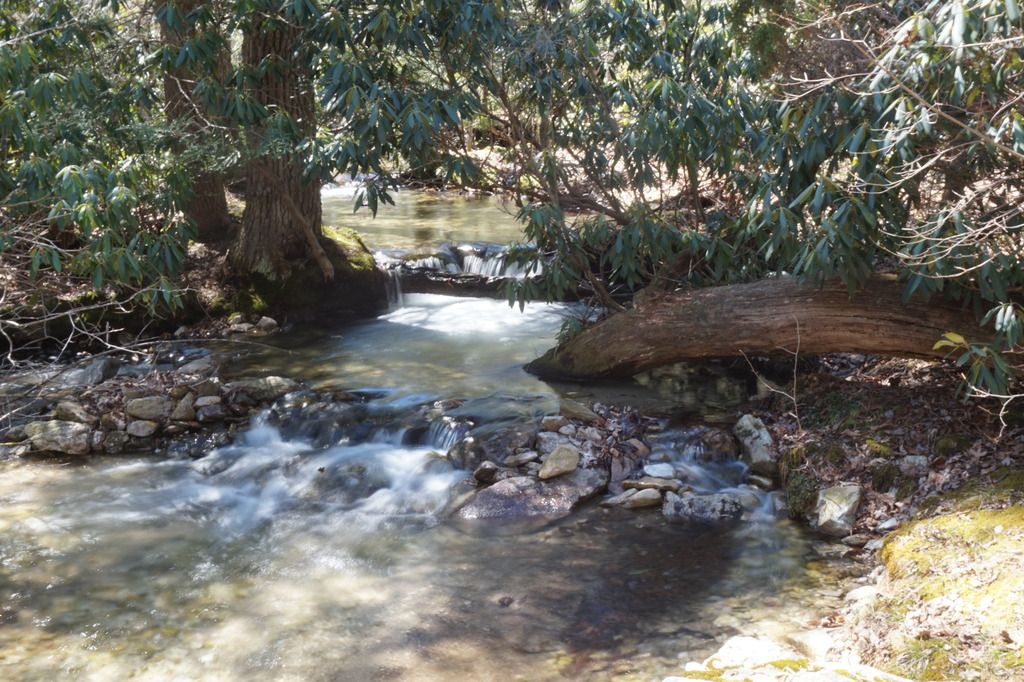
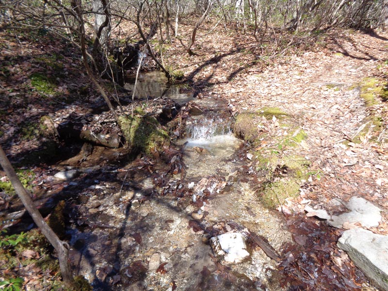
After a short conversation we continue on the Blueberry Trail, now a nice footpath weaving through mountain laurel thickets. (To further shorten the hike one can alternately take the Dead Woman Hollow “Trail”.) The trail crosses a stream just below its confluence with another.
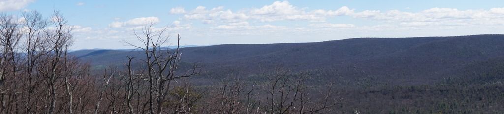
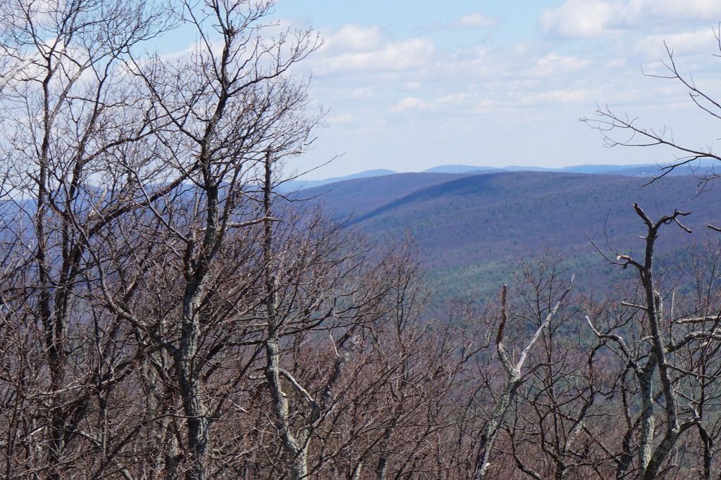
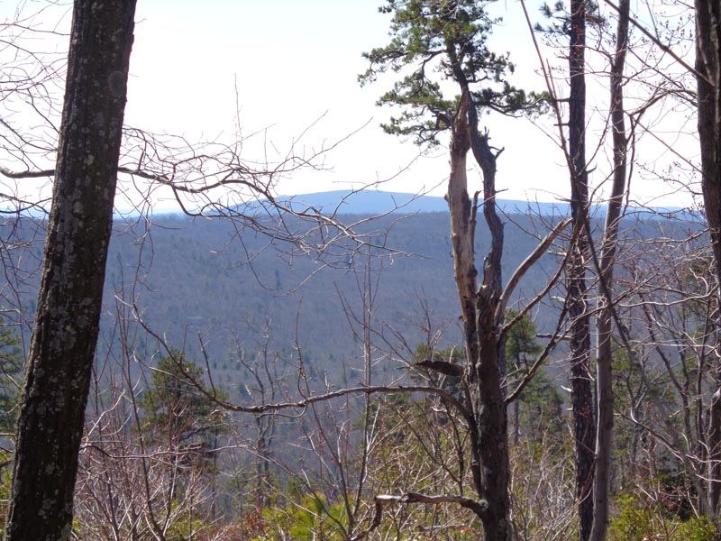
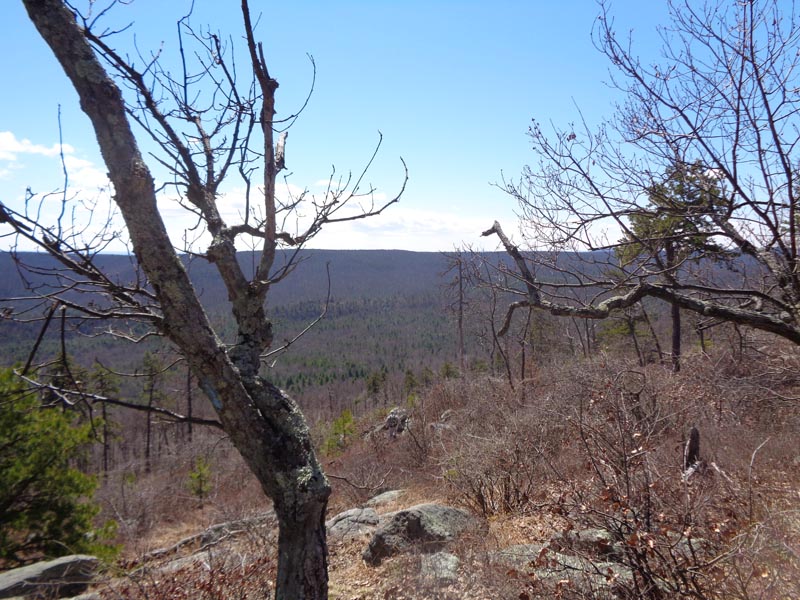
We stop at a small rock pile in 0.7 miles near the edge of the eastern flank of South Mountain incorrectly thinking that we were at a vista created by recent logging activity but another couple hundred yards brings us to a rocky ledge, a much better view point. I think Christopher Robins got better shots than I as he was able to maneuver around on the rocks.
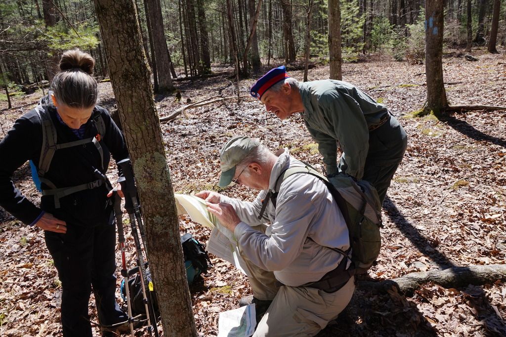
Hardcore scouted out the continuation of the trail which was hard to pickup at this point. Over the next ½ mile the trail descended rather steeply to the point that I was reaching out to grab trees to prevent myself from falling. There were a couple of switchbacks but they did little to help. As the steepness relented we arrive at an obvious trail junction. My GPS and the Hatter’s old PATC map told us we should turn right here. But Wooly’s newer PATC map did not show the trail at all. There was a blaze but it had been blackened out – usually a sign that the trail has been abandoned. We continued following the blue blazes thinking that perhaps there had been a trail relocation but I continued to monitor my GPS. When I saw we were quickly approaching Rt 233 my original assumption proved correct. Not wanting to do a road walk on that dangerous road we retreated to the abandoned trail. After a few steps it became a woods road, an obvious extension of Dead Woman Hollow Road. It was wide and mostly grassy. After an easy 0.7 mile walk we reached the road itself. We looked for and found an unofficial trail that was on the gpx file I was using but it seemed to peter out after a 100 yards or so. At this point we didn’t feel an “adventure” was warranted, and on second thought realizing that what looked like an apparent stream crossing on the map might be a bit more than merely technical, we opted to just follow the road back up to the AT. It was a long 1.9 mile climb gaining 800 feet over that distance but there was only one or two parts that might be considered remotely steep. Otherwise it was just a long, continuous slog. We did manage to find the upper end of the stream trail a bit more than halfway up. It was just before the southern terminus of the Dead Woman Hollow “Trail”. Once we reached the AT we took a short break and then retraced our initial 1.1 miles back to the truck. At 8 miles (counting our explorations) and 1400 feet of E.G. it was the ideal hike for a sunny but blustery spring day.
The AT parking lot on Shipensburg road is a large gravel affair enclosed by a corral and small pine trees. We began our hike NOBO on the AT, first through a pine forest on a wide grassy, woods road and then the more typical rocky footpath through mixed hardwood forest over rolling terrain.
In 1,1 miles we reached the junction of the Dead Woman Hollow Road (our return route). Lore has it that a local woman whose name has long been forgotten was bitten by a snake in the hollow and died there. There is a nice parking area here should a hiker prefer to shorten this 7 mile circuit by 2 miles. Shortly after passing this intersection the AT joins the access road for the Michner cabin (a PATC rental). Once again we were walking on mostly flat, smooth trail covered with pine straw. In ¾ miles the AT makes a 90 degree left turn while the access road becomes the Blueberry Trail. We reach the occupied Michner cabin in ¼ mile.
After a short conversation we continue on the Blueberry Trail, now a nice footpath weaving through mountain laurel thickets. (To further shorten the hike one can alternately take the Dead Woman Hollow “Trail”.) The trail crosses a stream just below its confluence with another.
We stop at a small rock pile in 0.7 miles near the edge of the eastern flank of South Mountain incorrectly thinking that we were at a vista created by recent logging activity but another couple hundred yards brings us to a rocky ledge, a much better view point. I think Christopher Robins got better shots than I as he was able to maneuver around on the rocks.
Hardcore scouted out the continuation of the trail which was hard to pickup at this point. Over the next ½ mile the trail descended rather steeply to the point that I was reaching out to grab trees to prevent myself from falling. There were a couple of switchbacks but they did little to help. As the steepness relented we arrive at an obvious trail junction. My GPS and the Hatter’s old PATC map told us we should turn right here. But Wooly’s newer PATC map did not show the trail at all. There was a blaze but it had been blackened out – usually a sign that the trail has been abandoned. We continued following the blue blazes thinking that perhaps there had been a trail relocation but I continued to monitor my GPS. When I saw we were quickly approaching Rt 233 my original assumption proved correct. Not wanting to do a road walk on that dangerous road we retreated to the abandoned trail. After a few steps it became a woods road, an obvious extension of Dead Woman Hollow Road. It was wide and mostly grassy. After an easy 0.7 mile walk we reached the road itself. We looked for and found an unofficial trail that was on the gpx file I was using but it seemed to peter out after a 100 yards or so. At this point we didn’t feel an “adventure” was warranted, and on second thought realizing that what looked like an apparent stream crossing on the map might be a bit more than merely technical, we opted to just follow the road back up to the AT. It was a long 1.9 mile climb gaining 800 feet over that distance but there was only one or two parts that might be considered remotely steep. Otherwise it was just a long, continuous slog. We did manage to find the upper end of the stream trail a bit more than halfway up. It was just before the southern terminus of the Dead Woman Hollow “Trail”. Once we reached the AT we took a short break and then retraced our initial 1.1 miles back to the truck. At 8 miles (counting our explorations) and 1400 feet of E.G. it was the ideal hike for a sunny but blustery spring day.