Sleepy Creek triple vista hike in autumn
Feb 3, 2015 22:38:36 GMT -5
Post by AegisIII on Feb 3, 2015 22:38:36 GMT -5
Photos
The south end of Sleepy Creek WMA has a set of nice vistas. I have been wanting to do a hike taking me to all three; but doing so would require a long out-and-back section, plus a hike longer than I would want to do. On trail, that is. If I did a bushwhack to approach one of the vistas, I'd eliminate the out-and-back and shorten the hike to a more reasonable distance.
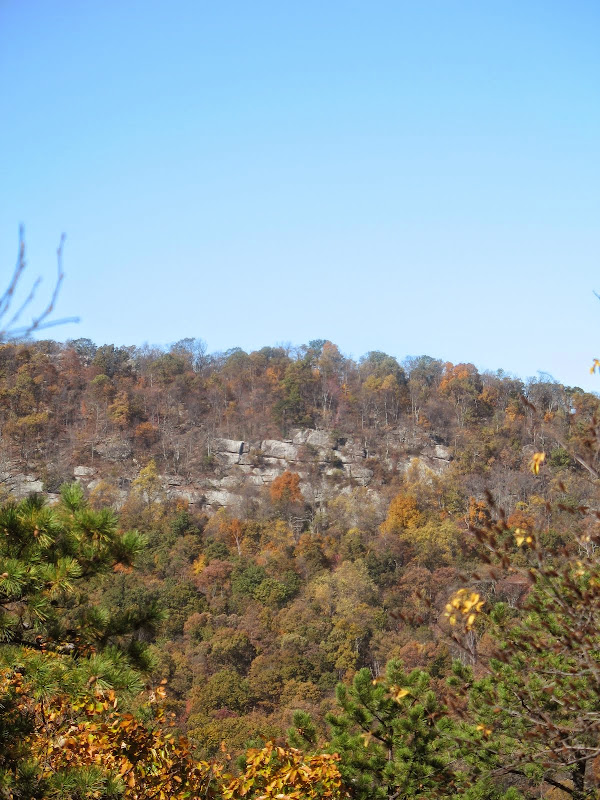
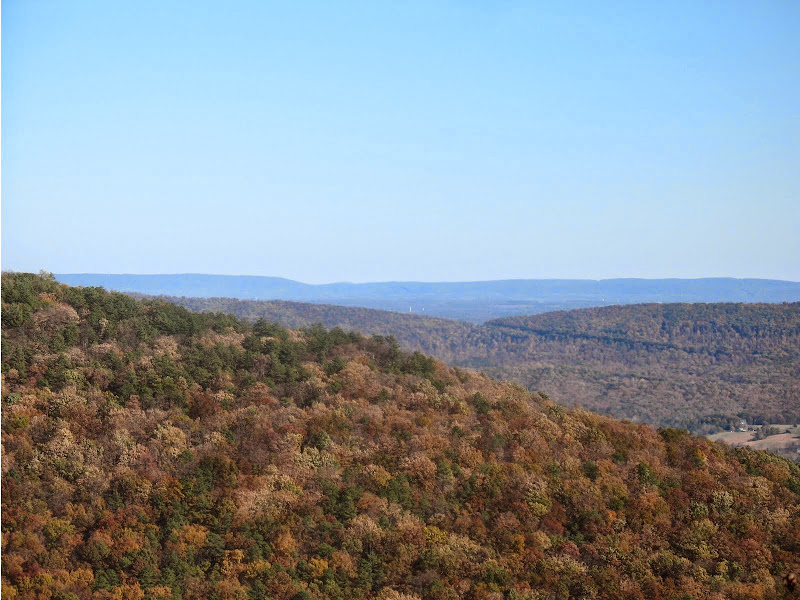
I started at the Brushy Creek access point, and hiked along the jeep trail, some color left in autumn but most of the leaves fallen. Then onto a side woods road (or really mostly beside it due to blowdowns) to the edge of a field and the trail's end. Took a short bushwhack to the merging of a few dry creeks. After checking my compass to find north, I bushwhacked uphill to the end of the mountain, due north. Mostly gentle, some steep stretches. The final stretch was a short rock scramble, perhaps avoidable by flanking the southwestern talus slope, but I missed a good point to do that. Atop is the Pee Wee Point vistas, to the south and east, plus a smaller view west to a large cliff on Sleepy Creek Mountain.


I then took the trail north from Pee Wee Point, then down into the Little Brushy Creek valley, and south to the High Rock Trail. Climbed it up to the Tuscarora Trail. First went north to the Mini-Knife Edge Trail, for its good view to the southeast.


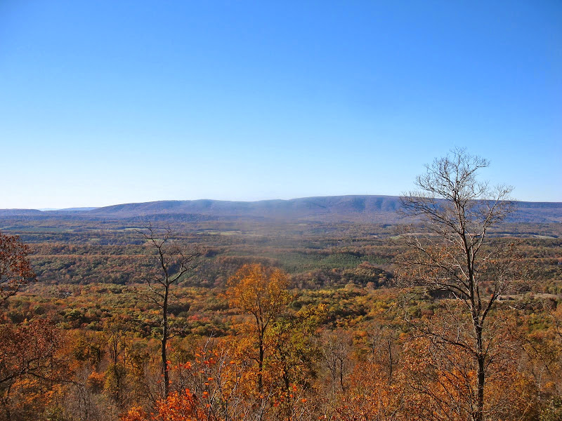
After that view, headed back south on the Tuscarora Trail. At top of first little climb, tried to find a way to the cliff visible from Pee Wee Point, but could not find a good way to it, mainly due to growth and poison ivy. A bit later, explored where it looked like some rocks may give a view; they did. Need to watch for poison ivy, though.

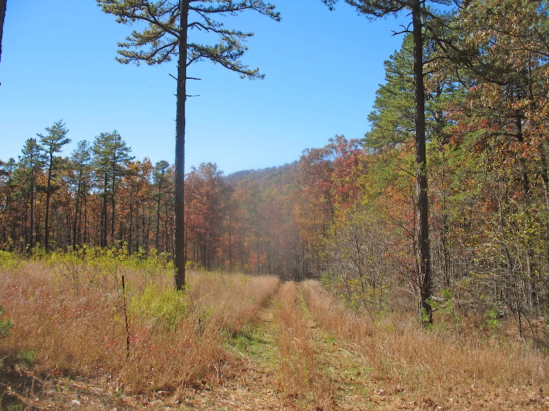
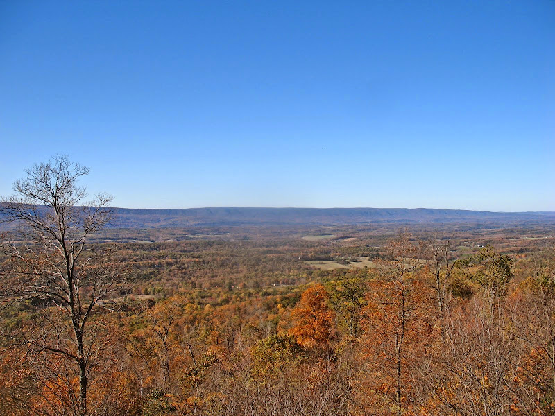
Then continued south on the TT, leaving the WMA and its jeep trail for singletrack. Got lost at one point due to a blowdown before getting back on track. Then made it to the expansive Shockeys Knob view to the west; this is a quad-state vista. Very windy day.
After the view, continued on the TT south. The side trail to the nearby spring had been cleared, so took it to the covered water hole. Then stopped at the Shockey's Knob shelter, probably for longer than I should have. After the break, descended from Sleepy Creek Mountain, first on the TT and then the Mill Race Trail, to its rock crossing of Little Brushy Creek. Then a short climb and hike back to the parking area in the dimming light.

The south end of Sleepy Creek WMA has a set of nice vistas. I have been wanting to do a hike taking me to all three; but doing so would require a long out-and-back section, plus a hike longer than I would want to do. On trail, that is. If I did a bushwhack to approach one of the vistas, I'd eliminate the out-and-back and shorten the hike to a more reasonable distance.
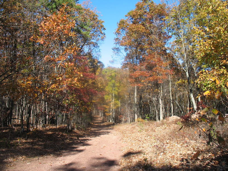
I started at the Brushy Creek access point, and hiked along the jeep trail, some color left in autumn but most of the leaves fallen. Then onto a side woods road (or really mostly beside it due to blowdowns) to the edge of a field and the trail's end. Took a short bushwhack to the merging of a few dry creeks. After checking my compass to find north, I bushwhacked uphill to the end of the mountain, due north. Mostly gentle, some steep stretches. The final stretch was a short rock scramble, perhaps avoidable by flanking the southwestern talus slope, but I missed a good point to do that. Atop is the Pee Wee Point vistas, to the south and east, plus a smaller view west to a large cliff on Sleepy Creek Mountain.
I then took the trail north from Pee Wee Point, then down into the Little Brushy Creek valley, and south to the High Rock Trail. Climbed it up to the Tuscarora Trail. First went north to the Mini-Knife Edge Trail, for its good view to the southeast.
After that view, headed back south on the Tuscarora Trail. At top of first little climb, tried to find a way to the cliff visible from Pee Wee Point, but could not find a good way to it, mainly due to growth and poison ivy. A bit later, explored where it looked like some rocks may give a view; they did. Need to watch for poison ivy, though.
Then continued south on the TT, leaving the WMA and its jeep trail for singletrack. Got lost at one point due to a blowdown before getting back on track. Then made it to the expansive Shockeys Knob view to the west; this is a quad-state vista. Very windy day.
After the view, continued on the TT south. The side trail to the nearby spring had been cleared, so took it to the covered water hole. Then stopped at the Shockey's Knob shelter, probably for longer than I should have. After the break, descended from Sleepy Creek Mountain, first on the TT and then the Mill Race Trail, to its rock crossing of Little Brushy Creek. Then a short climb and hike back to the parking area in the dimming light.