|
|
Post by Admin on Jan 6, 2015 11:28:04 GMT -5
a new member of the boards, lwtrekpa, recently posted an Outing Critique for this wonderful hike. I had hesitated posting the hike when Hossier showed it to us primarily because of the very steep descent along the dam fence and the need to ford the spillway at the end of the hike. He had found another way: "The 3rd caveat (in the description) is not all true. If doing the full loop and you find yourself on the path above the dam, the trail continues on in a slight upward path back into woods on a defined path down thru woods and brings you out on the back side of one of the municipal buildings that you passed on your trek up to the dam at the start of hike. I'm most certain the municipality of Lebanon would not want people hanging on their chain link fence in an attempt to descend the hill and then have people try and rock hop across what would considered a spillway to the dam."If anyone has a GPX file showing this last trail I will use it to amend the hike and give "the new guy" and you credit. |
|
|
|
Post by AegisIII on Jan 6, 2015 22:15:42 GMT -5
I've recently finished my collection of gps data for SGL 211. I haven't cleaned it up yet, so I don't particularly want to share it, but I suppose that I could extract that trail if no one else has the data for it. (Though, since I have it, it is online somewhere, so maybe I'll just look for it again.
|
|
|
|
Post by hoosier on Jan 7, 2015 7:23:02 GMT -5
That's good news. I will have to take a trip back up that way and see if I can locate this trail, as I never looked all that hard. And log it into my GPS
|
|
|
|
Post by hoosier on Jan 19, 2015 11:12:39 GMT -5
a new member of the boards, lwtrekpa, recently posted an Outing Critique for this wonderful hike. I had hesitated posting the hike when Hossier showed it to us primarily because of the very steep descent along the dam fence and the need to ford the spillway at the end of the hike. He had found another way: "The 3rd caveat (in the description) is not all true. If doing the full loop and you find yourself on the path above the dam, the trail continues on in a slight upward path back into woods on a defined path down thru woods and brings you out on the back side of one of the municipal buildings that you passed on your trek up to the dam at the start of hike. I'm most certain the municipality of Lebanon would not want people hanging on their chain link fence in an attempt to descend the hill and then have people try and rock hop across what would considered a spillway to the dam."If anyone has a GPX file showing this last trail I will use it to amend the hike and give "the new guy" and you credit. Mike
I went up and located, and hiked that trail that he mentions, this past Saturday (01/07/2015) I will post a trip report Tuesday. And will e mail you my GPS data for the trail location.
Bill
|
|
|
|
Post by Admin on Jan 19, 2015 12:22:41 GMT -5
Thanks.
|
|
|
|
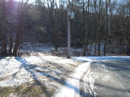
Post by hoosier on Jan 20, 2015 8:05:57 GMT -5
|
|
|
|
Post by Admin on Jan 20, 2015 10:00:33 GMT -5
That certainly makes life easier. Thanks for checking it out.
|
|
|
|
Post by hoosier on Jan 20, 2015 11:35:47 GMT -5
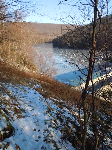
That certainly makes life easier. Thanks for checking it out. If you are doing the Lebanon Reservoir loop hike as we did it. When arriving at the fencing surrounding the west side of the dam breast. The trail (faint) veers to the right and uphill through the grassy area, to the tree line, and may not be readily noticeable if the straw like grass is tall in the summertime. But it's definitely there, and well defined once past the grassy area. |
|
|
|
Post by Admin on Jan 22, 2015 11:32:50 GMT -5
I've made changes to the map and trail notes. The gpx file didn't have to be changed since the last waypoint is where the trail leaves the RR grade at the gate.
|
|