

Sideling Hill Exploration
Jan 4, 2015 23:07:16 GMT -5
Post by AegisIII on Jan 4, 2015 23:07:16 GMT -5
Photos
Back in September, I decided to go into exploration mode, and headed to the Sideling Hill area of Buchanan State Forest, mainly to check if certain trails exist and were usable, and where some others went. My goal was centered on Jerry Road, just north of US-30, where it crosses the pipeline.
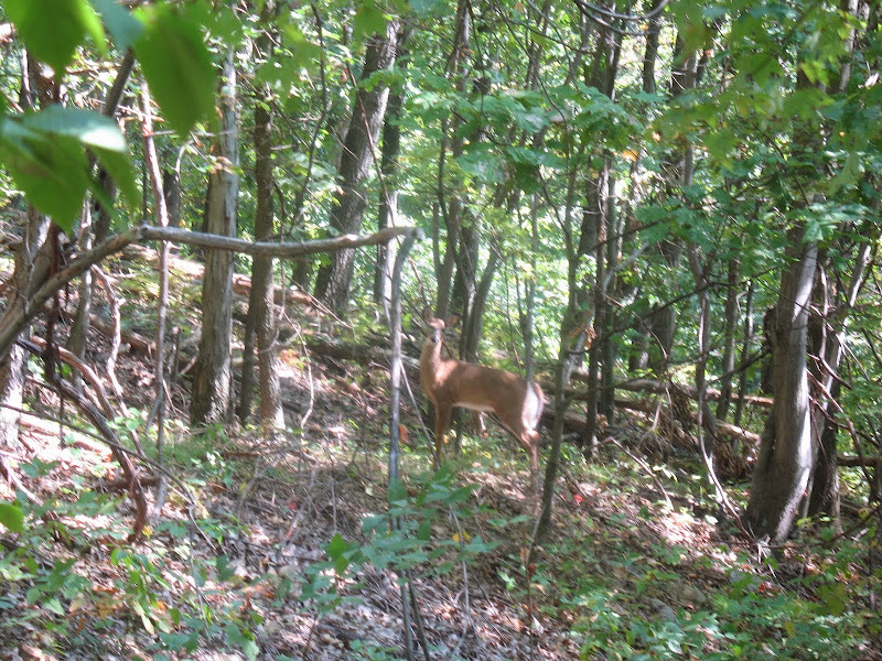
I first took the pipeline east, descending from the mountain. The beginning was nice, then passed a logging area where it had become somewhat overgrown. Further down was a nasty multiple blowdown section. Past there, the pipeline became nice again, and now below the canopy. Saw a few deer. I reached the unsigned junction with the obvious Mitchell Trail. Somewhat surprisingly, even southbound the trail was clear, save for one blowdown stretch. Past it the trail follows and crosses the Sindeldecker Branch, lightly flowing over a shale boulder creek bed. I was here surprised that the trail was blazed, as that was helpful and most trails in the area are not. (Light blue, BTW). After heading partly up the hemlock hollow, the trail turns and begins a steep ascent, soon reaching the clearing for US-30, where I turned around. (It continues on the other side, perhaps a loop can be made.)


Back past the pipeline heading north, I now took the very obvious Mitchell Trail uphill, passing an animal burrow in the middle of the trail, and then reaching the King Trail, here a logging road. I leave it at a logging road at a clearing, which leads to the Laidig Spring Trail. I find a singletrack trail, which in fact turns out to be an old skid, to an area of a few meadows, where the trail fades out. Could be a view around here, but I didn't find it. Back on the logging road north to Laidig Spring Tr. Took that back west to the King Trail. Starts off nice, then gets worse and worse with ingrowing brush and spider webs.

Then further north on the King Trail, passing the Deep Hollow Trail, and then a bit more to where I find the secret "red trail," marked by a single, fading red blaze (no further blazes). This wound its way west, a faint trail that I had to pay attention to to keep on it. It reached the Deep Hollow Trail without warning. (It continued west, but in worse shape, and as I really had no idea where it went, decided that it could wait for another time.)


Deep Hollow is a typical, narrow woods road style state forest trail, fairly straight as it descends into a hollow. Many spider webs. A couple of blowdowns, only one area major. Generally gentle descent, but with a couple of steep areas. The stream crossing partway down, while dry, is slightly difficult due to blowdowns and holes in the rocks making up the trail and those making up the streambed. Very light in rhododendrons. Nearing the bottom, some small interesting shale outcrops appear, and then the trial drops to Wooden Bridge Creek, lightly flowing and heavy with shale boulders and rhododendrons. Good spot for lunch. The trail seemed to continue, but it had to end soon, due to the turnpike splitting it in two. No obvious way to head downstream to get to the tunnel area.


Then took Deep Hollow back to King, King back to Laidig Spring. Headed west on Laidig Spring, first as logging road through early autumn brush, then woods road through the lowlands of a branch of Wooden Bridge Creek, a short climb up to Jerry Road. Continued on Laidig Spring, again as a logging road, had one turkey run away from me. Short snowmobile connector to the Jerry Trail and its red dirt logging road. South on Jerry, turning onto the old Jerry Trail to avoid a gravel logging road, passed a grassy clearing and then some lowlands with light invasive growth, and made it back to Jerry Road a short distance from the car. Got some good ideas for future hikes in the area.


Back in September, I decided to go into exploration mode, and headed to the Sideling Hill area of Buchanan State Forest, mainly to check if certain trails exist and were usable, and where some others went. My goal was centered on Jerry Road, just north of US-30, where it crosses the pipeline.
I first took the pipeline east, descending from the mountain. The beginning was nice, then passed a logging area where it had become somewhat overgrown. Further down was a nasty multiple blowdown section. Past there, the pipeline became nice again, and now below the canopy. Saw a few deer. I reached the unsigned junction with the obvious Mitchell Trail. Somewhat surprisingly, even southbound the trail was clear, save for one blowdown stretch. Past it the trail follows and crosses the Sindeldecker Branch, lightly flowing over a shale boulder creek bed. I was here surprised that the trail was blazed, as that was helpful and most trails in the area are not. (Light blue, BTW). After heading partly up the hemlock hollow, the trail turns and begins a steep ascent, soon reaching the clearing for US-30, where I turned around. (It continues on the other side, perhaps a loop can be made.)
Back past the pipeline heading north, I now took the very obvious Mitchell Trail uphill, passing an animal burrow in the middle of the trail, and then reaching the King Trail, here a logging road. I leave it at a logging road at a clearing, which leads to the Laidig Spring Trail. I find a singletrack trail, which in fact turns out to be an old skid, to an area of a few meadows, where the trail fades out. Could be a view around here, but I didn't find it. Back on the logging road north to Laidig Spring Tr. Took that back west to the King Trail. Starts off nice, then gets worse and worse with ingrowing brush and spider webs.
Then further north on the King Trail, passing the Deep Hollow Trail, and then a bit more to where I find the secret "red trail," marked by a single, fading red blaze (no further blazes). This wound its way west, a faint trail that I had to pay attention to to keep on it. It reached the Deep Hollow Trail without warning. (It continued west, but in worse shape, and as I really had no idea where it went, decided that it could wait for another time.)
Deep Hollow is a typical, narrow woods road style state forest trail, fairly straight as it descends into a hollow. Many spider webs. A couple of blowdowns, only one area major. Generally gentle descent, but with a couple of steep areas. The stream crossing partway down, while dry, is slightly difficult due to blowdowns and holes in the rocks making up the trail and those making up the streambed. Very light in rhododendrons. Nearing the bottom, some small interesting shale outcrops appear, and then the trial drops to Wooden Bridge Creek, lightly flowing and heavy with shale boulders and rhododendrons. Good spot for lunch. The trail seemed to continue, but it had to end soon, due to the turnpike splitting it in two. No obvious way to head downstream to get to the tunnel area.
Then took Deep Hollow back to King, King back to Laidig Spring. Headed west on Laidig Spring, first as logging road through early autumn brush, then woods road through the lowlands of a branch of Wooden Bridge Creek, a short climb up to Jerry Road. Continued on Laidig Spring, again as a logging road, had one turkey run away from me. Short snowmobile connector to the Jerry Trail and its red dirt logging road. South on Jerry, turning onto the old Jerry Trail to avoid a gravel logging road, passed a grassy clearing and then some lowlands with light invasive growth, and made it back to Jerry Road a short distance from the car. Got some good ideas for future hikes in the area.