|
|
Post by arfcomhkr on Nov 8, 2014 20:21:05 GMT -5
|
|
WoolyBully
Full Member
Walking slow.....
Posts: 32 
|
Post by WoolyBully on Nov 9, 2014 7:49:42 GMT -5
This is very interesting for me as we have Oil Creek on the 2015 schedule, for a 3-day in late April. Lots of historical sites in this park, including the first producing oil well in the US, the Drake Well. Can you share the routes you took? Thanks.
|
|
|
|
Post by arfcomhkr on Nov 9, 2014 8:38:58 GMT -5
This is very interesting for me as we have Oil Creek on the 2015 schedule, for a 3-day in late April. Lots of historical sites in this park, including the first producing oil well in the US, the Drake Well. Can you share the routes you took? Thanks. The trail just runs (mostly) above both sides of the river. It's pretty much a big loop from point A to B , cross and run it in reverse on the other side of the river. There are a couple of bridges on the river where you can cross besides the beginning and end points. There's one shelter area on each side of the river. Those are the only areas you can legally camp so you kind of have to plan your hike around those. You can reserve and pay for them ahead of time online. You can day hike it in sections pretty easily if you have two vehicles if you want. |
|
MRHyker
Forum Elder
Out to Lunch
Posts: 130
|
Post by MRHyker on Nov 9, 2014 9:52:41 GMT -5
It looks like, except for a couple of places, there are no major elevation changes. 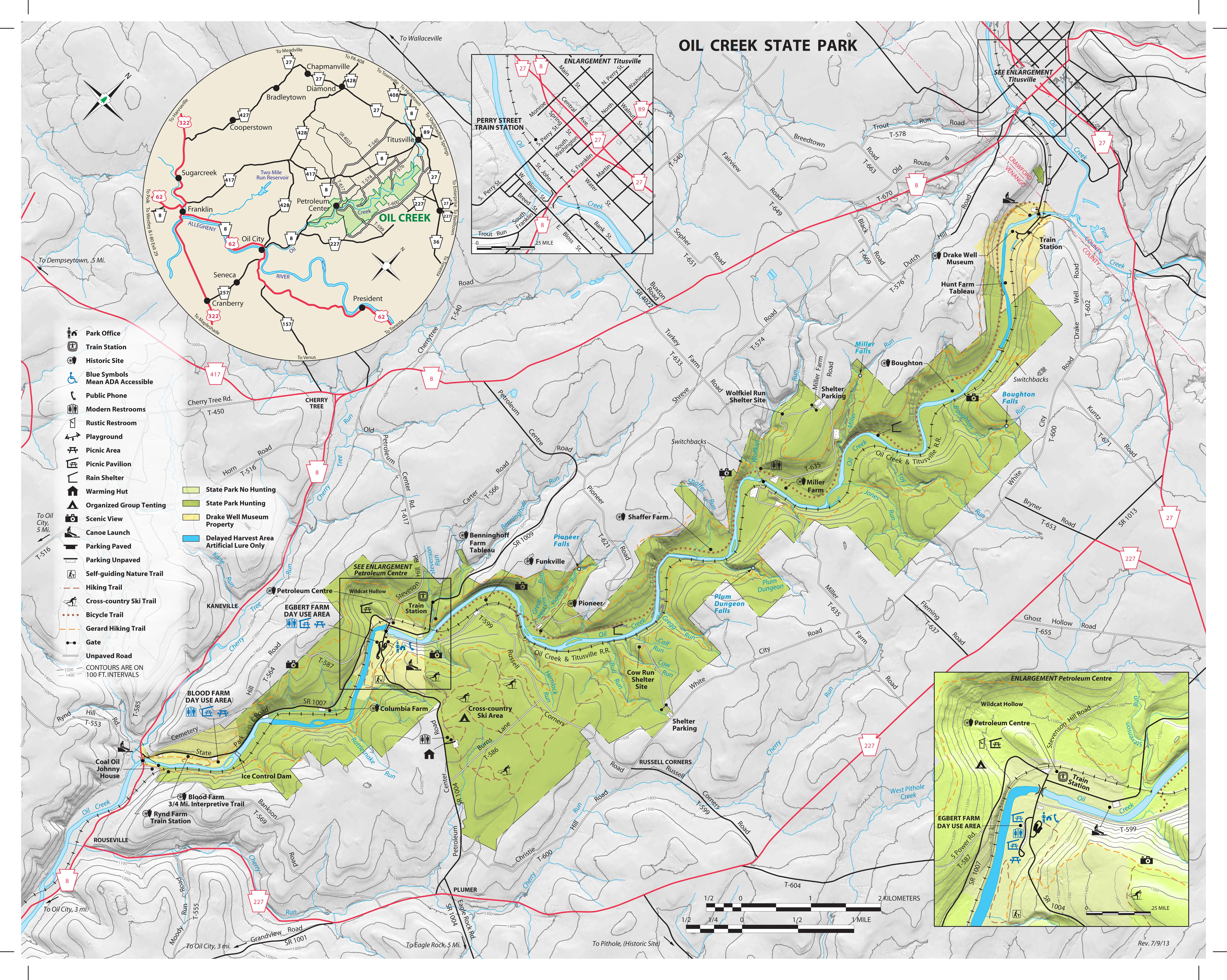 |
|
|
|
Post by GaliWalker on Nov 9, 2014 10:02:41 GMT -5
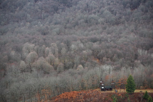
If arfcomhkr's talking about the same loop I did 4ys ago, then the stats are 7.2mi, 1100ft elevation gain.
This photo gives some idea of the elevation change:
 |
|
MRHyker
Forum Elder
Out to Lunch
Posts: 130
|
Post by MRHyker on Nov 9, 2014 10:12:03 GMT -5
If arfcomhkr's talking about the same loop I did 4ys ago, then the stats are 7.2mi, 1100ft elevation gain.
This photo gives some idea of the elevation change:
The entire loop is 36 miles more or less. You just did a small part of it. |
|
|
|
Post by GaliWalker on Nov 9, 2014 10:23:57 GMT -5
Oops. 
(Your map wasn't showing up, when I posted.) |
|
MRHyker
Forum Elder
Out to Lunch
Posts: 130
|
Post by MRHyker on Nov 9, 2014 10:34:54 GMT -5
I tried to post a pdf from the DNR site but proboards doesn't recognize .pdfs as being image files. So I downloaded/converted to jpg and uploaded to my server.
BTW, this is the same resolution as what's on their site so you can save it to your hard drive from here.
|
|
|
|
Post by arfcomhkr on Nov 9, 2014 10:54:58 GMT -5
The map is deceiving when it comes to elevation changes. While it looks like mostly ridge top hiking, the trail will go up to the ridge, maybe follow it for a while then drop almost to the river, then back up again in many places.
I'm guessing private land had something to do with how the trail was laid out.
Forgot to add a word of caution if you're going there in the winter. The road from Wolfkiel Shelter down to the river and back up the other side of the valley isn't plowed during the winter. (Miller Farm, I think). It's usually plowed back to the last house for the school bus and mail and kind of plowed back to the shelter parking lot (maybe).
Venture down into the valley in winter at your own risk even with a 4x4.
We drove down there once on the way out to day hike the bike trail a bit and got caught in an ice storm that rolled in on us. By the time we got back to the trucks it was a real bugger getting back up out of there.
|
|
jbs86
New Member
Posts: 8
|
Post by jbs86 on Nov 9, 2014 18:24:23 GMT -5
I hiked about 20 miles of the loop back in mid-June, and was very pleasantly surprised by how nice it is. Plenty of view, waterfalls and interesting mushrooms. Plus enough topography to keep it interesting. My favorite part though was certainly all the old structures along the trail   |
|