Detweiler Run circuit
Oct 23, 2014 21:34:51 GMT -5
Post by AegisIII on Oct 23, 2014 21:34:51 GMT -5
Photos
Still in July, I decided I should take another rhododendron hike. Not wanting to go to Michaux three hikes in a row, I decided to head up to Rothrock State Forest, where the Alan Seeger and Detweiler Run Natural Areas should give me the hike I was looking for.
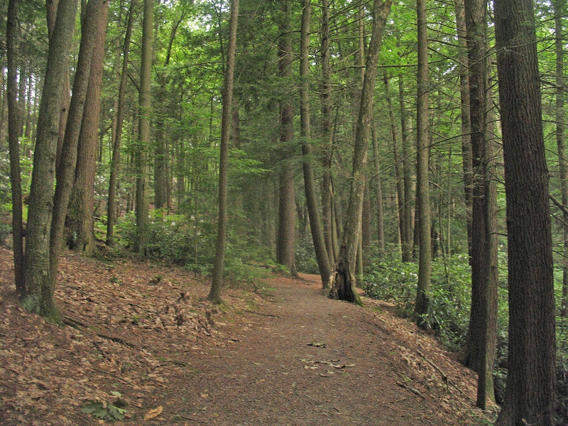
I started at the large lot of the picnic area, and hopped onto the loop trail, paralleling the road. This half of the Seeger loop was mostly through pine and hemlocks, away from the creek and mainly lacking rhododendron. When I reached the Greenwood Spur, I took it slightly north to paved Seeger Rd. A very short walk east on the road led me to the base of the Long Mountain Trail.

This trail slowly and steadily climbs Grass Mountain, first as a logging road through open woods, then as a woods road in somewhat denser woods. There are two small wet meadows the trail passes by. As it levels out, the trail becomes nicely moss covered. Near the summit, the trail switches from unblazed to red blazed. Views to the south, and somewhat to the north, are present at a pipeline crossing. Past the pipeline, the trail becomes singletrack, as it winds along the Grass Mountain summit area, passing a couple of hemlock groves. It begins to switchback down the eastern bowl of the mountain, before becoming an eroded path leading to the gated grassy Thickhead Mountain Rd.


This I took downhill to Penn Roosevelt State Park. Along Thickhead, I searched out the Grass Mountain Trail shown on some maps. It's unmarked and unblazed, but I think I found it. It was, however, too overgrown for a July hike. I had lunch at the park, at a picnic table near the mostly drained lake, with a good view of Broad Mountain Rising above. Numerous northern water snakes were hiding amongst the rocks of the dam.


After lunch, I headed south on the Mid State Trail, meaning I headed north over Grass Mountain on the Shingle Path. I go past the chimney, and the climb is moderately steep to steep, but not rocky. It is very lightly switchbacked. The trail has the canopy somewhat open, and the July sun made this a hard climb. Some burrs on the ground tell me there is an American Chestnut by the trail, but I could find none. At the top of the mountain, the trail levels out as it makes it way to Thickhead Mtn Rd.
Across the grassy road, the trail drops off the mountain. Unlike the other side, the trail dropping to Detweiler Run is purely boulders, and steeper. Going is slower, but the trail becomes less rocky further into the hollow. At the bottom, the trail crosses the dry streambed of Detweiler Run, and soon turns off of the Shingle Path.

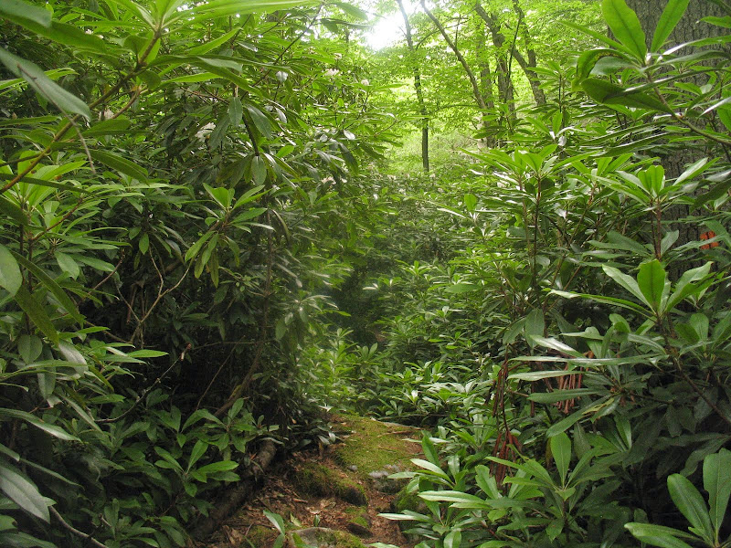
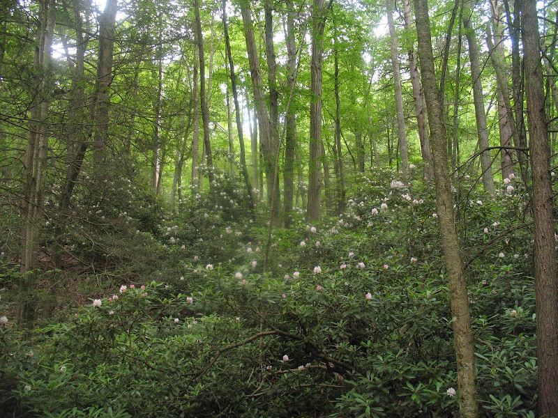
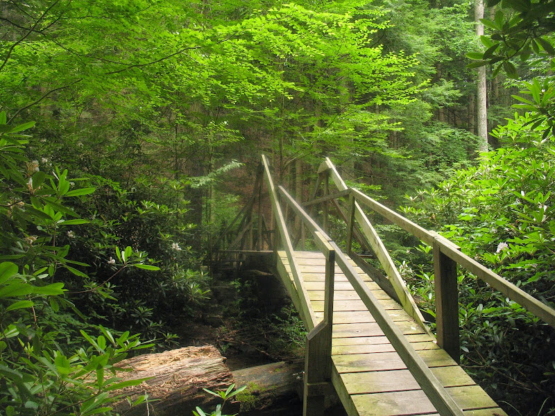
Here started the long rail trail section. Of course, as this is the Mid State Trail, this is not the typical rail trail but rather a nearly straight line of rocks elevated a foot or two above the valley floor. The woods start off open, but pass through a few groves of shady hemlocks. Then the rhododendrons start. I thought Michaux had copious rhodos. Well, that was nothing. Detweiler Run has them spanning the hollow, for a long distance of it, and expanding up the sides for a few hundred feet of elevation. And at peak bloom! The rocks and the photography made for slow going here. At points the trail left the old rail line and usually in these spots entered into the black hole of the rhododendron jungle. The pipeline offered a respite from the rocks and branches, but the footing here was wet. The wondrous display continued on the west side of the clearing, continuing to the bridge over Detweiler Run.


Past the bridge, the MST is generally not on any obvious railroad grade, and lightly undulates through the hemlock and rhododendrons. Numerous views of the creek. I soon reach Detweiler Junction, leaving the MST and continuing straight ahead onto the Greenwood Spur. The trail mostly follows rail grades, first rocky but then nice dirt. A few stream crossings on good bridges. It goes past the abandoned blue cabin, then a couple of used cabins. Still good rhodos in bloom. It leaves the rail grade just short of the Long Mountain Trail, and I soon make it back to Seeger Road.


I then enter Pete, Mike, and Peggy's Uncle Natural Area, and take the Greenwood Spur through the area. I first go through hemlocks, and then enter the mixed hemlock/rhododendron area crossing a small branch/channel of Standing Stone Creek. The rhodos are not quite as nice as Detweiler Run, but the hemlocks are better. I then takes bridges over the channels of Standing Stone Creek, each fancier than the last. After the last channel, the trail enters the big giant trees section, leaving the rhododendrons behind, as the trail makes its loop back to the road and parking area.


Still in July, I decided I should take another rhododendron hike. Not wanting to go to Michaux three hikes in a row, I decided to head up to Rothrock State Forest, where the Alan Seeger and Detweiler Run Natural Areas should give me the hike I was looking for.
I started at the large lot of the picnic area, and hopped onto the loop trail, paralleling the road. This half of the Seeger loop was mostly through pine and hemlocks, away from the creek and mainly lacking rhododendron. When I reached the Greenwood Spur, I took it slightly north to paved Seeger Rd. A very short walk east on the road led me to the base of the Long Mountain Trail.
This trail slowly and steadily climbs Grass Mountain, first as a logging road through open woods, then as a woods road in somewhat denser woods. There are two small wet meadows the trail passes by. As it levels out, the trail becomes nicely moss covered. Near the summit, the trail switches from unblazed to red blazed. Views to the south, and somewhat to the north, are present at a pipeline crossing. Past the pipeline, the trail becomes singletrack, as it winds along the Grass Mountain summit area, passing a couple of hemlock groves. It begins to switchback down the eastern bowl of the mountain, before becoming an eroded path leading to the gated grassy Thickhead Mountain Rd.
This I took downhill to Penn Roosevelt State Park. Along Thickhead, I searched out the Grass Mountain Trail shown on some maps. It's unmarked and unblazed, but I think I found it. It was, however, too overgrown for a July hike. I had lunch at the park, at a picnic table near the mostly drained lake, with a good view of Broad Mountain Rising above. Numerous northern water snakes were hiding amongst the rocks of the dam.
After lunch, I headed south on the Mid State Trail, meaning I headed north over Grass Mountain on the Shingle Path. I go past the chimney, and the climb is moderately steep to steep, but not rocky. It is very lightly switchbacked. The trail has the canopy somewhat open, and the July sun made this a hard climb. Some burrs on the ground tell me there is an American Chestnut by the trail, but I could find none. At the top of the mountain, the trail levels out as it makes it way to Thickhead Mtn Rd.
Across the grassy road, the trail drops off the mountain. Unlike the other side, the trail dropping to Detweiler Run is purely boulders, and steeper. Going is slower, but the trail becomes less rocky further into the hollow. At the bottom, the trail crosses the dry streambed of Detweiler Run, and soon turns off of the Shingle Path.
Here started the long rail trail section. Of course, as this is the Mid State Trail, this is not the typical rail trail but rather a nearly straight line of rocks elevated a foot or two above the valley floor. The woods start off open, but pass through a few groves of shady hemlocks. Then the rhododendrons start. I thought Michaux had copious rhodos. Well, that was nothing. Detweiler Run has them spanning the hollow, for a long distance of it, and expanding up the sides for a few hundred feet of elevation. And at peak bloom! The rocks and the photography made for slow going here. At points the trail left the old rail line and usually in these spots entered into the black hole of the rhododendron jungle. The pipeline offered a respite from the rocks and branches, but the footing here was wet. The wondrous display continued on the west side of the clearing, continuing to the bridge over Detweiler Run.
Past the bridge, the MST is generally not on any obvious railroad grade, and lightly undulates through the hemlock and rhododendrons. Numerous views of the creek. I soon reach Detweiler Junction, leaving the MST and continuing straight ahead onto the Greenwood Spur. The trail mostly follows rail grades, first rocky but then nice dirt. A few stream crossings on good bridges. It goes past the abandoned blue cabin, then a couple of used cabins. Still good rhodos in bloom. It leaves the rail grade just short of the Long Mountain Trail, and I soon make it back to Seeger Road.
I then enter Pete, Mike, and Peggy's Uncle Natural Area, and take the Greenwood Spur through the area. I first go through hemlocks, and then enter the mixed hemlock/rhododendron area crossing a small branch/channel of Standing Stone Creek. The rhodos are not quite as nice as Detweiler Run, but the hemlocks are better. I then takes bridges over the channels of Standing Stone Creek, each fancier than the last. After the last channel, the trail enters the big giant trees section, leaving the rhododendrons behind, as the trail makes its loop back to the road and parking area.