|
|
Post by GaliWalker on Oct 19, 2015 8:35:54 GMT -5
5 days in Great Smoky Mountains National Park (Oct/12-16/'15)Great Smoky Mountains National Park is America's most visited park. Most of the visitors see the park from a single mountain skimming highway that cuts across its middle. A few other roads make forays into some of the nooks and crannies of the park, but that leaves an enormous expanse to explore from the trail. The Smokies are a hiker's playground. And what an amazing playground it is! Soaring peaks provide sweeping views of waves upon waves of mountain scenery, every inch of which is covered with forest. Streams, decorated with waterfalls, tumble down the various folds of the mountains. The lush forest provides sanctuary for a perfusion of wildlife. Great Smoky Mountains National Park is first and foremost a celebration of life. Oct 12, 2015 - Day 1: Charlies Bunion and Clingmans DomeCharlies BunionThe primary reason that the Smokies are America's most visited park is its location. There is a huge population that lives within a 10hr drive of the park. I just about fell within this population base: it took me 8.5 tedious hours to reach the park entrance and a further 40min to reach a crowded Newfound Gap and the trailhead for Charlies Bunion, on the Appalachian Trail. It was noon as I began my hike on a beautifully sunny day. Most of the hike was along an undulating, up and down ridge, but trees grudgingly gave up only filtered views of the mountains on either side. No matter, the day was so lovely and I'd had such a long drive that it was good to get out into the open and stretch my legs. In about 1.5hrs I reach Charlies Bunion and its superb views. The vista was a rocky outcrop stuck to the steep mountainside, where one could bask in the sunshine and soak in the scenery. Of course, the smallish area was crawling with people, but I didn't let that dampen my spirits, especially once I'd escaped most of them by climbing up to another, slightly better viewpoint, a few dozen yards up the mountainside. Stats: 8.2mi, 1640ft elevation gain, 4.25hrs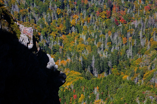 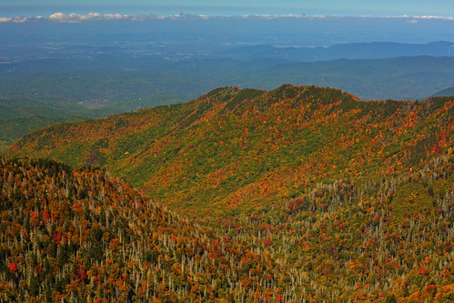 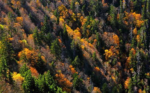 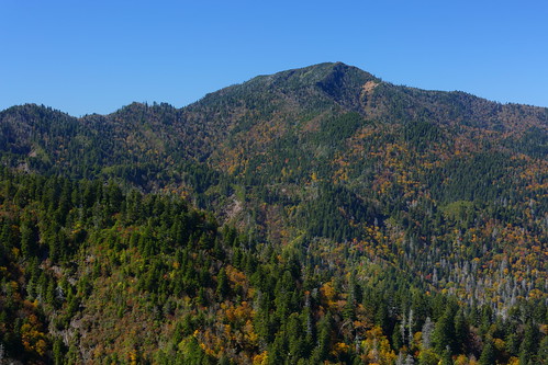 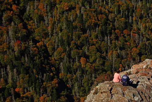 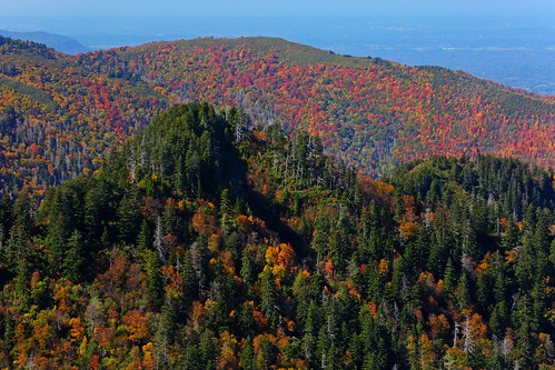 Clingmans Dome Clingmans DomeAfter my Charlies Bunion hike, I drove over to nearby Clingmans Dome, at 6643ft the highest point in the park. Views from the parking lot are fantastic, but a short, paved road takes one to the actual summit. The summit area is treed, but a massive concrete tower puts you above the trees and provides access to the simply amazing 360° views. The sunset was spectacular! Stats: 1mi, 360ft elevation gain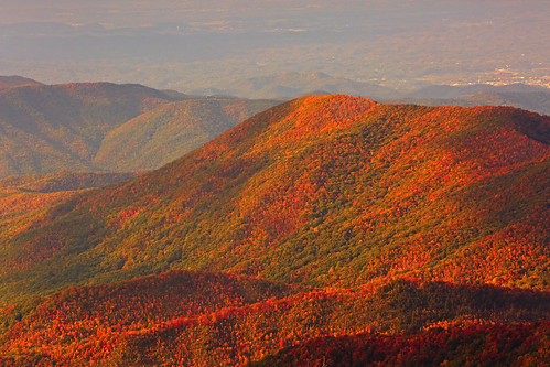 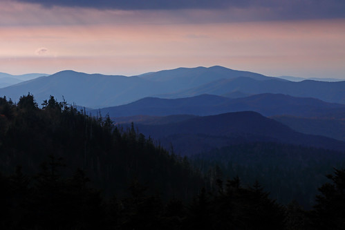 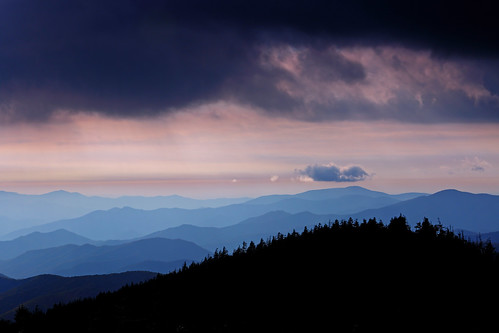 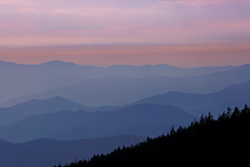 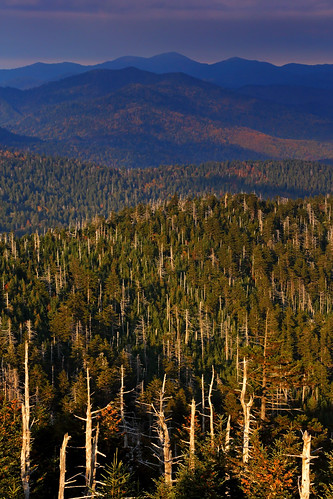 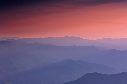 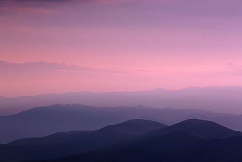 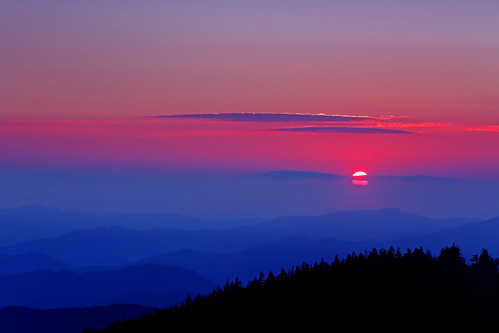 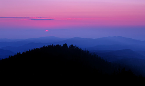
|
|
|
|
Post by GaliWalker on Oct 19, 2015 8:36:46 GMT -5
Oct 13, 2015 - Day 2: Grotto Falls, Brushy Mountain, Mount LeConte and the Roaring Fork Motor Nature TrailGrotto Falls - Brushy Mountain - Mount LeConteOne of the most prominent high points in the Smokies is Mount LeConte. I had already been up to it via Alum Cave on an earlier trip, so decided to take the slightly longer way up this time via Trillium Gap. Along the way I'd also be able to enjoy Grotto Falls, which is one of the more scenic waterfalls in the park. The trailhead for Grotto Falls was located on the one way Roaring Fork Motor Nature Trail. The 'trail' is a narrow but paved road, and makes for a popular driving tour. As I drove to the trailhead in the wee morning hours I realized that I was the first to hit this road: intense thunderstorms had hit the area overnight and I had to clear some downed tree branches from the road. It was 7:15am, and barely light enough to see without a headlamp, when I began my hike. The initial going was on hard-packed dirt and not too rocky, so the 1.3mi to Grotto Falls went by in 30min, despite the ~1000ft elevation gain. Then, I lay becalmed for an hour as the pretty little waterfall and associated cascades kept me beguiled for an hour. 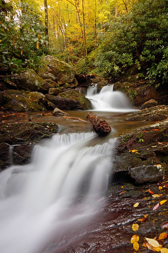 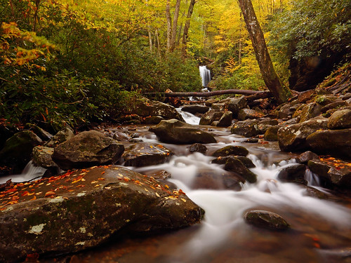 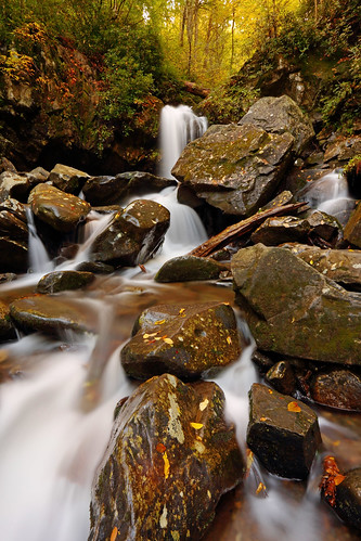 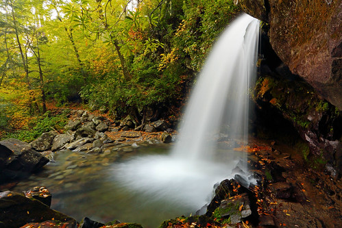 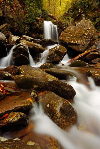 After the waterfall the trail got a whole lot rockier. The grade remained consistently steep, but nothing too extreme, so I motored along, all the way to Trillium Gap, 3.1mi in. (I was a bit surprised by my pace, because the 6yrs living in Pennsylvania gives me few opportunities to tackle sustained elevation gain. All the gain is in installments.) At Trillium Gap, I took a 0.6mi side trip to the summit of Brushy Mountain, which sported some of the best views on the hike. 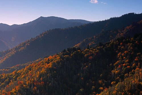 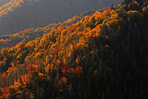 Back at Trillium Gap, I continued 3.6mi up to Mount LeConte. The summit is treed, but nice views were available from the Cliff Tops overlook (a 0.5mi side trip).  I had a relaxed lunch at the Mount LeConte lodge, before heading back down to the car. Stats: 14.6mi, 3900ft gain, 7.75hrs.I took my time driving the Roaring Fork Motor Nature Trail, especially once the drive began to parallel scenic Roaring Fork. 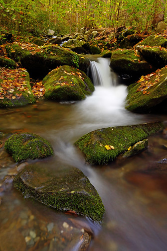 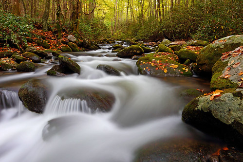
|
|
|
|
Post by GaliWalker on Oct 19, 2015 8:37:38 GMT -5
Oct 14, 2015 - Day 3: Andrews Bald and bugling elk in CataloocheeAndrews BaldDay 3 began with an early morning drive up to the Clingmans Dome, which was the location of the trailhead for Andrews Bald. The balds of Great Smoky Mountains National Park are open grassy spaces. There are various theories for why these spots became treeless, but no definitive one, as far as I know. Whatever the reason, for now the National Park Service maintains them as such. I had visited Gregory Bald, the largest of the balds, on an earlier trip, but not Andrews Bald. I had timed my arrival at the trailhead parking lot to catch the sunrise, since views from the parking lot are superb. It was cold and extremely windy, so I bundled up to brave the elements, but the sunrise was completely worth it. 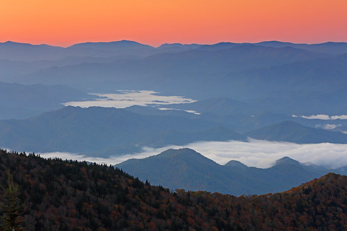  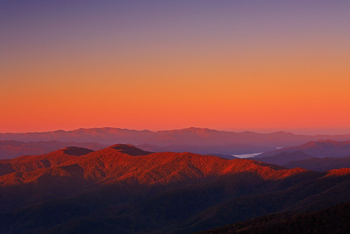 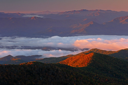  The short, mostly downhill hike to Andrews Bald went by in the blink of an eye. The views were pretty cool, though some of their thunder had been stolen by the earlier sunrise at the trailhead. I poked around the area for a bit before heading back. Stats: 3.6mi, 900ft elevation gain, 2hrs.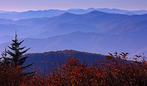 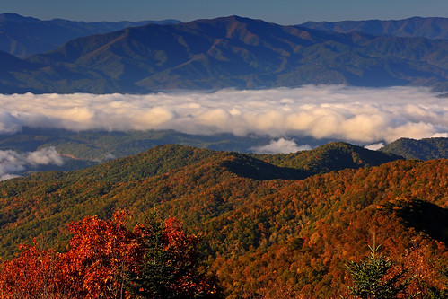 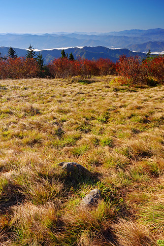 The elk of Cataloochee The elk of CataloocheeThis was my favorite part of the entire trip to Great Smoky Mountains National Park. Cataloochee is a secluded valley, tucked away in the southeast part of the park, on the North Carolina side. Historic buildings have been preserved in the valley, though these weren't what I was drawn to... Elk, which used to roam the southern Allegheny Mountains, died out from North Carolina in the 1700s, due to loss of habitat and hunting. The National Park Service is trying to reintroduce them into the park, and Cataloochee is the spot they have selected. The drive to Cataloochee from Gatlinburg, Tennessee, was long and tedious, but I was prepared to spend all day in the valley. On my one previous trip there I had come up empty; not an elk to be seen in the two hours I spent there. This time I was hoping to be luckier, especially since it was rut season.  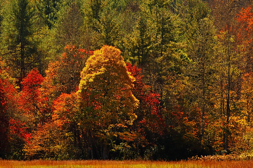 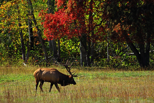 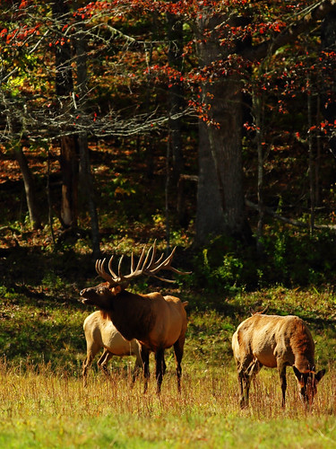 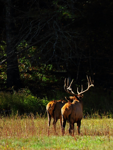 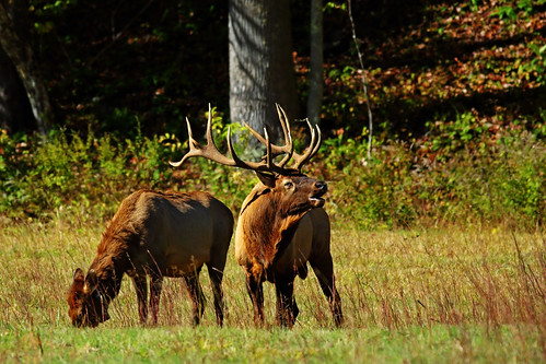 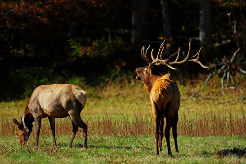 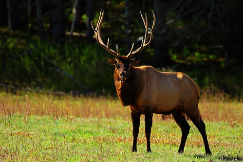 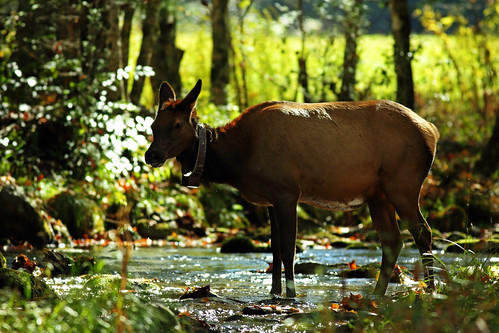 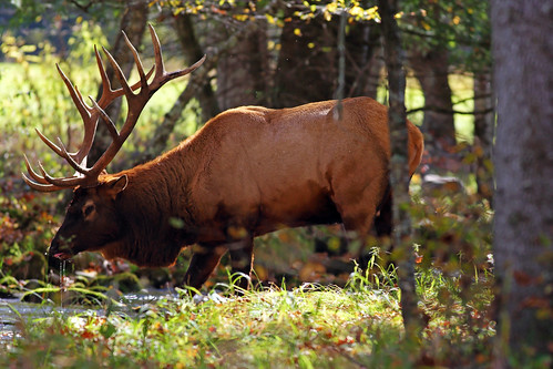  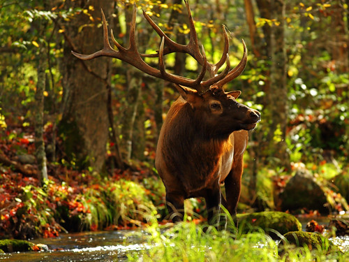 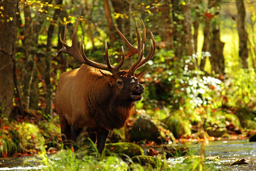 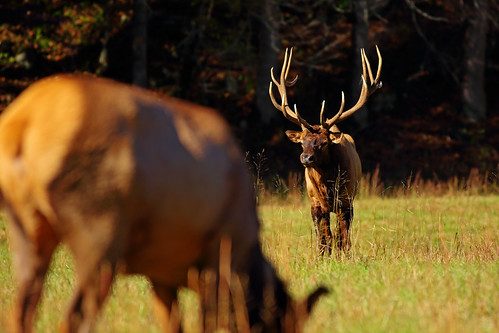 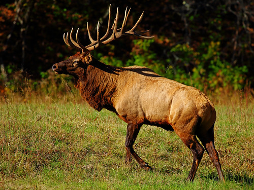 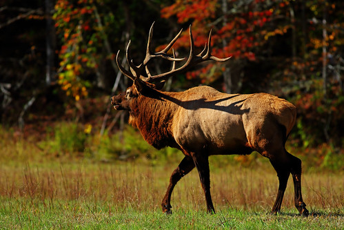 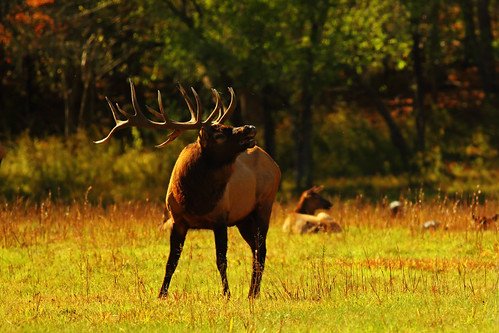 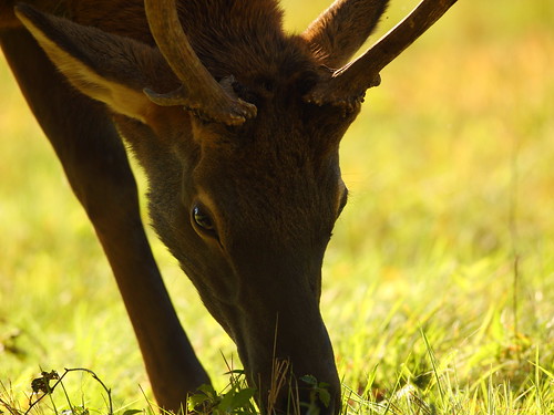 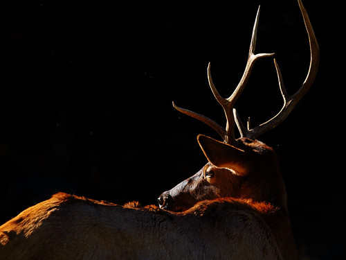
|
|
|
|
Post by GaliWalker on Oct 19, 2015 8:38:43 GMT -5
Oct 15, 2015 - Day 4: Waterfalls and a summitWaterfalls of Lynn Camp ProngThroughout my Great Smoky Mountains National Park trip I wanted to strike a good balance between waterfalls and summits. Since Day 4 was forecast as being a blue sky day, and sunshine and waterfall photography don't make for good bedfellows, I decided that I'd have to become creative with my selection of Lynn Camp Prong as a hiking destination. Basically, I'd have to take all my photos before the sun rose high enough to strike Lynn Camp Prong. With dawn scheduled for 7:30am, I was on the Middle Prong trail, which would parallel Lynn Camp Prong, by 6:15am. My plan was to do the 8mi hike in reverse: hike up to Indian Flats Falls, my turn around point, in the dark and then work my way back to the car, photographing the stream as I went along. I used my headlamp for the first 3mi, by which time it got bright enough to do without it. Throughout this part I could hear the roar of waterfalls, which in hindsight was even more amplified to my heightened senses. My timing was spot on, since the light had brightened just enough for photography over the final mile to Indian Flats Falls, and I got going almost immediately. Indian Flats Falls was a series of three drops. The upper falls were by far the best, and would have been extremely special with a bit more water. 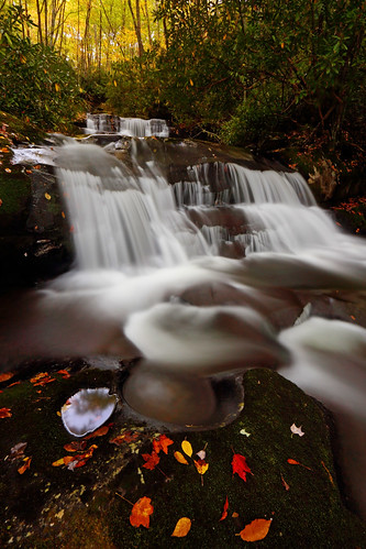 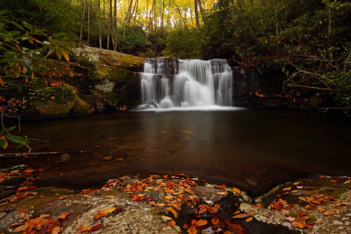 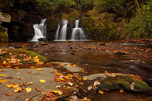 Ever conscious of the rising sun, I did not tarry too long. Unfortunately, the next series of waterfalls were at the 0.5-0.6mi mark, so almost at the trailhead. This meant that I had to turn on the jets to get to them in time. As I got closer to them I began to think that I was too late; sunshine was already hitting the trail. However, the heavens were smiling on me, since the valley made a sharp turn just before the falls which put them in shadow. Whew! 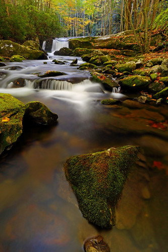 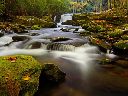 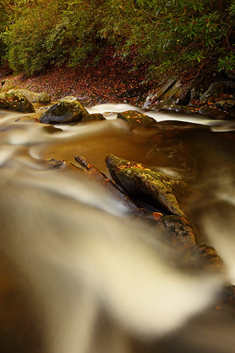 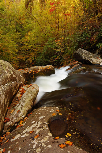 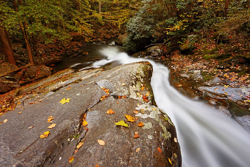 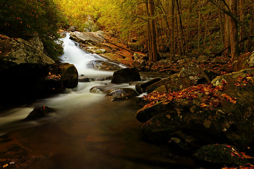 Stats: 8mi, 1350ft gain, 4.75hrs.Mount Sterling Stats: 8mi, 1350ft gain, 4.75hrs.Mount SterlingWith waterfalls out of my system, I was keen to climb something and see some fine views. The short and sweet hike to Mount Sterling, from Sterling Gap, with reputedly some of the best views in the Smokies, sounded perfect. Since I'd done the longer hike in quick time, and the second hike wasn't the longest, I drove the 2hrs or so to 3888ft high Sterling Gap in relaxed fashion. The hike up was through some of the prettiest forest I've seen - hardwoods, giving way to spruce and fir. The grade was consistent though steep, until the final 0.3mi when I hit the treed summit ridge and took a right. 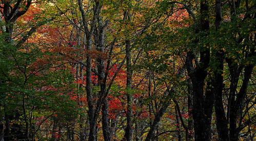 The summit was treed, but a 60ft tall steel fire tower allowed one access to the famed views. The top of the tower was windy as heck. I spent 1.5hrs up there and was feeling seasick by the time I made my way down, because of the almost constant swaying I had been subjected to! It was all worth it though since the views were superb, especially so because they were of the northeastern peaks, which one doesn't usually see from the usual spots in the park. Stats: 5.4mi, 2100ft gain, 4.25hrs.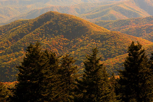 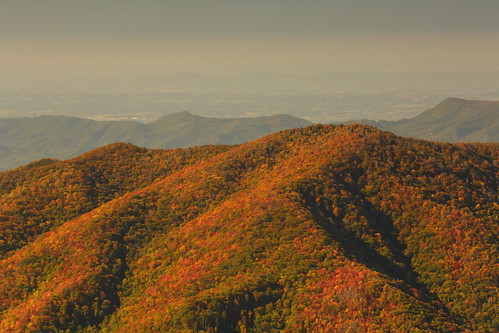 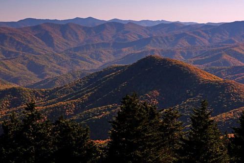 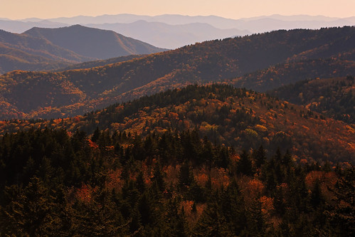 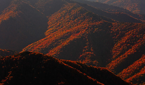
|
|
|
|
Post by GaliWalker on Oct 19, 2015 8:40:16 GMT -5
Oct 16, 2015 - Day 5: Winding upLaurel FallsLaurel Falls is quite possibly the most visited waterfall in the Smokies. The trailhead is located less than 4mi from the Sugarlands Visitor Center, the 'trail' is paved and its only a 1.3mi hike to the waterfall. I'd driven past the trailhead a few times over the past few days and seen an overflowing parking lot each time. With all this drama I wasn't too enthusiastic about visiting the waterfall, so I'd left it to my final day in the National Park. Hoping to beat the crowds, I was at the parking lot before 7:00am. It was still pretty dark - headlamp dark - so I had the parking lot to myself! I took off immediately, knocking off the 1.3mi/315ft gain to the falls in 25min. I actually had to wait a bit before it got bright enough to shoot. The waterfall was quite pretty, but there wasn't a whole lot of water in it, so I satisfied myself with the standard composition that you see in all the brochures and called it good. Stats: 2.6mi, 315ft elevation gain, 1.5hrs. Spruce Flats Falls Spruce Flats FallsBy now I was steeling myself for the long 9hr drive back to Pittsburgh, but wasn't ready to throw in the towel just yet. I thought I had time for one more short hike, so I decided to visit Spruce Flats Falls, which I had visited before on my previous trip to the Smokies earlier in the year. I think this is one of the nicest waterfalls in the park, and surprisingly not quite as crowded. Stats: 2mi, 560ft elevation gain, 1.5hrs.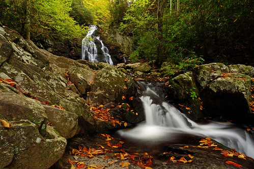  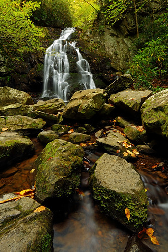 Conclusion ConclusionOn the final day of five spent hiking in Great Smoky Mountains National Park, as I walked through a beautiful, lush forest, I thought back over my nearly completed trip. I relived all the flowing mountain scenery I had experienced, and how all of it had featured peaks covered from end to end with forest. I thought back to the streams and waterfalls, and how these had cut their way through dense vegetation. I looked around at all the trees that surrounded me, at that very moment, and noticed how each of those trees was festooned with ivy. I remembered the solitary bear, the solitary fox, the solitary owl, the plethora of birds and all the elk I'd seen, and extrapolated that to all the wildlife I hadn't seen, and how all of this was sheltered, nurtured, protected by these forested valleys and peaks. And I got it. Great Smoky Mountains National Park was life. 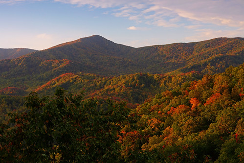
|
|

