
TR: North Cascades National Park
Oct 2, 2017 8:38:17 GMT -5
Post by rpcv on Oct 2, 2017 8:38:17 GMT -5
For the second week of our trip, we were supposed to do Cycle Oregon. Unfortunately, because of all of the terrible wildfires, it was canceled, leaving us with a free week. We found out right before we were supposed to fly to Portland, so we left the bicycle gear in the spare bedroom and packed our backpacking gear, figuring we could make a decision once we arrived. We debated between Olympic National Park and North Cascades National Park. Ultimately, the fire locations, smoke, and the fact that we had been to Olympic NP before all pointed towards North Cascades NP. We walked into the wilderness office on a Sunday morning without a plan and worked with a ranger to set up a reasonable itinerary. Permits in hand for a five day trip, we had breakfast in town, and then headed for Cascade Pass Trailhead. It was an amazing trip and I'd love to go back.
Day 1: Cascade Pass Trailhead to Basin Creek Campsite
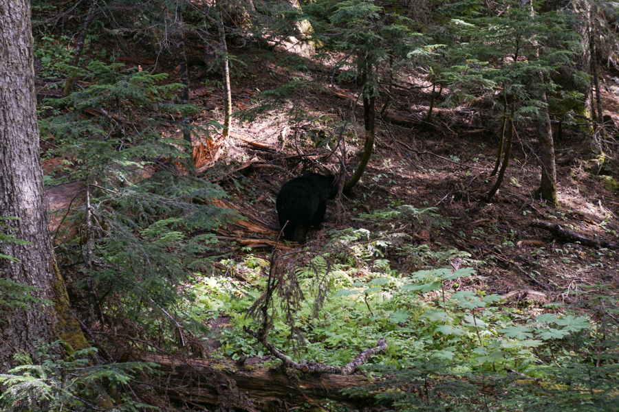
We started up the trail, which is a long series of switchbacks. About 3/4 of a mile in, we realized that Michael had forgotten his camera on the floorboard of the car. I sat down on a log for a snack, he put his pack down and headed back down to get it (mainly, we didn't want someone to break the window for it). While I was sitting there, this guy came around the corner. He was probably close to 400 pounds. We surprised each other. I yelled at him to go on and he looked at me with all of the disdain of a local inconvenienced by a tourist before going on his way. He was much closer than this initially, but I was more concerned with encouraging him to move on than with getting a picture.
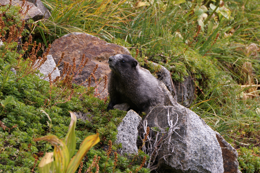
A marmot closer to the pass.
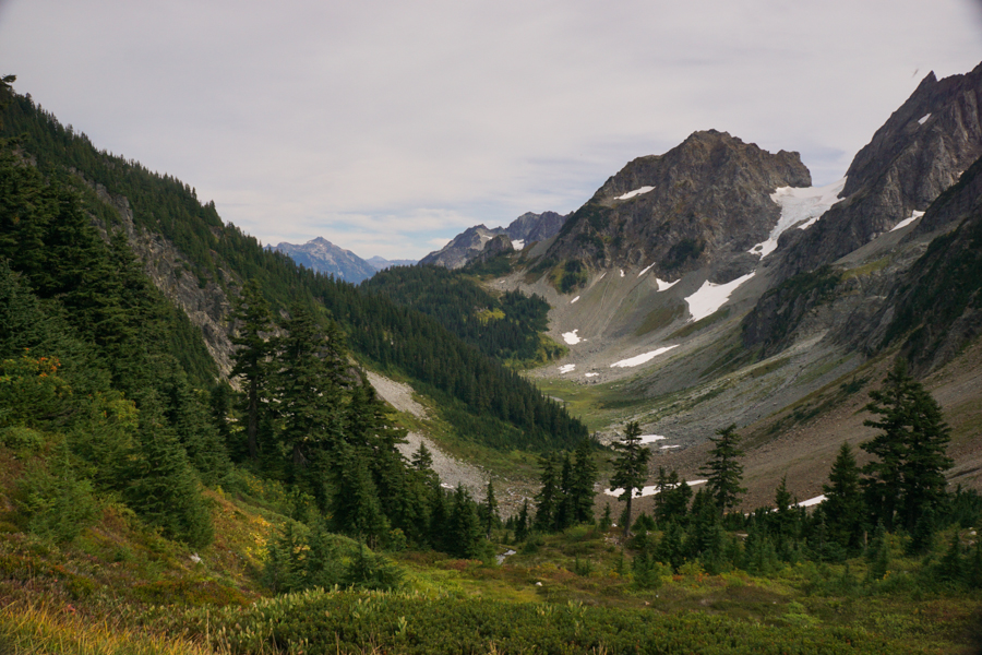
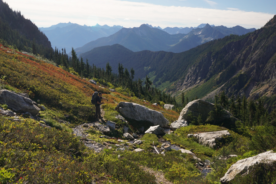
The view east from Cascade Pass. Up to this point, there had been a number of hikers. Once we passed a campsite about half a mile below this, we only saw one person in the next two days.
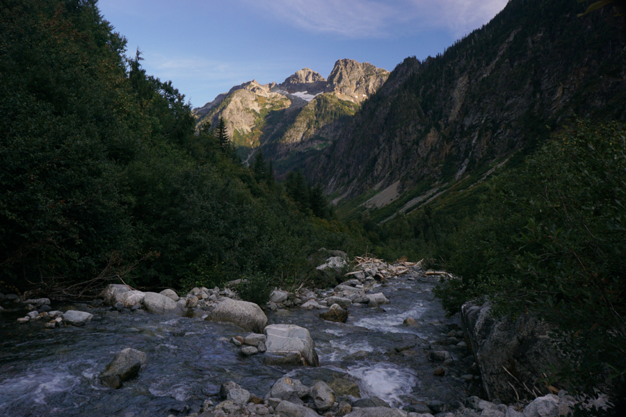
The evening view from Basin Creek, right by our campsite.
Day Two: Basin Creek Campsite to Buckner Campsite. We continued down the Stehikin River to Park Creek. There we turned north and hiked up the Park Creek Valley for the rest of the afternoon and the following day.
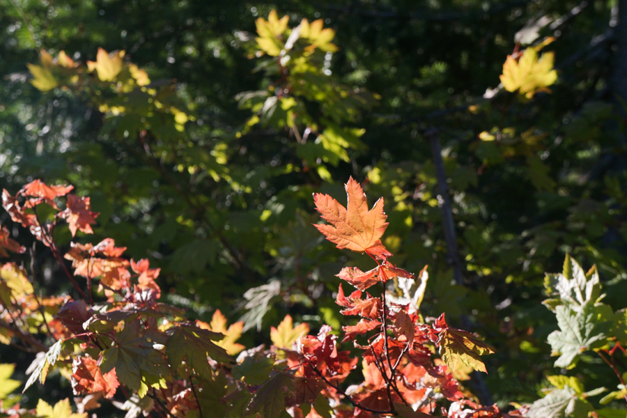
Fall was well on its way. The leaves were beginning to change everywhere.
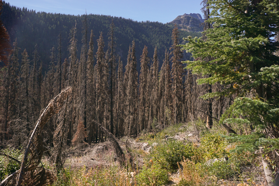
We hiked through a small burn from a 2015 fire.
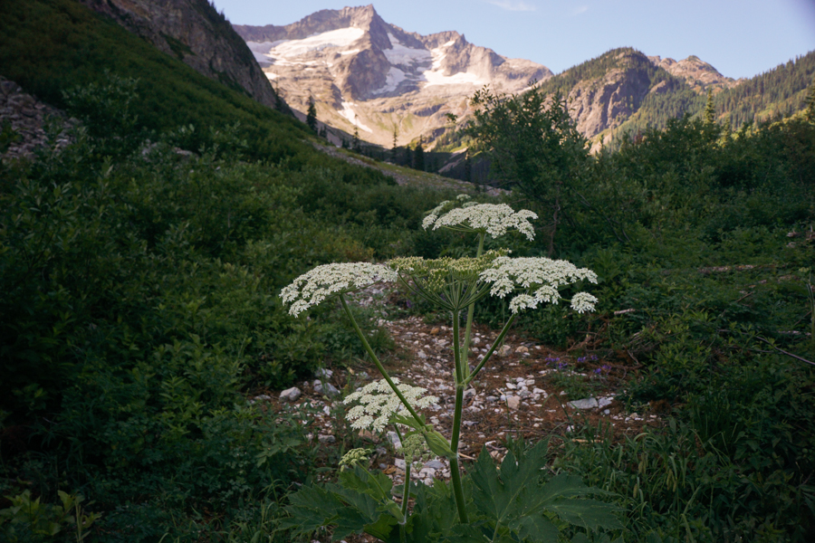
Cow Parsnip near Buckner Campsite
Day Three: Buckner Campsite to Skagit Queen Campsite. This was my favorite day of the trip. We hiked up over Park Creek Pass, which was spectacular.
Hiking up Park Creek Pass (and shooting straight into the sun).
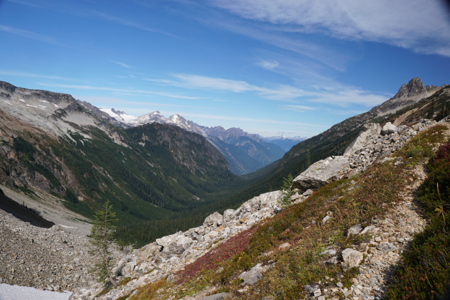
Looking north from Park Creek Pass down into Thunder Basin
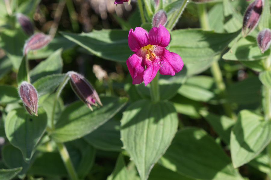
Monkey Flower near the pass
We discovered a map error that afternoon. The map said we had 5.5 miles from the top of the pass to Skagit Queen Campsite. It is a relatively easy hike that took us a solid four hours. We expected to do 8 miles that day. The fitness tracker on my phone said we did more like 11. I don't expect super accuracy from those, but that is a lot more consistent with the length of time we walked, given the straightforward terrain (I mean, if you hike enough, you usually have a good sense of what a mile feels like). The unfortunate thing was, we had planned a long day (13 miles) the following day. The additional distance meant we were going to have a 16 mile day instead of 13. Not the end of the world, but kind of annoying.
Day four: Skagit Queen Campsite to Flat Creek Campsite: The weather deteriorated as we hiked back over Park Creek Pass. Fog rolled in and it started raining as we got near the top of the pass. It was pretty chilly, too. We were fortunate that the wind was at our backs, so at least it wasn't blowing rain into our faces.

A somewhat blurry photo of old mining equipment just above Skagit Queen campsite.

Fog rolling in as we were hiking
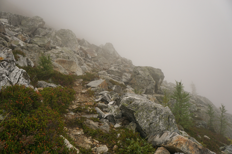
Socked in going up the pass

On the other side of the pass it was like a different day. Clear and much warmer.
Day Five: Flat Creek Campsite to the car.

On the path out of the campsite area in the morning, we saw bear tracks on top of our boot prints from the night before (this wasn't particularly near where we had pitched our tent).
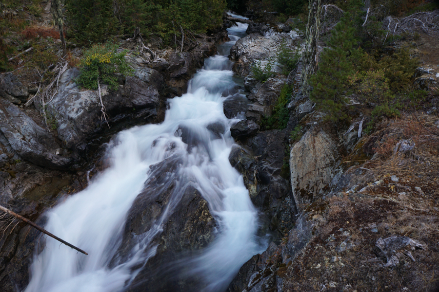
The Stehekin River near our campsite

Our last view of Cascade Pass on our way down to the car.
More pictures on my blog.
Day 1: Cascade Pass Trailhead to Basin Creek Campsite
We started up the trail, which is a long series of switchbacks. About 3/4 of a mile in, we realized that Michael had forgotten his camera on the floorboard of the car. I sat down on a log for a snack, he put his pack down and headed back down to get it (mainly, we didn't want someone to break the window for it). While I was sitting there, this guy came around the corner. He was probably close to 400 pounds. We surprised each other. I yelled at him to go on and he looked at me with all of the disdain of a local inconvenienced by a tourist before going on his way. He was much closer than this initially, but I was more concerned with encouraging him to move on than with getting a picture.
A marmot closer to the pass.
The view east from Cascade Pass. Up to this point, there had been a number of hikers. Once we passed a campsite about half a mile below this, we only saw one person in the next two days.
The evening view from Basin Creek, right by our campsite.
Day Two: Basin Creek Campsite to Buckner Campsite. We continued down the Stehikin River to Park Creek. There we turned north and hiked up the Park Creek Valley for the rest of the afternoon and the following day.
Fall was well on its way. The leaves were beginning to change everywhere.
We hiked through a small burn from a 2015 fire.
Cow Parsnip near Buckner Campsite
Day Three: Buckner Campsite to Skagit Queen Campsite. This was my favorite day of the trip. We hiked up over Park Creek Pass, which was spectacular.
Hiking up Park Creek Pass (and shooting straight into the sun).
Looking north from Park Creek Pass down into Thunder Basin
Monkey Flower near the pass
We discovered a map error that afternoon. The map said we had 5.5 miles from the top of the pass to Skagit Queen Campsite. It is a relatively easy hike that took us a solid four hours. We expected to do 8 miles that day. The fitness tracker on my phone said we did more like 11. I don't expect super accuracy from those, but that is a lot more consistent with the length of time we walked, given the straightforward terrain (I mean, if you hike enough, you usually have a good sense of what a mile feels like). The unfortunate thing was, we had planned a long day (13 miles) the following day. The additional distance meant we were going to have a 16 mile day instead of 13. Not the end of the world, but kind of annoying.
Day four: Skagit Queen Campsite to Flat Creek Campsite: The weather deteriorated as we hiked back over Park Creek Pass. Fog rolled in and it started raining as we got near the top of the pass. It was pretty chilly, too. We were fortunate that the wind was at our backs, so at least it wasn't blowing rain into our faces.
A somewhat blurry photo of old mining equipment just above Skagit Queen campsite.
Fog rolling in as we were hiking
Socked in going up the pass
On the other side of the pass it was like a different day. Clear and much warmer.
Day Five: Flat Creek Campsite to the car.
On the path out of the campsite area in the morning, we saw bear tracks on top of our boot prints from the night before (this wasn't particularly near where we had pitched our tent).
The Stehekin River near our campsite
Our last view of Cascade Pass on our way down to the car.
More pictures on my blog.