|
|
Post by jmitch on Nov 26, 2018 12:24:55 GMT -5
endlessmountains.wordpress.com/2018/11/20/pa-wilds-trail/A few years ago I realized a continuous network of trails stretched across the PA Wilds, following both backpacking and connector trails. I always thought this could be a premier hiking route. After hiking extensively in the region I came up with the most scenic and feasible route, featuring vistas, waterfalls, vast meadows, streams, big rocks, diverse forests, isolation, superb camping, canyons, gorges, and wild elk. The route goes through four rural communities. There is no bushwhacking or new trail construction; it only follows existing trails. It is about 171 miles long, from Parker Dam State Park to Arnot Road. Hopefully this will attract more hikers across the vast trail system in the PA Wilds.     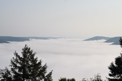 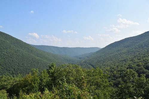 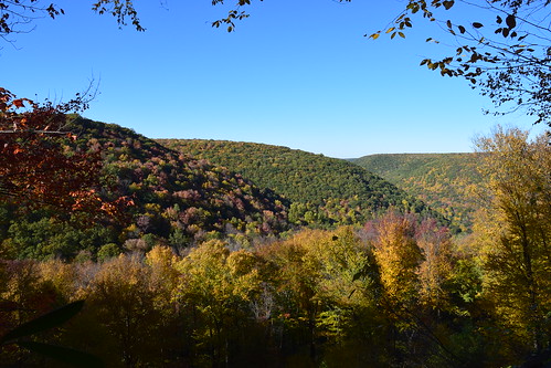  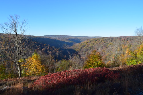  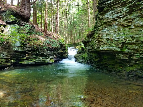  
|
|
|
|
Post by anfhiker on Dec 5, 2018 14:40:53 GMT -5
I have often dreamed, as I looked through maps during the PA winters, of a hike like this. In my mind, I just went on up the West Rim trail to Ansonia. I've never had the time to be able to pull it off, but it would be epic. This looks great and it would be splendid to see happen! Fine proposal, Jeff.
|
|
|
|
Post by jmitch on Dec 5, 2018 18:38:17 GMT -5
WRT is a fine option, but I think the MST to Arnot is more diverse.
|
|
ki0eh
Forum Elder
Posts: 196 
|
Post by ki0eh on Jan 2, 2019 11:27:03 GMT -5
WRT is a fine option, but I think the MST to Arnot is more diverse. ...and for those who don't know, this is a big reason why the MST goes that way, rather than an overlay on the WRT continuing north on to NY State. On Facebook within the last week, a recent MST completer said his favorite sections are north of Blackwell to 287, and north of Antrim. Though it's well over 10 years now since they opened, and still have free maps, it seems not many go that direction yet. |
|
|
|
Post by anfhiker on Feb 24, 2019 18:48:45 GMT -5
Is there any sort of map or anything to give approximate mileage on the Donut Hole Trail? Seems all the other major trails on this route have good info on mileage between points whether on a map or guide book, but the DHT is hard to find.
I'd like to scout out and maybe plan a hike of this whole trail this year or next, with that area being the toughest to find info on. It really seems like a lonely trail apart from where it nears state parks like Kettle Creek (where I have walked on it before).
|
|
|
|
Post by jmitch on Feb 25, 2019 12:36:38 GMT -5
The DHT was about 90 miles, but was rerouted through Hyner View State Park and Nature Conservancy lands, adding some miles. I don't know the total length now.
|
|
|
|
Post by anfhiker on Feb 25, 2019 15:52:08 GMT -5
Mainly what I'm looking for is a guide book or site with maps that might give a better estimate of trail miles between points, as opposed to the total trail length. As mentioned, the other parts of the PAWT have pretty solid mileages on either maps or within published guide books, but no one has tackled the DHT yet, it seems?
I spent this morning putting together a rough itinerary for a 9 or 10 day through hike, which was fun. I've got maps and/or a guide book in possession from other hikes or random pickups at Pine Creek Outfitters for the QT, STS, BFT, WRT and MST...just missing that lonely Donut Hole. I'm guessing it will come down to extra scouting trips.
|
|
|
|
Post by anfhiker on Aug 13, 2019 10:22:24 GMT -5
So I am firming up plans to hike this proposed route October 5-14. I've got a pretty good itinerary scoped out and I've scouted and hiked chunks of most of the trails so I have a solid idea of where I can camp and what the trails should be like.
A question for Jeff...the Donut Hole trail appears to have been relocated for a section right around where the STS and it connect for a while. Officially, would you prefer the PAWT to utilize the DHT (it's marked green on your map) or follow the STS? I do know that there is a new shelter on that STS section although it won't come into play for me as I've planned it.
I'm excited to make the trip. I'm planning to GPS track the entire route and will post it after I'm done, God willing.
|
|
|
|
Post by jmitch on Aug 14, 2019 15:21:36 GMT -5
I was told that is a mistake, DHT and STS follow the same section on that part of trail. I might route the PAWT to the STS, North Link Trail, and to BFT but I've not been able to return to those trails. Good luck on the hike, you might be the first thruhiker of the PAWT. Let us know how it goes.
|
|
|
|
Post by anfhiker on Aug 15, 2019 11:15:50 GMT -5
I was told that is a mistake, DHT and STS follow the same section on that part of trail. I might route the PAWT to the STS, North Link Trail, and to BFT but I've not been able to return to those trails. Good luck on the hike, you might be the first thruhiker of the PAWT. Let us know how it goes. Excellent...that will make the decision much easier. And I will do so...I'm really looking forward to going. I've got some training hikes (including the Loyalsock Trail in September) to finish up and then it's just making sure all the details are set. |
|
|
|
Post by jmitch on Oct 15, 2019 17:20:17 GMT -5
Anfhiker, did you hike the PAWT? How was it?
|
|
|
|
Post by anfhiker on Oct 15, 2019 19:42:59 GMT -5
Jmitch, I did...mostly. I will post a thread with my trip report starting maybe tomorrow.
|
|
|
|
Post by kristin on Jun 26, 2020 7:39:01 GMT -5
Thank you for sharing your write up of the PA Wilds Trail!
|
|
|
|
Post by jmitch on Feb 5, 2021 14:59:37 GMT -5
|
|
|
|
Post by superhiker on Feb 7, 2021 11:50:13 GMT -5
I look forward to hiking it some day. The route travels many of my favorite areas.
|
|
|
|
Post by kbusko on Feb 12, 2021 13:48:14 GMT -5
I look forward to hiking it some day. The route travels many of my favorite areas. You should do it. If we did not have so many other trails on our list I would go back this summer and hike it again. |
|
|
|
Post by trailnotfound on Feb 21, 2021 14:13:54 GMT -5
I look forward to hiking it some day. The route travels many of my favorite areas. You should do it. If we did not have so many other trails on our list I would go back this summer and hike it again. Given how many great side options there are, I bet you could do that and only repeat half of it. |
|
|
|
Post by trailnotfound on Feb 21, 2021 14:21:35 GMT -5
That's awesome! Thanks for keeping this a living and evolving idea. If an official guidebook for this ever comes out it will likely need to be massive in order to accommodate all the options and variations. A "Choose Your Own Adventure" guidebook sounds pretty fun to be honest. |
|


